- 10, Jun 2026 | Khilak Budhathoki
The Everest Base Camp trek route covers 130 km (81 mi) round trip from Lukla to base camp and back. The standard 14-day itinerary follows the Dudh Koshi River valley through Phakding, Namche Bazaar, Tengboche, Dingboche, Lobuche, and Gorak Shep. Total elevation gain from Lukla (2,860 m / 9,383 ft) to EBC (5,364 m / 17,598 ft): 2,504 m (8,215 ft) over 65 km (40 mi).
Two mandatory acclimatization days are built in: Day 3 at Namche Bazaar (3,440 m / 11,286 ft) and Day 6 at Dingboche (4,410 m / 14,468 ft). Nine suspension bridges cross the Dudh Koshi River and its tributaries on the lower route. Kala Patthar (5,544 m / 18,192 ft), a pre-dawn scramble above Gorak Shep, is the highest point and the route's definitive Everest viewpoint.
Alternative routes include the Gokyo Lakes via Cho La Pass (5,420 m / 17,782 ft) and the Three Passes circuit crossing Kongma La (5,535 m / 18,159 ft), Cho La, and Renjo La (5,360 m / 17,585 ft). Return options: walk back to Lukla (3 to 4 days) or helicopter from Gorak Shep ($400 to $600 per person shared).
Trail conditions vary by season: October delivers the driest trail and clearest skies. Monsoon (June to September) brings mud below Namche and leech activity below 3,000 m (9,843 ft). January and February bring snow above Namche, requiring microspikes above Lobuche (4,940 m / 16,207 ft).
What is the Everest Base Camp trek route?
The Everest Base Camp trek route is the 130 km (81 mi) round-trip trekking corridor from Lukla airport (2,860 m / 9,383 ft) to Nepal-side base camp (5,364 m / 17,598 ft). The route follows the Dudh Koshi River valley north through Sagarmatha National Park. Key waypoints: Phakding (2,610 m / 8,563 ft), Namche Bazaar (3,440 m / 11,286 ft), Tengboche (3,860 m / 12,664 ft), Dingboche (4,410 m / 14,468 ft), Lobuche (4,940 m / 16,207 ft), Gorak Shep (5,164 m / 16,942 ft), Everest Base Camp (5,364 m / 17,598 ft).
The route is noncircular, ascending north from Lukla to EBC, then descending south on the identical trail. Helicopter return from Gorak Shep ($400 to $600 per person shared) is the only option to avoid retracing the route. Sagarmatha National Park, covering the entire Khumbu trekking zone, was designated a UNESCO World Heritage Site in 1979.
Where does the Everest Base Camp trek start and end?
The EBC trek starts and ends at Lukla, Tenzing-Hillary Airport (2,860 m / 9,383 ft). Lukla is reached by a 30- to 35 minute domestic flight from Kathmandu or Ramechhap (Manthali Airport). No road connects Lukla to the outside world; the flight is the only practical access for most trekkers.
The trek ends at Everest Base Camp (5,364 m / 17,598 ft) on the Khumbu Glacier edge. Most trekkers descend the same day to Gorak Shep, summit Kala Patthar (5,544 m / 18,192 ft) the next pre-dawn, then begin the 3 to 4 day return to Lukla.
Helicopter return from Gorak Shep or Pheriche (4,240 m / 13,911 ft) to Lukla or Kathmandu: $400 to $600 per person shared. This eliminates 3 to 4 days of descent and is chosen by trekkers with tight international flight connections.
How long is the Everest Base Camp trek route in total distance?
The EBC route totals 130 km (81 mi) round trip, 65 km (40 mi) each way. Daily trekking averages 10 to 14 km (6 to 9 mi) on active days. Acclimatization days at Namche and Dingboche cover shorter 8 to 10 km (5 to 6 mi) distances.
One-way distance by section:
-
Lukla to Phakding: 8.7 km (5.4 mi)
-
Phakding to Namche Bazaar: 11 km (6.8 mi)
-
Namche to Tengboche: 9 km (5.6 mi)
-
Tengboche to Dingboche: 8 km (5 mi)
-
Dingboche to Lobuche: 12 km (7.5 mi)
-
Lobuche to Gorak Shep: 3.5 km (2.2 mi)
-
Gorak Shep to EBC: 5.5 km (3.4 mi)
-
Gorak Shep to Kala Patthar: 2 km (1.2 mi)
Total elevation gain Lukla to EBC: 2,504 m (8,215 ft). Total descent on the same approach: 1,060 m (3,478 ft). The route undulates; it is not a straight uphill line. Net altitude gained: 2,504 m.
What is the day-by-day breakdown of the Everest Base Camp route?
The standard 14-day EBC itinerary includes 10 trekking days, 2 acclimatization days, and 2 buffer or return days.
Day 1, Lukla to Phakding
Distance: 8.7 km (5.4 mi) | Altitude: 2,860 m to 2,610 m (9,383 ft to 8,563 ft) | Time: 3 to 4 hours. The route descends from Lukla airport into the Dudh Koshi valley through Cheplung village. Three suspension bridges cross the river on Day 1; this gentle 250 m (820 ft) descent allows first-day altitude adjustment.
Day 2, Phakding to Namche Bazaar
Distance: 11 km (6.8 mi) | Altitude: 2,610 m to 3,440 m (8,563 ft to 11,286 ft) | Time: 5 to 7 hours. The trail crosses the Hillary Suspension Bridge (60 m / 197 ft above the Dudh Koshi) and ascends 830 m (2,723 ft) to Namche. The Monjo gate, Sagarmatha National Park entry, checks permits here. The climb from Hillary Bridge to Namche takes 2 to 3 hours.
Day 3: Namche Bazaar Acclimatization Day
Altitude: 3,440 m (11,286 ft), bank, and a full rest day. The recommended acclimatization hike ascends to Everest View Hotel (3,880 m / 12,730 ft) or Khumjung village. Namche holds the route's last reliable ATMs (Himalayan Bank and Everest Bank) and full gear shops. SpO₂ typically drops 5 to 8 points versus home altitude; this is a normal acclimatization response.
Day 4: Namche Bazaar to Tengboche
Distance: 9 km (5.6 mi) | Altitude: 3,440 m to 3,860 m (11,286 ft to 12,664 ft) | Time: 4 to 5 hours. The trail descends 300 m (984 ft) to the valley floor, then climbs through rhododendron forest. Tengboche Monastery, the largest Tibetan Buddhist monastery in the Khumbu, marks the day's end. First clear Ama Dablam (6,812 m / 22,349 ft) views appear from the Tengboche ridge.
Day 5: Tengboche to Dingboche
Distance: 8 km (5 mi) | Altitude: 3,860 m to 4,410 m (12,664 ft to 14,468 ft) | Time: 4 to 5 hours. The trail descends through Pangboche village and continues to Dingboche , the last agricultural village on the route. AMS symptoms begin for trekkers with incomplete acclimatization above 4,000 m (13,123 ft).
Day 6: Dingboche Acclimatization Day
Altitude: 4,410 m (14,468 ft), full rest day. Standard acclimatization hike ascends to Nangkartshang Peak (5,083 m / 16,677 ft), 2 to 3 hours from Dingboche. SpO₂ for well-acclimatized trekkers at Dingboche: 85 to 90%. Readings below 85% at rest indicate incomplete acclimatization; rest and reassess before proceeding.
Day 7: Dingboche to Lobuche
Distance: 12 km (7.5 mi) | Altitude: 4,410 m to 4,940 m (14,468 ft to 16,207 ft) | Time: 5 to 6 hours. This is the longest trekking day above 4,000 m on the standard route. The Thukla memorial chorten field (Chukpi Lhara) honors Everest climbers who died on the mountain, including Scott Fischer and Rob Hall.
Day 8: Lobuche to Gorak Shep and Everest Base Camp
Total distance: 9 km (5.6 mi) | Altitude: 4,940 m to 5,364 m (16,207 ft to 17,598 ft) | Time: 6 to 8 hours. Bags are deposited at Gorak Shep (5,164 m / 16,942 ft). The 5.5 km (3.4 mi) glacier moraine walk to EBC takes 2 to 3 hours one way. Everest Base Camp sits at 5,364 m (17,598 ft) at the foot of the Khumbu Icefall.
Day 9: Gorak Shep to Kala Patthar and Descent to Pheriche
Altitude: 5,164 m to 5,544 m to 4,240 m (16,942 ft to 18,192 ft to 13,911 ft) | Time: 7 to 9 hours. Pre-dawn start at 4:00 to 5:00 am for Kala Patthar (5,544 m / 18,192 ft). Sunrise from Kala Patthar illuminates Everest's South Face, the defining photographic moment of the trek. Descent continues to Pheriche (4,240 m / 13,911 ft), where the HRA medical post operates with altitude physicians during peak seasons.
Day 10 Onwards: Return to Lukla
Standard return: Pheriche to Namche over Days 10 to 11, then Namche to Lukla on Day 12. The 800 m (2,625 ft) descent from Namche to Phakding on the return is the highest-impact knee day on the full trek. Trekking poles with wrist straps reduce descent stress on this section.
What is the elevation profile of the Everest Base Camp route?
The EBC elevation profile is not a straight upward line. The route undulates; significant descents are built into the overall ascent at every valley crossing.
Altitude by overnight stop:
-
Lukla: 2,860 m (9,383 ft)
-
Phakding: 2,610 m (8,563 ft)
-
Namche Bazaar: 3,440 m (11,286 ft)
-
Tengboche: 3,860 m (12,664 ft)
-
Dingboche: 4,410 m (14,468 ft)
-
Lobuche: 4,940 m (16,207 ft)
-
Gorak Shep: 5,164 m (16,942 ft)
-
Everest Base Camp: 5,364 m (17,598 ft)
-
Kala Patthar: 5,544 m (18,192 ft)
The steepest single day: Phakding to Namche, 830 m (2,723 ft) gain over 4 to 5 km (2.5 to 3 mi). The most deceptively hard day: Lobuche to Gorak Shep, only a 224 m (735 ft) gain, but each step at 5,000 m (16,404 ft) demands 30 to 40% more effort than at sea level.
What are the key stops on the Everest Base Camp trek route?
Nine distinct overnight stops define the standard EBC route. Each has specific features that make it a reference point rather than an interchangeable teahouse village.
-
Lukla (2,860 m / 9,383 ft): Gateway airport, gear shops, departure logistics hub
-
Phakding (2,610 m / 8,563 ft): Peaceful Dudh Koshi riverside village, first overnight on trail
-
Namche Bazaar (3,440 m / 11,286 ft): Khumbu capital, ATMs, bakeries, gear shops, Sherpa Museum, Saturday market, first Everest ridge view
-
Tengboche (3,860 m / 12,664 ft): Tengboche Monastery (largest in Khumbu), Ama Dablam viewpoint, Mani Rimdu festival in October and November
-
Dingboche (4,410 m / 14,468 ft): Last agricultural village, stone-walled potato fields, Nangkartshang acclimatization hike, HRA post nearby at Pheriche
-
Lobuche (4,940 m / 16,207 ft): Cold, basic facilities, Thukla memorial chortens nearby
-
Gorak Shep (5,164 m / 16,942 ft): Final overnight stop, most basic facilities on the route, SpO₂ typically 80 to 85% for well-acclimatized trekkers at Gorak Shep.
-
Everest Base Camp (5,364 m / 17,598 ft): Khumbu Glacier edge, expedition tents in spring, Khumbu Icefall immediately above
-
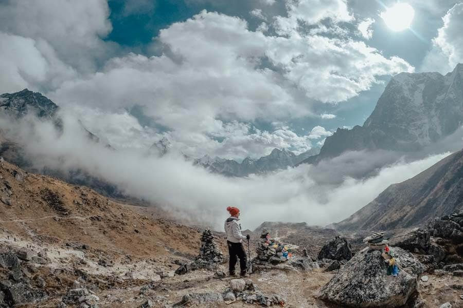
Kala Patthar (5,544 m / 18,192 ft): Highest accessible viewpoint, 360° Himalayan panorama, Everest sunrise views
What alternative routes exist for Everest Base Camp?
Four established alternatives reach or combine with the standard EBC route. Each adds distance, challenge, and a different Khumbu perspective.
Gokyo Lakes via Cho La Pass: Combines EBC with a detour through Gokyo Lakes (4,750 m / 15,584 ft) and crosses Cho La Pass (5,420 m / 17,782 ft). Adds 3 to 5 days. Gokyo Ri (5,357 m / 17,575 ft) offers comparable Everest views to Kala Patthar. Cho La glacier crossing requires microspikes; a guide is strongly advised.
Three Passes route: Crosses Kongma La (5,535 m / 18,159 ft), Cho La (5,420 m / 17,782 ft), and Renjo La (5,360 m / 17,585 ft) while visiting EBC and Gokyo Lakes. Total: 21 to 25 days. Requires prior high-altitude trekking experience; not recommended for first-timers.
Jiri to EBC: The original pre-airport route starts at Jiri (1,905 m / 6,250 ft) by bus from Kathmandu (8 to 9 hours). Adds 10 to 14 days, the route used by the 1953 Hillary-Tenzing expedition. Chosen by fewer than 2% of modern EBC trekkers.
Helicopter return from Gorak Shep: Not a different ascent route, eliminates the 3-day descent. Cost: $400 to $600 per person shared. Saves 3 days and 1,500 m (4,921 ft) of knee-stressing return descent.
What are the most difficult sections of the Everest Base Camp route?
Three sections are consistently rated the most demanding by returning EBC trekkers.
Phakding to Namche ascent (Day 2): 830 m (2,723 ft) gain over 4 to 5 km (2.5 to 3 mi) above the Hillary Suspension Bridge. The body processes 2,860 m (9,383 ft) altitude for the first time here. The climb from Hillary Bridge to Namche takes 2 to 3 hours without stopping.
Lobuche to Gorak Shep plateau (Day 8): Rocky moraine terrain, only 224 m (735 ft) gain over 3.5 km (2.2 mi). At 5,000 m (16,404 ft), available oxygen is 53% of sea-level concentration. Trekkers who performed well below Dingboche frequently struggle on this section.
Kala Patthar pre-dawn scramble (Day 9): 2 km (1.2 mi) rocky scramble with 380 m (1,247 ft) gain, starting at 5,164 m (16,942 ft) in darkness at 10°C to 20°C (14°F to 4°F). No technical climbing skills are needed, but cold, darkness, altitude, and fatigue combine to make this the most demanding single hour of the trek.
What trail conditions affect the Everest Base Camp route?
The EBC trail surface changes significantly by altitude zone and season. Trail conditions determine equipment needs, pace, and safety considerations at each stage.
Trail surface by altitude zone:
-
Lukla to Namche: Stone-paved paths, suspension bridge wire mesh, occasional dirt and rock
-
Namche to Dingboche: Mixed stone and packed dirt, rhododendron forest floor, stone staircase sections
-
Dingboche to Lobuche: Exposed gravel and loose rock, glacial moraine boulders, minimal paved sections
-
Lobuche to EBC: Rocky moraine with loose glacial debris, uneven terrain requiring ankle-supporting boots
Suspension bridge protocol: Nine major bridges cross the route, with steel cable and wire mesh construction. Maximum load signs are posted; follow them. Protocol: give way to yak caravans, move to the uphill side of the trail, and stand still until the caravan passes.
Seasonal conditions: October delivers the driest trail and clearest skies. Monsoon (June to September) brings mud and leech activity below 3,000 m (9,843 ft). December to February brings snow above Namche; microspikes are required above Lobuche, and crampons are advised above Gorak Shep in January and February.
Can the Everest Base Camp route be done in reverse?
The EBC route is technically doable in reverse, starting from the EBC side before descending to Lukla, but it offers no practical advantage over the standard direction. The standard northbound direction (Lukla to EBC) aligns acclimatization days with altitude gain milestones naturally.
Acclimatization days at Namche (Day 3) and Dingboche (Day 6) are positioned where altitude gain demands a physiological pause. Reversing the route without repositioning acclimatization days produces the same trekking protocol. The trail direction makes no meaningful difference to altitude safety or route experience.
Emergency exits: No roads or vehicles exist at any point on the EBC trail. Evacuation is by foot or helicopter only. Helicopter evacuation is available from Gorak Shep, Lobuche, Pheriche, Dingboche, and Namche in favorable weather. Himalaya Trekking Nepal guides carry Garmin InReach satellite communicators to coordinate evacuations from any point on the route.
How is the Everest Base Camp route different from the Gokyo Lakes route?
Gokyo Lakes is the most popular EBC alternative in the Khumbu. Both routes start and end at Lukla. Divergence begins at Namche Bazaar (3,440 m / 11,286 ft), where Gokyo branches northwest instead of northeast toward EBC.
Route overlap: Lukla to Namche (2 days) is common to both routes. Above Namche, routes diverge completely. A Cho La Pass crossing (5,420 m / 17,782 ft) reconnects them, creating a loop without retracing any trail.
Difficulty comparison: The Standard Gokyo route (without Cho La) is marginally easier , the maximum altitude at Gokyo Ri is 5,357 m (17,575 ft) versus Kala Patthar at 5,544 m (18,192 ft). The Gokyo plus Cho La plus EBC circuit is significantly harder; the Cho La glacier crossing requires prior experience and microspikes.
Which route to choose: First-time Khumbu trekkers with 14 days choose the standard EBC route for the complete base camp experience. Return Khumbu visitors with 18 to 21 days choose the combined Gokyo, Cho La, and EBC loop for the full Khumbu circuit.
Frequently Asked Questions About the Everest Base Camp Route
Is the EBC route the same going up and coming back?
Yes, ascent and descent routes are identical. The descent experience differs: visual perspective reverses, altitude pressure decreases daily, and knee stress increases on downhill sections. Quad and back-of-knee fatigue on the Namche-to-Phakding return descent (800 m / 2,625 ft) is the most common physical complaint on return days. Trekking poles reduce descent impact by 25%.
Are there roads on any part of the EBC route?
No roads exist on any section of the EBC route between Lukla and Everest Base Camp. The trail is exclusively a foot and pack animal path, protected by the Sagarmatha National Park designation. The nearest road access is at Salleri, approximately 2 days' walk south of Lukla, outside the standard EBC route.
Is the EBC route well-marked, or do I need a guide?
The main EBC trail is well-used and followable during peak season. Trail junctions at Namche, Tengboche, and Dingboche have directional signage. A guide's primary value above Dingboche is medical: AMS monitoring, SpO₂ tracking, and evacuation coordination, not navigational.
Can I do the EBC route without flying to Lukla?
Yes, the Jiri overland approach starts at Jiri (1,905 m / 6,250 ft), reachable by bus from Kathmandu in 8 to 9 hours. The Jiri route adds 10 to 14 trekking days and crosses Lamjura La (3,530 m / 11,581 ft). Fewer than 2% of modern EBC trekkers use this approach.
Are there emergency exits off the EBC route?
No road-based emergency exits exist at any point. Helicopter evacuation is the only rapid option above Namche Bazaar. The HRA medical post at Pheriche (4,240 m / 13,911 ft) provides altitude medicine triage during the October and April,to,May peak seasons. Himalaya Trekking Nepal guides carry satellite communicators for evacuation coordination from any point on the route.
More About Author

Khilak Budhathoki
Travel Director
Khilak Budhathoki is the co-founder and lead trekking guide at Himalaya Trekking Nepal, a locally owned and operated adventure company based in Kathmandu. Born and raised in the foothills of Nepal, Khilak developed a deep love for the mountains from an early age. With over a deca...

USD$1,600 pp
Our Recommendation
Related Blogs
.jpg)
Oct 30, 2025
Best Time for Annapurna Base Camp Trek
