- 21, Nov 2025 | Khilak Budhathoki
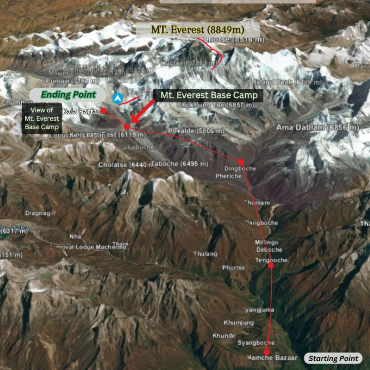
Everest Base Camp trek weather is shaped by season, altitude, temperature, precipitation, wind, cloud cover, and visibility across the Khumbu region of Nepal. The route rises from Lukla at 2,860 meters through Namche Bazaar, Tengboche, Dingboche, Lobuche, and Gorak Shep to Everest Base Camp at 5,364 meters, with Kala Patthar reaching 5,545 meters. This elevation change creates distinct weather conditions along the trail: spring and autumn generally bring stable skies and clearer mountain views, the June–August monsoon brings heavy rainfall and low cloud at lower elevations, and winter brings severe cold and snowfall across the high-altitude sections.
.webp)
Weather on the Everest Base Camp trek directly influences trail conditions, Lukla flight operations, mountain visibility, wind exposure, daily trekking times, and the clothing and equipment required at altitude. Temperatures fall substantially as elevation increases, while wind chill can make exposed ridges and high passes feel far colder than the recorded temperature. Rain can turn lower trails muddy and slippery, while snow and ice can affect the route between Lobuche, Gorak Shep, Everest Base Camp, and Kala Patthar. Understanding these seasonal and altitude-based weather patterns helps trekkers choose the most suitable month, anticipate changing conditions, prepare for temperature extremes, and make safer decisions throughout the journey.
How Does Everest Base Camp Trek Weather Change by Season?
Everest Base Camp trek weather follows 4 distinct seasonal cycles. Spring (March–May) and autumn (September–November) deliver the most stable, clear conditions. Summer (June–August) brings the South Asian monsoon with 80% of the region's annual rainfall. Winter (December–February) produces extreme cold and high snowfall above 4,000 meters.
Each season presents a completely different trekking environment. The temperature range across the full year at Everest Base Camp spans from a daytime high of approximately 2°C in spring to a nighttime low of −35°C in January. Knowing which season aligns with your fitness level, schedule, and risk tolerance is the first planning decision you make.
What Is Everest Base Camp Trek Weather Like in Spring?
Spring is the primary trekking season for Everest Base Camp, running from March through May. Temperatures at Base Camp reach −5°C to 2°C during daylight hours and drop to −15°C to −20°C overnight. At Lukla (2,860m), daytime temperatures range from 8°C to 16°C in April and May, making lower trail sections comfortable and pleasant.
Spring produces stable morning weather with cloud buildup in the afternoon between 13:00 and 15:00. Pre-monsoon winds arrive from the southwest by May, occasionally gusting above 50 km/h above Namche Bazaar. The trail is fully snow-free below 4,000 meters from April onward, and rhododendron forests between Phakding and Namche bloom red and pink throughout March and April.
March is cooler and drier, with excellent visibility. April is the most balanced month: warm enough for comfort, cold enough to prevent altitude-related fatigue, and clear enough for unobstructed Everest views from Kala Patthar. May brings warmer lower-elevation temperatures but increases the risk of afternoon thunderstorms and the earliest monsoon clouds.
Trekking parties attempting Everest summits also operate in spring, which means Base Camp is populated with expedition teams from mid-March through late May, a factor that adds unique energy to the trek during this period.
What Is Everest Base Camp Trek Weather Like in Summer?
Summer on the Everest Base Camp route (June–August) is the monsoon season, bringing 80% of the Khumbu region's annual precipitation in just 3 months. Trekkers weighing this window can see exactly what to expect in our dedicated guide to the Everest Base Camp trek in June. Rainfall at lower elevations between Lukla (2,860m) and Namche Bazaar (3,440m) averages 300–450mm during this period. Above 4,000 meters, precipitation increasingly falls as snow.
Cloud cover dominates the sky from early morning, reducing mountain visibility to near zero on most days. Trails below 3,500 meters become muddy, slippery, and infested with leeches, a genuine hazard that slows progress and requires gaiters and salt or repellent. Suspension bridges flood and sometimes become temporarily impassable after sustained rainfall.
Daytime temperatures at lower elevations (Lukla to Namche) stay mild at 10°C to 18°C, but the humidity makes it feel warmer. At Everest Base Camp, temperatures remain cold at −5°C to −2°C during the day, and nighttime temperatures drop to −18°C to −22°C even in July.
The primary risk during monsoon trekking is trail erosion, landslide potential on steep hillside paths, and Lukla flight disruptions from low cloud. Experienced trekkers who complete the EBC route in summer report that high-altitude sections above Dingboche (4,360m) are often above the clouds, offering surprising clarity, but reaching those elevations through the lower monsoon belt requires persistence and careful timing.
What Is Everest Base Camp Trek Weather Like in Autumn?
Autumn (September–November) is the second primary trekking season and widely regarded as the best period for mountain visibility. Post-monsoon air clarity in October and November produces the sharpest, most detailed views of Everest, Lhotse, Ama Dablam, and Pumori. Temperatures at EBC range from −5°C to −2°C in September, dropping to −15°C to −8°C by November.
September carries residual monsoon cloud in the first two weeks. From late September onward, skies clear progressively. October delivers the most consistently clear and stable weather of the entire year, with 8–10 hours of sunshine daily at high altitudes. Winds remain calm, snowfall above 5,000 meters is minimal, and temperatures at lower elevations stay comfortable.
By November, temperatures drop sharply. Nighttime temperatures at EBC reach −25°C to −20°C. Lukla morning temperatures fall to 2°C–5°C, and frost appears on trail sections above 3,000 meters.The trails remain dry, the rhododendron forests have turned gold and amber, and while slightly less crowded than October, the trail still carries a very high density of trekkers, often seeing 200 to 300 departures from Lukla per day.
What Is Everest Base Camp Trek Weather Like in Winter?
Winter trekking on the Everest Base Camp route (December–February) means extreme cold, high snowfall above 4,500 meters, and sparse trail conditions. Nighttime temperatures at EBC plunge to −30°C to −35°C in January. Daytime temperatures at Lobuche (4,940m) stay below −10°C. Even at Namche Bazaar (3,440m), overnight temperatures fall to −15°C.
Snowfall above 4,000 meters accumulates through January and February, with some trail sections between Lobuche and Gorak Shep requiring crampons or microspikes. Lukla flights operate with more reliability than during monsoon but face occasional disruption from high-altitude jet stream winds affecting approach paths.
The trail is quiet, fewer than 5% of annual EBC trekkers visit in December and January. Teahouses along the route remain open but reduce to skeleton menus and heating limitations. Clear winter skies produce stunning visibility, often rivaling October clarity. For trekkers with high cold tolerance, proper insulation gear, and experience in sub-zero mountain environments, winter offers an exceptionally raw and uncrowded EBC experience.
How Does Everest Base Camp Trek Weather Change by Altitude?
 Everest Base Camp trek weather changes according to a clear altitudinal gradient: temperature drops approximately 6.5°C for every 1,000 meters of elevation gain. The route spans from Lukla at 2,860m to Kala Patthar at 5,545m, a 2,685-meter elevation gain that creates 7 distinct weather micro-zones along the trail.
What Is the Weather Like at Lukla?
Lukla (2,860m) has the warmest and most moderate climate on the Everest Base Camp route. Daytime temperatures range from 12°C–18°C in spring and autumn, dropping to 0°C–5°C in winter. Annual rainfall at Lukla reaches approximately 700mm, concentrated between June and August. The airport at Lukla sits in a narrow valley where morning fog and low cloud frequently delay flights between October and November, and almost daily during monsoon season.
What Is the Weather Like in Namche Bazaar?
Namche Bazaar (3,440m) experiences cooler temperatures than Lukla with more pronounced afternoon cloud buildup. Daytime temperatures reach 8°C–14°C in spring and 6°C–12°C in autumn. Winter daytime temperatures fall to −2°C–3°C, with nights reaching −15°C. Namche sits in a natural bowl that traps wind, creating distinct micro-climate behavior, mornings are typically calm and clear, while afternoons often bring cloud and wind funneling up the Dudh Koshi valley from the south.
What Is the Weather Like at Tengboche?
Tengboche (3,867m) sits at the ridge above the Imja Khola confluence and receives direct southwest monsoon winds. Daytime temperatures in April average 5°C–10°C. In October, temperatures reach 3°C–8°C during the day and −12°C at night. The famous Tengboche Monastery sits on an exposed ridge, making it particularly susceptible to afternoon gusts. Morning cloud inversion regularly fills the valleys below Tengboche while the ridge itself remains clear, a photographic highlight for trekkers arriving between 06:00 and 09:00.
What Is the Weather Like at Dingboche?
Dingboche (4,360m) marks the transition into the high-altitude weather zone where temperature fluctuations become more extreme within a single day. The daytime temperature range in October spans from −3°C to 6°C. At night in October, temperatures drop to −14°C to −18°C. The Dingboche valley is sheltered from direct winds by the Chukhung ridge to the north, but cold katabatic drainage winds, cold air flowing downslope from glaciers, reach the village between 20:00 and midnight, dropping temperatures sharply after dark.
What Is the Weather Like at Lobuche?
Lobuche (4,940m) is exposed to valley channel winds accelerated by the Khumbu glacier terrain and receives its coldest temperatures between December and February. October daytime temperatures average −1°C to 4°C. November nighttime temperatures at Lobuche regularly fall below −20°C. Wind acceleration between Lobuche and Gorak Shep is measurably stronger than at Dingboche due to the valley constriction effect, wind speeds routinely exceed 30 km/h by mid-afternoon in spring and autumn.
What Is the Weather Like at Everest Base Camp?
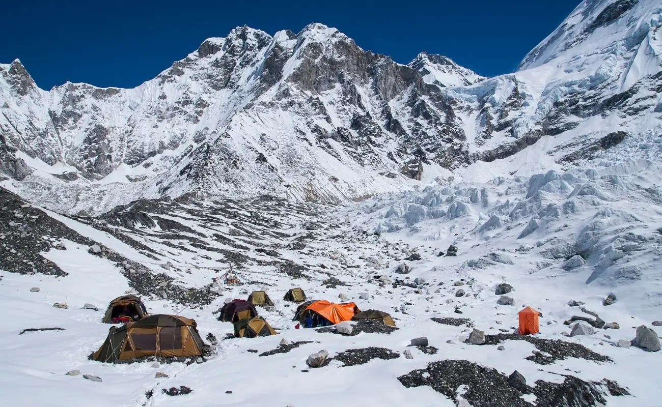
Everest Base Camp (5,364m) experiences arctic-like weather year-round, with no month recording an average temperature above freezing. In October, daytime highs reach −2°C to 2°C, and nighttime temperatures drop to −18°C to −25°C. In January, nighttime temperatures at EBC plunge to −30°C to −35°C. Katabatic winds from the Western Cwm above Base Camp create sudden temperature drops that can reduce a clear −5°C afternoon to a felt temperature of −20°C within 30 minutes.
The Khumbu Icefall generates localized cloud and mist during midday as solar radiation heats exposed ice, a weather phenomenon specific to this elevation zone. Afternoon cloud formation directly over the icefall is normal and not indicative of incoming storm systems.
What Is the Weather Like at Kala Patthar?
Kala Patthar (5,545m) is the highest point on the standard Everest Base Camp trek and the most exposed to high-altitude jet stream wind. Daytime temperatures in October reach −8°C to −3°C. Wind speeds on the summit ridge regularly hit 40–60 km/h in the afternoon, creating dangerous wind chill. The recommended summit time is 05:30 to 08:00, early morning provides the clearest views, lowest wind speeds, and temperatures that, while cold at −10°C to −15°C, remain manageable with proper layering, which is exactly why a Kala Patthar sunrise is the highlight most trekkers plan their morning around.
How Cold Does It Get During the Everest Base Camp Trek?
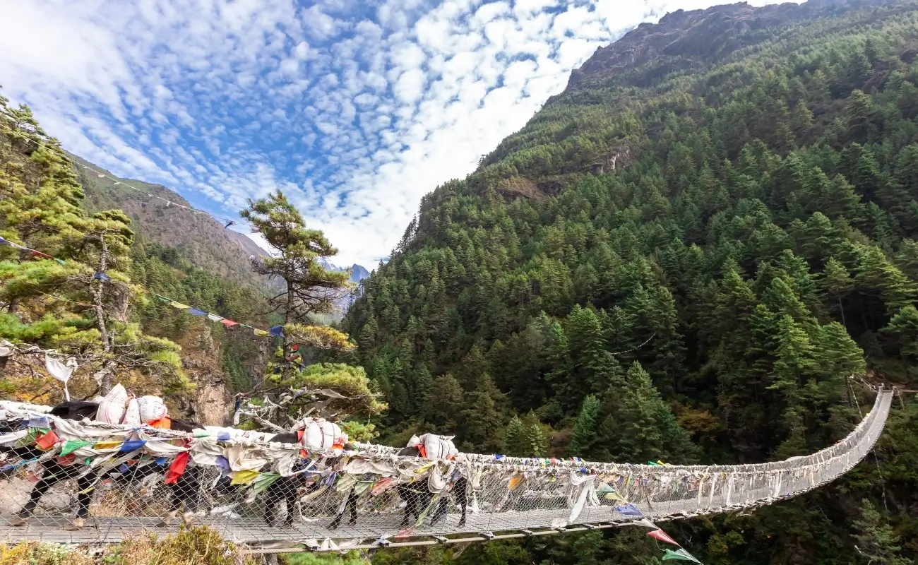 Temperatures on the Everest Base Camp trek span from a comfortable 18°C at Lukla in spring to a life-threatening −35°C at Kala Patthar on a January night. For context on the summit itself, our breakdown of how cold is Mount Everest covers the extremes above Base Camp. The 17°C to 35°C temperature gradient across the route is the primary factor driving gear selection, daily trekking schedules, and acclimatization timelines.
What Are Daytime Temperatures Like on the Everest Base Camp Trek?
Daytime temperatures across the EBC route during the 2 peak seasons (spring and autumn) range from 15°C at Lukla to −5°C at Everest Base Camp. The following table reflects average October daytime highs, the single most popular trekking month:
|
Location |
Elevation |
October Daytime High |
|
Lukla |
2,860m |
12°C–16°C |
|
Namche Bazaar |
3,440m |
8°C–13°C |
|
Tengboche |
3,867m |
5°C–10°C |
|
Dingboche |
4,360m |
2°C–7°C |
|
Lobuche |
4,940m |
−1°C–4°C |
|
Everest Base Camp |
5,364m |
−3°C–2°C |
|
Kala Patthar |
5,545m |
−8°C–−3°C |
Solar radiation at high altitude intensifies the perceived daytime warmth significantly. At 5,000 meters, UV radiation is 50–60% stronger than at sea level. Trekkers standing in direct sunlight at Base Camp on a calm October afternoon often feel uncomfortably warm despite ambient temperatures below freezing, a deceptive condition that masks real cold exposure.
What Are Nighttime Temperatures Like on the Everest Base Camp Trek?
Nighttime temperatures at every elevation on the EBC route drop sharply after sunset, with the most extreme drops occurring above 4,500 meters. At Lobuche in October, the temperature falls from a 2°C afternoon high to −18°C by midnight, a 20°C drop in under 6 hours. At EBC in November, overnight temperatures reach −25°C to −28°C. Sleeping bags rated to −20°C are the minimum standard for the high-altitude section; a bag rated to −30°C provides the appropriate safety margin for late October through February.
Teahouses above Dingboche (4,360m) heat dining rooms in the evening but leave sleeping rooms unheated. A quality sleeping bag liner adds 5°C–8°C of effective warmth and weighs under 400 grams, one of the highest value-to-weight investments in an EBC packing list.
How Much Does Wind Chill Affect Everest Base Camp Trek Weather?
Wind chill reduces the effective temperature on the EBC route by 8°C–20°C depending on wind speed and elevation. At Kala Patthar in October, an ambient temperature of −8°C combined with a 40 km/h wind creates a wind chill temperature of approximately −22°C. At Lobuche in January, the same calculation produces a felt temperature below −40°C.
Wind chill is most severe at 3 locations on the route: the ridge above Tengboche, the exposed moraine walk between Lobuche and Gorak Shep, and the Kala Patthar summit ridge. All 3 sections require a wind-blocking outer layer, a hardshell jacket rated to at least −10°C with sealed seams and a helmet-compatible hood. Balaclavas, insulated gloves, and wind-resistant trekking pants are not optional above Dingboche.
How Much Rain and Snow Can You Expect on the Everest Base Camp Trek?
The Everest Base Camp route receives an annual precipitation total of approximately 450–700mm, depending on elevation, with 75–80% falling during the June–August monsoon. Above 4,500 meters, most precipitation arrives as snow regardless of season.
When Does Rainfall Affect the Everest Base Camp Trek?
Rainfall directly affects trekking between Lukla and Dingboche from early June through mid-September, with peak intensity in July and August. Daily rainfall totals at Namche Bazaar in July average 12–18mm, with multi-day rain events totaling 80–120mm across 5 to 7 consecutive days.
Rainfall in spring (March–May) is intermittent and localized, typically afternoon showers lasting 30 to 90 minutes below 4,000 meters. These pre-monsoon showers rarely affect morning trekking but create slippery trail sections on descents after 14:00. Waterproof trail shoes or gaiters handle this effectively. Above 4,000 meters in spring, these same weather systems deposit light snow, clearing within hours.
When Is Snowfall Most Common Along the Everest Base Camp Route?
Snowfall above 4,000 meters occurs in every month of the year, with the heaviest accumulation between December and February. Trail sections between Lobuche (4,940m) and Gorak Shep (5,140m) accumulate 20–40cm of snowpack in January and February, requiring microspikes for safe passage. The moraine path approaching Everest Base Camp from Gorak Shep crosses sections of snow-covered glacier debris that obscure trail markers during heavy snowfall.
In spring, snowfall above 5,000 meters is possible through late April. In autumn, the first significant snowfall at Lobuche typically arrives in mid-to-late November. A notable weather risk exists in October, an early winter storm can deposit 30–50cm of snow above 4,500 meters within 48 hours, temporarily closing the upper trail. Such events occur roughly every 3 to 5 years during the October peak season and are the primary cause of trail closures and helicopter evacuations during the autumn period.
How Do Clouds and Visibility Affect the Everest Base Camp Trek?
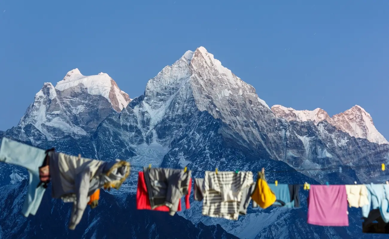 Clouds and visibility on the Everest Base Camp trek follow a predictable daily cycle: mornings are clearest, afternoons bring cloud buildup, and evenings often clear again before sunset. Mountain views from Kala Patthar, Tengboche ridge, and the approach to Everest Base Camp are best observed between 06:00 and 09:30 regardless of season.
Monsoon cloud creates near-total obscuration of peaks from June through mid-September. Valley fog, distinct from weather cloud, forms at lower elevations (Lukla to Namche) on autumn mornings as warm valley air meets cold mountain drainage air. This valley fog burns off by 09:00 and does not affect visibility above 3,500 meters.
Above 5,000 meters in October and November, visibility on clear days extends beyond 150 kilometers. Views include Everest's Southeast Ridge, the Lhotse Face, Nuptse (7,861m), and Pumori (7,161m), offering some of the most spectacular, up-close Himalayan panoramas visible from a single vantage point on Kala Patthar.
How Does Weather Affect Everest Base Camp Trek Conditions?
Everest Base Camp trek weather directly determines 4 critical trekking conditions: Lukla flight operations, trail surface safety, wind exposure above Namche, and mountain photography windows. Understanding these 4 links between weather and conditions separates trekkers who manage the route smoothly from those who encounter costly and dangerous disruptions.
How Can Weather Affect Lukla Flights?
Lukla airport (Tenzing-Hillary Airport, IATA: LUA) at 2,860m is one of the world's most weather-sensitive airstrips, and cloud or wind conditions below visibility minimums cancel all flights with no warning. The airport's 527-meter runway and steep 11.7° gradient approach require clear sight lines; visibility below 5 kilometers or crosswinds above 25 knots will ground all aircraft.
Cancellation rates at Lukla reach 30–40% of scheduled flights during monsoon season. In October and November, cancellation rates fall to 10–15%, but morning fog between 07:00 and 09:00 causes significant delays. Winter fog in December and January delays morning flights by 2–4 hours on average 8 days per month. Trekkers with fixed international departure dates build a minimum 2-day Lukla weather buffer into their itinerary to account for this reality.
Helicopter transfers from Kathmandu to Lukla or directly to Phakding operate in weather windows that fixed-wing flights cannot use, reducing (but not eliminating) weather-related access delays. Helicopter operations cease in winds above 40 km/h, which occur regularly above Namche during spring and in winter jet stream periods.
How Can Snow Affect Everest Base Camp Trekking Trails?
Fresh snowfall above 4,000 meters transforms trail surfaces from packed earth or gravel to slippery ice-coated paths within hours. The most affected sections are the lateral moraine path from Dughla (4,620m) to Lobuche (4,940m), the Gorak Shep to Everest Base Camp glacier approach, and the steep rocky ascent from Gorak Shep to Kala Patthar.
Microspikes (not crampons) are sufficient for consolidated snow up to 10cm depth. Fresh, unconsolidated snow above 20cm depth on the Gorak Shep–Base Camp section requires trekking pole self-arrest technique and confidence in navigation when trail markers are buried. The standard EBC trail uses cairns and prayer flag lines as markers, both become invisible under 30cm of snowfall.
How Can High Winds Affect Trekking Above Namche?
Wind speeds above Namche Bazaar accelerate through 4 valley constriction points: the Dudh Koshi gorge above Namche, the Tengboche ridge, the moraine corridor above Dughla, and the Kala Patthar summit. At these 4 locations, wind speeds averaging 20 km/h at valley level routinely double to 40 km/h due to the Venturi effect.
Above Namche in spring, afternoon winds between 14:00 and 17:00 are the most consistently strong. Trekkers who descend from Tengboche after 13:00 frequently encounter sustained winds that make balanced walking on exposed ridge sections difficult. Starting high-altitude days before 07:00 eliminates this problem on most days in spring and autumn. Winter jet stream events drop winds above 80 km/h onto the Kala Patthar ridge, conditions that make the ascent physically dangerous, not merely uncomfortable.
How Does Weather Affect Mountain Visibility?
Mountain visibility on the Everest Base Camp route depends on 3 factors: cloud altitude, aerosol load, and precipitation. October and early November consistently produce the lowest aerosol concentrations and highest frequency of cloud-free mornings, 22 to 26 days per month with clear summit views from Kala Patthar.
March and April rank second for clear-sky frequency, 18 to 22 clear mornings per month. The Himalayan Climate Bulletin (2024) documents a measurable trend of earlier monsoon onset in the Khumbu region since 2018, with cloud cover arriving at high elevations approximately 7–10 days earlier in May than the 1990–2010 baseline average. Trekkers planning for late May now target departure from Kala Patthar before 08:00 to capture cloud-free summit views.
What Is the Best Weather for an Everest Base Camp Trek?
The best weather for an Everest Base Camp trek occurs in October, followed by April, March, November, and May, in that order. These 5 months deliver the most consistent combination of stable temperatures, low precipitation, calm winds, and clear mountain visibility.
Which Months Offer the Most Stable Trekking Weather?
October delivers the most stable trekking weather of the year, with 22–26 clear days, post-monsoon clean air, calm winds, and temperatures that remain manageable from Lukla to Kala Patthar. April ranks second, offering equally stable conditions with the addition of spring bloom at lower elevations and warmer afternoon temperatures below 4,000 meters.
March is the most underrated trekking month. Trail crowds are 40–50% lower than October. Temperatures are cold but consistent. Snowfall above 5,000 meters from the previous winter is still present but does not block trails. Views of Everest carry a distinctive winter clarity, sharper and more defined than the post-monsoon clarity of October.
Which Months Offer the Clearest Mountain Views?
October and November produce the clearest mountain views, with post-monsoon atmospheric clarity creating visibility windows that extend to 150+ km. The post-monsoon air is washed clean by 3 months of rain, eliminating the dust and haze that reduces spring visibility in dry years.
April occasionally rivals October for clarity, particularly in years with strong spring pre-monsoon precipitation that washes fine dust from the upper atmosphere. The clearest recorded visibility days on Kala Patthar, where individual rock features on Everest's upper mountain become visible to the naked eye, occur in October and April, based on expedition meteorological records from the Tribhuvan University Institute of Engineering, Kathmandu (2023).
Which Months Have the Lowest Weather-Related Risks?
October carries the lowest composite weather risk of any trekking month, followed by April and early November. The 4 measurable weather risks, trail snowfall, Lukla flight cancellation, wind above Namche, and lightning/storm exposure, all reach their minimum frequency in October.
December and January carry the highest weather risk combination: Lukla flight delays from winter fog, extreme cold above 4,500 meters, snowpack on high trails, and reduced daylight hours (sunset at 17:15 in January). June, July, and August carry the highest precipitation risk and the lowest visibility probability.
How Should You Prepare for Everest Base Camp Trek Weather?
Effective preparation for Everest Base Camp trek weather requires a 3-layer clothing system, dedicated weather protection gear, and a flexible daily schedule that responds to morning conditions. These 3 components, layering, protection, and flexibility, account for every weather scenario the route presents.
What Clothing Should You Pack for Changing Mountain Weather?
Pack a 3-layer system: a moisture-wicking base layer, an insulating mid-layer, and a waterproof/windproof outer shell. For every item across all altitude zones, see our complete Everest Base Camp packing list. The specific items that function across all EBC weather zones are:
-
Base layer: Merino wool long-sleeve top and leggings (150–200g/m² weight) for moisture management and odor resistance across 2-week itineraries
-
Mid-layer: 800-fill-power down jacket or synthetic equivalent rated to −10°C
-
Outer shell: Gore-Tex or equivalent 3-layer hardshell with pit zips, rated to 20,000mm waterproof column
-
Leg insulation: Softshell trekking pants with a wind-blocking outer layer for above Namche
-
Extremities: Liner gloves + insulated outer mittens, wool balaclava, insulated hat, UV400 wrap-around sunglasses or glacier goggles
The single most common gear mistake on the EBC route is treating the outer shell as the primary insulation layer. The shell blocks wind and rain; the down jacket provides thermal retention. Both are non-negotiable above Dingboche.
What Weather Protection Should You Carry on the Trek?
Carry 4 essential weather protection items: a rain cover for your pack, trekking poles, microspikes (October through April for high sections), and a personal weather thermometer. These 4 items address rain, balance on uneven terrain, icy trail conditions, and informed decision-making.
A pack rain cover protects sleeping bag, down jacket, and electronics during rain events. Wet down insulation loses 80–90% of its thermal efficiency, making a dry sleeping bag a safety-critical item above 4,000 meters. Trekking poles reduce knee impact on descents by approximately 25% (measured force reduction at Dingboche-to-Namche descent grade), and provide balance support on wind-exposed ridge sections.
Glacier or UV-rated sunglasses (minimum UV400) are mandatory above 4,000 meters. Snow blindness, ultraviolet radiation-induced photokeratitis, develops within 2–4 hours of unprotected UV exposure on snow-covered high-altitude terrain. Symptoms include severe eye pain, tearing, and temporary vision loss, typically appearing 6–12 hours after exposure.
How Can You Prepare for Sudden Weather Changes?
Responding to sudden weather changes on the EBC route requires 3 habits: monitoring morning conditions before departure, carrying all weather layers in your daypack, and understanding the 14:00 rule.
The 14:00 rule states that trekking above 4,500 meters after 14:00 exposes you to the highest-risk window for afternoon thunderstorm lightning, wind acceleration, and cloud engulfment. Experienced EBC guides schedule all high-altitude sections (Lobuche to EBC, Gorak Shep to Kala Patthar) to complete the outbound leg by 13:30 at the latest.
Carry a lightweight emergency bivy or Mylar survival blanket. These 2 items weigh under 200 grams and provide critical protection during unplanned weather exposure above 5,000 meters when temperatures drop sharply within 20 minutes. Downloading the mountain weather forecast from Mountain-Forecast.com (which provides point forecasts at Everest Base Camp altitude) each evening gives you the next 24-hour prediction to plan your departure time.
How Can Himalaya Trekking Nepal Help You Trek Everest Base Camp in Different Weather Conditions?
Himalaya Trekking Nepal provides expert-guided Everest Base Camp treks designed around real-time weather adaptation. Their guides carry experience across all 4 seasons and train specifically on high-altitude weather reading, emergency route modification, and Lukla flight management. This local knowledge, built over years on the Khumbu route, translates to safer itinerary decisions and weather-aware daily scheduling for every trekking group they lead.
Their local field staff in Namche Bazaar and Dingboche monitor trail and flight conditions daily, relaying updates to trip leaders 24–48 hours ahead of critical decisions. This network reduces weather-related itinerary disruption, particularly during the shoulder periods of late May, early September, and November, months when weather transitions unpredictably and groups without local intelligence face avoidable delays.
Can Himalaya Trekking Nepal Help You Choose the Best Season for Everest Base Camp?
Yes, Himalaya Trekking Nepal's team provides personalized season recommendations based on your specific objectives, fitness level, cold tolerance, and flexibility. For trekkers prioritizing mountain photography, they recommend 2 windows: October 5–20 for post-monsoon clarity, and April 5–20 for spring bloom and equally reliable views.
Trekkers with a lower cold tolerance receive autumn recommendations. Trekkers seeking fewer crowds receive March or early November suggestions. Groups with strict fixed departure windows receive scheduling advice that maximizes weather probability within their available dates. The team monitors seasonal forecast trends each year, incorporating current data rather than relying solely on historical averages, a distinction that matters increasingly as Himalayan weather patterns shift.
What Are the Key Takeaways About Everest Base Camp Trek Weather?
Everest Base Camp trek weather defines every aspect of the trekking experience, from clothing decisions and gear selection to daily scheduling, acclimatization timing, and safety management. The 6 most actionable takeaways from this guide are:
-
October and April are the 2 optimal trekking months, offering the highest frequency of stable, clear, wind-calm conditions.
-
Temperature drops approximately 6.5°C per 1,000 meters of elevation, creating a massive 53°C temperature variance from the warmest Lukla spring days to the coldest Kala Patthar winter nights.
-
Wind chill reduces effective temperature by 8°C–20°C above Namche Bazaar, a factor that determines gear selection more than ambient temperature alone.
-
Lukla flights carry a 10–40% cancellation rate depending on season; a 2-day weather buffer at the start or end of any itinerary is standard practice.
-
The 14:00 rule, complete high-altitude legs before 14:00, eliminates exposure to the daily peak risk window for thunderstorms, wind, and cloud engulfment.
-
A 3-layer clothing system with a sleeping bag rated to −30°C covers every weather scenario from Lukla in summer to Kala Patthar in late autumn and winter, providing a vital safety margin for sudden temperature drops.
Understanding Everest Base Camp trek weather is not preparation for one specific condition. The route delivers sunshine, snow, rain, wind, and sub-zero nights, sometimes within a single 12-hour day. Trekkers who plan for all of these conditions, rather than the best-case scenario, arrive at Base Camp on schedule and return safely. Ready to experience it with expert weather guidance? Explore our guided Everest Base Camp trek packages, built around real-time seasonal planning.
More About Author

Khilak Budhathoki
Travel Director
Khilak Budhathoki is the co-founder and lead trekking guide at Himalaya Trekking Nepal, a locally owned and operated adventure company based in Kathmandu. Born and raised in the foothills of Nepal, Khilak developed a deep love for the mountains from an early age. With over a deca...

USD$1,600 pp
Our Recommendation
USD$1500 pp
Our Recommendation

USD$850 pp
Our Recommendation
Related Blogs