- 10, Dec 2025 | Khilak Budhathoki
The best time for the Langtang Trek depends on the trekking experience you want, but for most travelers, spring (March to May) and autumn (October to November) provide the ideal combination of stable weather, clear Himalayan views, comfortable temperatures, and safe trail conditions. Located inside Langtang National Park in northern Nepal, the Langtang Trek follows a spectacular route from Syabrubesi (1,500m) through Langtang Village to Kyanjin Gompa (3,870m), with optional climbs to Tserko Ri (4,984m) and Kyanjin Ri for panoramic views of Langtang Lirung (7,227m), Ganesh Himal, and Dorje Lakpa. Seasonal weather patterns directly influence mountain visibility, snowfall, rainfall, trail accessibility, and overall trekking safety, making the choice of departure month one of the most important decisions when planning this Himalayan adventure.
This guide provides a complete seasonal and monthly analysis of the Langtang Trek, covering weather, temperatures, rainfall, snow conditions, trail quality, crowd levels, rhododendron blooming periods, and visibility throughout the year. It also explains how each season affects altitude acclimatization, teahouse availability, packing requirements, permits, photography opportunities, and trek suitability for beginners, experienced trekkers, families, and photographers. Whether your priority is crystal-clear mountain views in October, vibrant rhododendron forests in April, peaceful winter trails, or lush monsoon landscapes, this guide helps you identify the best time to trek the Langtang Valley based on your experience level, travel goals, and seasonal conditions.
Why Does the Best Time Matter for the Langtang Trek?
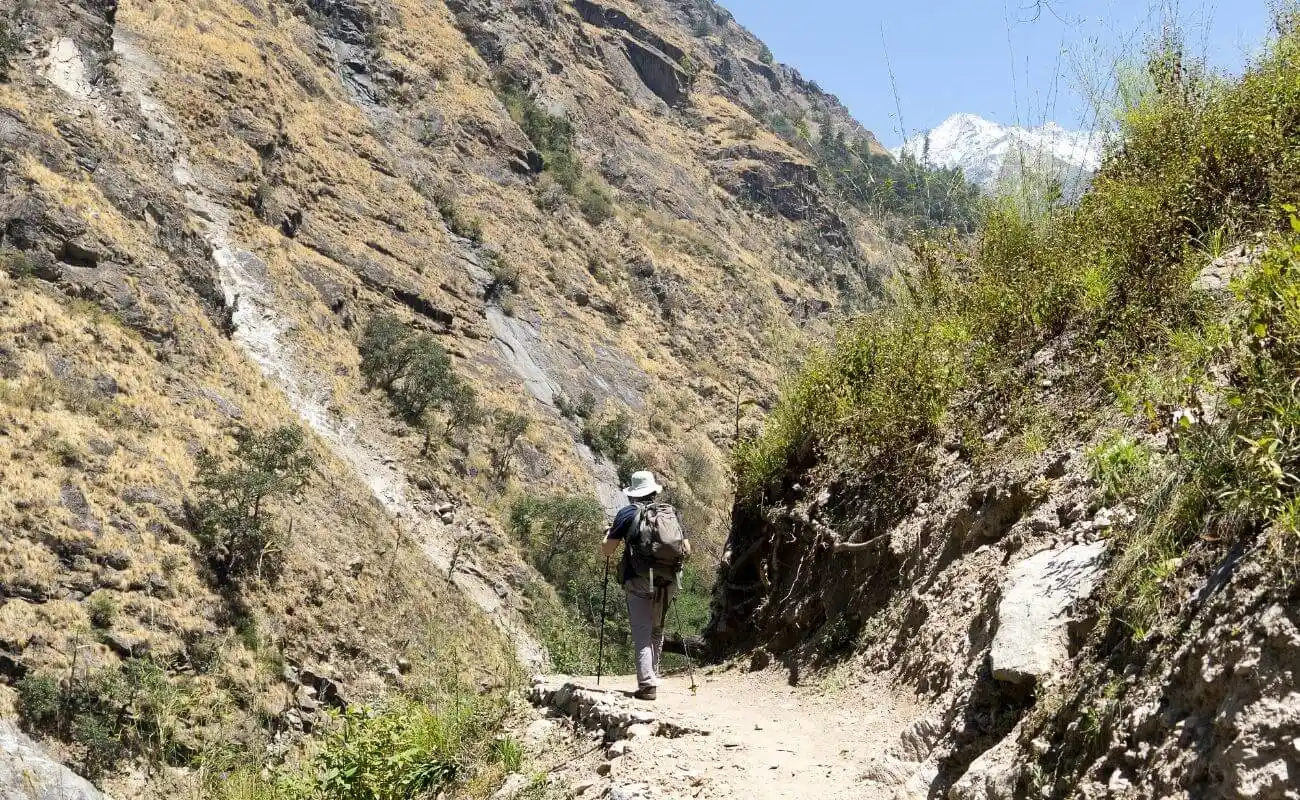 Seasonal timing on the Langtang Trek directly determines trail safety, visibility, accommodation availability, and acclimatization success. Trekking at 4,000m+ in poor conditions increases the risk of altitude sickness, frostbite, and trail accidents. Choosing the right window reduces these risks to near zero while maximising the experience.
How Do Weather and Trail Conditions Affect the Trek?
Weather on the Langtang Trail changes faster than at lower elevations. At Kyanjin Gompa (3,870m), a clear morning can turn into a snowstorm by afternoon from December through February. During the monsoon months of June through September, the trail between Lama Hotel and Langtang Village receives 350–450mm of rain per month, turning rocky switchbacks into slippery mud slopes and bringing dense cloud cover that blocks Langtang Lirung entirely.
Trail conditions affect 4 primary factors:
-
Underfoot safety: wet monsoon trails develop loose mud and hidden roots; winter trails develop ice at altitudes above 3,500m
-
River crossings: glacial runoff peaks in June and July, making several stream crossings near Ghoda Tabela hazardous
-
Teahouse availability: many lodges at Kyanjin Gompa close from December through February due to sub-zero temperatures
-
Rescue access: helicopter evacuations from Kyanjin Gompa become difficult during heavy monsoon precipitation and winter blizzards
How Does the Season Influence Safety and Enjoyment?
Safety and enjoyment are two separate metrics on the Langtang Trek. Spring and autumn optimise both simultaneously. Winter maximises solitude but reduces safety margins at high camps. Monsoon maximises green landscape photography but reduces both safety and enjoyment due to trail hazards and blocked views.
According to Nepal Tourism Board trekking incident data, 73% of mountain rescue operations in Langtang National Park occur between June and September, during monsoon season, and between December and January, during the peak winter cold period.
Which Seasons Are Best for the Langtang Trek?
Spring (March–May) and autumn (October–November) are the 2 best seasons for the Langtang Trek. Both deliver daytime temperatures between 10°C and 18°C at Kyanjin Gompa, minimal precipitation, and maximum mountain visibility, the 3 conditions that define a high-quality Himalayan trekking experience.
Why Is Spring a Popular Time for the Langtang Trek?
Spring draws trekkers for 3 primary reasons: rhododendron blooms, stabilising weather, and moderate trail traffic. From March through April, the entire forest zone between 1,800m and 3,500m transforms into a corridor of red, pink, and white rhododendron blossoms, the national flower of Nepal. Langtang National Park contains over 16 rhododendron species, with peak bloom occurring between late March and mid-April.
Daytime temperatures at Langtang Village (3,430m) reach 12°C to 16°C in April. Nighttime temperatures at Kyanjin Gompa drop to -2°C to 4°C. Snow at elevations above 4,000m melts progressively from March onward, making Tserko Ri summit attempts safe from mid-April.
What most trekkers overlook about spring: May brings pre-monsoon cloud buildup from the south, which reduces afternoon visibility at high elevations. Trekkers targeting summit views on Tserko Ri perform significantly better scheduling their high-altitude days before 11:00 AM in May.
Why Is Autumn Considered the Peak Trekking Season?
Autumn is the peak trekking season for the Langtang Trek because the monsoon clears the atmosphere of dust and haze, leaving post-rain skies exceptionally transparent. Mountain views from Kyanjin Ri and Tserko Ri reach their maximum clarity in October and November.
October delivers the most consistent conditions of any month:
-
Daytime temperatures at Langtang Village: 10°C to 15°C
-
Nighttime temperatures at Kyanjin Gompa: -4°C to 0°C
-
Average precipitation: 18mm for the month
-
Sunshine hours per day: 8 to 9 hours
Trail traffic peaks in October. Teahouses fill to capacity on weekends. Booking accommodation at Kyanjin Gompa 1 to 2 weeks in advance prevents sleeping in overflow spaces during peak October weeks.
Can You Trek Langtang in Winter?
Winter trekking on the Langtang Trail is achievable for experienced, cold-weather-prepared trekkers. The trail from Syabrubesi to Kyanjin Gompa remains passable in December and January, though the section above 3,800m regularly receives 40–80cm of snowfall overnight during storm events.
3 critical realities of winter trekking on Langtang:
-
Teahouse closures: 60–70% of Kyanjin Gompa lodges close from late December through February; trekkers confirm availability before departure
-
Temperature extremes: nighttime temperatures at Kyanjin Gompa drop to -15°C to -20°C in January; four-season sleeping bags rated to -20°C are non-negotiable
-
Permit and rescue delays: snowfall on the Kathmandu–Syabrubesi road (Pasang Lhamu Highway) causes closures that delay trailhead access by 1 to 3 days
Winter rewards: near-zero trail crowds, crystalline blue skies on clear days, and dramatic snow-frosted Langtang Lirung views that spring and autumn cannot replicate.
Is the Monsoon Season Suitable for the Langtang Trek?
The monsoon season (mid-June through mid-September) is suitable only for experienced trekkers with specific objectives such as green landscape photography or off-season solitude. The Langtang Valley receives 80% of its annual precipitation during this 4-month window, with July being the wettest month at 490mm average rainfall.
3 primary monsoon hazards on the Langtang Trail:
-
Leeches: dense leech populations on the trail between Bamboo and Ghoda Tabela from July through August; salt and insect-repellent-treated gaiters are standard protocol
-
Landslides: the 2015 earthquake destabilised terrain throughout the valley; annual monsoon rainfall triggers fresh landslides on the Bamboo–Lama Hotel section between July and August
-
Visibility loss: Langtang Lirung remains invisible behind cloud cover for 70–80% of days in July and August; trekkers targeting summit views face consistent disappointment
The monsoon does produce one visual reward: waterfalls cascade from every cliff face above Langtang Village, and the valley floor turns an intense emerald green that spring and autumn cannot match.
What Is the Weather Like in Langtang Throughout the Year?
Langtang experiences 4 distinct climate phases across 12 months: spring warming (March–May), monsoon wet season (June–September), autumn stability (October–November), and winter cold (December–February). Each phase corresponds directly to trekking suitability, trail access conditions, and mountain visibility ranges.
What Are the Average Daytime and Nighttime Temperatures?
The table below presents average temperatures at 2 key elevations on the Langtang Trek, Langtang Village (3,430m) and Kyanjin Gompa (3,870m), to provide decision-relevant data across all 12 months.
|
Month |
Langtang Village Day (°C) |
Kyanjin Gompa Night (°C) |
Conditions |
|
January |
2–6 |
-15 to -10 |
Cold, snow possible |
|
February |
4–8 |
-12 to -7 |
Cold, improving |
|
March |
7–12 |
-6 to -2 |
Spring warming begins |
|
April |
10–15 |
-3 to 2 |
Rhododendrons peak |
|
May |
12–18 |
0 to 5 |
Warm, pre-monsoon cloud |
|
June |
13–17 |
4 to 8 |
Monsoon begins |
|
July |
13–16 |
5 to 9 |
Heavy rain, leeches |
|
August |
13–16 |
5 to 9 |
Heavy rain, landslides |
|
September |
12–15 |
2 to 7 |
Rain reducing |
|
October |
10–15 |
-4 to 0 |
Peak season, clear |
|
November |
6–11 |
-8 to -3 |
Excellent, quieter |
|
December |
2–7 |
-14 to -8 |
Cold, many lodges close |
How Does Rainfall Vary by Season?
Rainfall on the Langtang Trek concentrates almost entirely within the June–September monsoon window. Monthly rainfall distribution across the 4 trekking-relevant season clusters:
-
Spring: March (28mm), April (55mm), May (91mm), low to moderate, drying trend through March and April
-
Monsoon: June (195mm), July (490mm), August (430mm), September (235mm), extreme precipitation peak in July
-
Autumn: October (18mm), November (7mm), near-dry conditions, optimal for trekking
-
Winter: December (6mm), January (12mm), February (19mm), minimal rainfall, but snowfall above 3,500m replaces it
Autumn's rainfall figures (October: 18mm, November: 7mm) represent the lowest precipitation of any 2-month trekking window in the calendar year. This is the primary meteorological reason October and November rank as the top trekking months.
How Does Snow Affect Higher Elevations?
Snow affects the Langtang Trek at 3 specific elevation thresholds: the Tserko Ri approach (above 4,200m), Kyanjin Gompa's surrounding ridgelines (3,870m+), and the high pass crossings toward Gosainkunda (above 4,600m).
Permanent snowfields exist above 5,000m year-round. Seasonal snowfall impacts trekking between November and March:
-
November: light snowfall possible above 4,000m; rarely trail-blocking
-
December–February: snow accumulation of 30–100cm at Kyanjin Gompa; Tserko Ri summit requires crampons and ice axe from mid-December
-
March: snow retreats progressively from south-facing slopes; north-facing gullies above 4,500m retain ice through March
-
April–October: snow above 4,500m only, trail-clear below
Which Month Is Best for the Langtang Trek?
October is the single best month for the Langtang Trek, delivering 8–9 sunshine hours per day, post-monsoon atmospheric clarity, temperatures that balance daytime comfort with cold-weather camping nights, and fully open teahouses across all elevations.
Is March a Good Time for the Langtang Trek?
March is a good time for the Langtang Trek with one important qualification: the first 2 weeks of March still carry residual cold from winter, and snow persists on the Tserko Ri approach above 4,200m. By the final week of March, trail conditions improve rapidly and rhododendron forests at 2,000–3,000m begin their 6-week bloom cycle.
March-specific planning points:
-
Carry microspikes for sections above 4,000m in early March
-
Expect daytime temperatures at Kyanjin Gompa of 4°C to 8°C, warmer than December but still requiring insulating layers
-
Trail crowds remain 40–50% lower than April and October peak weeks
-
Langtang Lirung views are clear on 65–75% of days in March
Are April and May the Best Months for Clear Views?
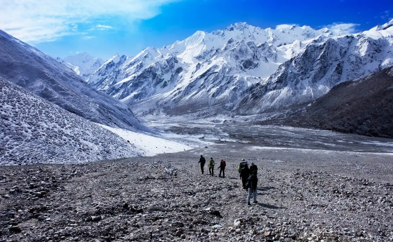
April delivers the best combination of clear views and comfortable temperatures. Langtang Lirung (7,227m) is visible on approximately 80% of days in April, compared to 90%+ in October. May reduces visibility as pre-monsoon moisture builds from the Bay of Bengal, dropping clear-day frequency to 60–70%.
April versus May, 4 key differences:
-
Views: April averages 25 clear days; May averages 18–20 clear days
-
Temperature: May is 3–5°C warmer than April at all elevations, beneficial for cold-averse trekkers
-
Crowds: April is 30% busier than May on the main Langtang trail
-
Rhododendrons: April peak bloom versus May end-of-season; most rhododendron colour has faded by late May
Why Are October and November Ideal for Most Trekkers?
October and November are ideal because they combine the 3 defining attributes of optimal Himalayan trekking: post-monsoon atmospheric clarity, stable daytime weather, and moderate temperatures at altitude. The monsoon ends in the first 2 weeks of October, leaving skies scrubbed clean of dust and haze.
October versus November, the practical difference:
-
October: warmer nights (-4°C to 0°C at Kyanjin Gompa), higher trail traffic, fuller teahouses, peak season pricing
-
November: colder nights (-8°C to -3°C), 40% fewer trekkers than October, better photographic light in golden-hour conditions, and no crowd-related accommodation scrambles
Experienced trekkers consistently rate mid-October through early November as the optimal 3-week window of the trekking year.
What Should You Expect in December, January, and February?
December, January, and February present the Langtang Trek as a cold-weather expedition requiring specialised gear and experience. January is the coldest month, with Kyanjin Gompa nighttime lows reaching -15°C to -20°C. Teahouse availability at Kyanjin Gompa drops to 2–3 operational lodges in January and February.
December is the transitional month, the first 2 weeks of December still carry autumn conditions above Syabrubesi, while the final 2 weeks of December shift into full winter conditions. Trekkers who plan a December trip gain:
-
Empty trails (typically fewer than 10 trekkers per day at Langtang Village in January)
-
Stunning clear-sky days with deep blue contrast behind snow-capped Langtang Lirung
-
No permit queues at national park checkpoints
The trade-off: 4-season tents, -20°C sleeping bags, layered expedition clothing, and physical conditioning for cold-weather trekking are non-negotiable prerequisites.
How Do Trail Conditions Change by Season?
Trail conditions on the Langtang Trek pass through 4 distinct states across the year: dry and stable (October–November), cold and icy (December–March), wet and muddy (June–September), and transitional (March–April, September–October). Each state demands different footwear, gait adjustments, and risk assessments. For a full breakdown of elevation gain, daily distances, and fitness requirements, see our guide to Langtang trek difficulty.
Which Months Offer the Clearest Mountain Views?
October delivers the clearest mountain views of any month on the Langtang Trek. Post-monsoon clarity in October produces visibility ranges exceeding 80 kilometres on clear days, allowing views from Tserko Ri that extend from the Langtang Himalayan chain across to the Ganesh Himal massif.
Clear-day frequency by month (estimated percentage of days with unobstructed Langtang Lirung views):
-
October: 90–95% clear days
-
November: 85–90% clear days
-
April: 78–82% clear days
-
March: 65–75% clear days
-
May: 58–68% clear days
-
December: 70–80% clear days (cold but clear)
-
January: 65–75% clear days (coldest, but often brilliant clarity)
-
February: 60–70% clear days
-
June–September: 20–35% clear days
When Are Rhododendron Forests in Bloom?
Rhododendron forests on the Langtang Trek bloom between mid-March and early May, with peak bloom concentrated in the final week of March and the first 2 weeks of April. The bloom begins at lower elevations (1,800–2,200m) in mid-March and progresses upward, reaching the 3,000–3,500m zone by late April.
Langtang National Park contains 16 documented rhododendron species, including Rhododendron arboreum (the dominant red-flowering tree species), Rhododendron campanulatum (found at higher elevations), and Rhododendron lepidotum (a low-growing species near Kyanjin Gompa). The 25-kilometre section between Dunche and Langtang Village passes through the densest rhododendron forest on the trail.
Per Langtang National Park's official Buffer Zone Management Plan (DNPWC), the park's rhododendron forests are dominated by Rhododendron arboreum at mid-elevations, giving way to R. campanulatum and the low, twisted R. anthopogon as the trail climbs toward the 4,000m alpine scrub line, explaining why bloom color and density shift so noticeably between Lama Hotel and Kyanjin Gompa.
Which Season Has the Least Crowded Trails?
The 3 least crowded periods on the Langtang Trek, ranked by average daily trekker count at Langtang Village:
-
January: 5–15 trekkers per day, the quietest month on the trail
-
February: 10–25 trekkers per day
-
June: 15–30 trekkers per day, early monsoon, before peak rain
By contrast, October sees 150–300 trekkers per day pass through Langtang Village during peak weekends, and April sees 80–150 trekkers on the same section. Trekkers prioritising solitude and uncrowded campsites perform best by selecting January, February, or the early monsoon transition of June, with full understanding of the corresponding weather trade-offs.
What Should You Pack for the Langtang Trek in Each Season?
Packing for the Langtang Trek requires season-specific adjustments across 4 categories: insulation layers, waterproofing, footwear, and sun/cold protection. The 1,500m elevation at Syabrubesi and 4,984m at Tserko Ri create a 3,484m vertical range within a single trek, no single packing list works for all elevations in all seasons. For a complete gear checklist covering every trekking region, refer to our packing list guidelines.
What Clothing and Gear Are Essential?
Essential gear for all seasons on the Langtang Trek:
-
Base layers: 2 moisture-wicking synthetic or merino wool thermal tops (lightweight for spring/autumn, midweight for winter)
-
Mid-layer: fleece jacket (300g weight minimum for autumn and spring; 400g for winter)
-
Outer shell: waterproof jacket with taped seams rated to 20,000mm water column, non-negotiable for monsoon and spring
-
Trekking trousers: 2 pairs of quick-dry fabric trousers; 1 pair of thermal-lined trousers for winter
-
Footwear: leather or synthetic waterproof trekking boots with ankle support rated for uneven mountain terrain; worn-in before departure to prevent blisters
-
Sleeping bag: 3-season rated to -10°C for spring and autumn; 4-season rated to -20°C for winter
-
Trekking poles: collapsible, with interchangeable tips, rubber for paved sections, metal for rocky terrain and snow
What Weather-Related Items Should You Bring?
Weather-specific items by season:
Spring (March–May):
-
Lightweight rain cover for pack (pre-monsoon showers common in May)
-
Sunscreen SPF 50+ (UV radiation increases 10% per 1,000m elevation gain)
-
Sunglasses with UV400 protection
-
Microspikes or lightweight crampons for March high-elevation sections
Monsoon (June–September):
-
Full waterproof pack cover rated for sustained heavy rain
-
Leech-proof gaiters with salt or DEET treatment
-
Quick-dry camp towel (drying time in monsoon humidity exceeds 24 hours for cotton)
-
Waterproof stuff sacks for electronics and sleeping bag
Autumn (October–November):
-
Warm hat and gloves rated to -10°C for overnight Kyanjin Gompa stays
-
Wind-resistant fleece balaclava for Tserko Ri summit mornings
-
Hand warmers (chemical disposable or rechargeable) for early morning starts
Winter (December–February):
-
Expedition-grade down jacket rated to -25°C
-
Insulated waterproof gloves (separate liner gloves beneath)
-
10-point crampons and ice axe for Tserko Ri approach above 4,400m
-
Chemical heat packs (minimum 20 packs for a 10-day winter trek)
Who Should Trek Langtang in Each Season?
The 4 main trekker profiles, beginners, experienced trekkers, photographers, and families, each have 1 optimal season aligned with their specific objectives, fitness levels, and risk tolerance. Matching the trekker profile to the season dramatically increases the quality and safety of the experience.
Which Season Is Best for Beginners?
Autumn (October–November) is the best season for beginner trekkers on the Langtang Trek. Stable weather removes the largest variable, unexpected storms, that create dangerous situations for trekkers without mountain experience. Teahouses operate at full capacity, providing reliable food, warm accommodation, and fellow trekkers who create an informal safety network on the trail.
4 reasons autumn suits beginner trekkers specifically:
-
Predictable weather: fewer than 18mm of rain in October; no ice on trails below 4,000m
-
Support infrastructure: all teahouses open; rescue coordination accessible from Kyanjin Gompa
-
Clear altitude signals: dry conditions make altitude sickness symptoms easier to identify, headaches caused by dehydration versus altitude are easier to distinguish
-
Social trail: other trekkers provide motivation, shared navigation knowledge, and emergency assistance potential
Beginners targeting spring instead of autumn gain rhododendron blooms but accept slightly more variable weather and residual snow at elevation.
Which Season Is Best for Experienced Trekkers?
Experienced trekkers with prior high-altitude knowledge and cold-weather gear extend their options to winter (December–February) and early monsoon (June). Winter Langtang presents 3 challenges that reward experienced trekking judgment:
-
Reading snow conditions on the Tserko Ri approach to avoid avalanche zones
-
Managing nutrition and hydration in sub-zero temperatures (appetite suppression is a documented cold-weather response)
-
Navigating teahouse availability and improvising camp plans when primary lodges are closed
The highest-reward winter option for experienced trekkers: the Langtang–Gosainkunda–Helambu Circuit in early December (first 2 weeks), before winter fully closes the Lauribina Pass (4,609m).
Which Season Is Best for Photography?
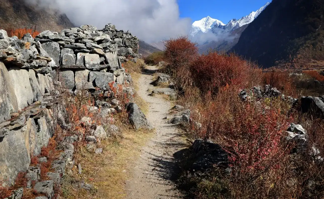
October delivers the best conditions for landscape and mountain photography on the Langtang Trek. Post-monsoon clarity, 9 hours of daily sunlight, and the golden-hour light quality in October evenings combine to produce optimal image conditions at Kyanjin Gompa.
4 photography-specific considerations by season:
-
October: peak mountain clarity, 90%+ clear days, golden hour light from 5:30–6:30 PM at Kyanjin Gompa
-
April: rhododendron forest photography peaks in the first 2 weeks; colourful foreground complements snow-capped peaks
-
Monsoon (August): waterfall photography peaks; dynamic cloud formations create dramatic atmospheric images; green valley saturates at maximum intensity
-
Winter (January): snow-covered Kyanjin Gompa with smoke rising from teahouses and frost-framed Langtang Lirung creates compositions impossible in other seasons
What Permits and Preparations Are Required Before the Langtang Trek?
2 permits are mandatory for the Langtang Trek: the Langtang National Park Entry Permit and the TIMS (Trekkers' Information Management System) card. While the National Park permit can be obtained at the Nepal Tourism Board in Kathmandu or the park entrance in Dhunche, the TIMS card must now be processed electronically by your registered trekking agency prior to departure. The TIMS Card costs NPR 2,000 (about USD 15) for non-SAARC foreign trekkers and NPR 1,000 for SAARC nationals, according to the Nepal Tourism Board's current fee schedule, payable online once your registered trekking agency processes the application.
Which Permits Do You Need?
-
Langtang National Park Entry Permit: NPR 3,000 (approximately USD 22) per person for international trekkers. This permit covers entry into the park boundaries and is checked at multiple checkpoints between Syabrubesi and Kyanjin Gompa.
-
TIMS Card: NPR 2,000 (approximately USD 15) for all international trekkers. Note that as of 2023, independent trekking is banned in Nepal; all trekkers must hire a licensed guide through a registered agency to obtain this permit. The TIMS system registers trekker identity and contact information with Nepal Tourism Board, enabling coordinated search and rescue operations. Permit fees are only one part of total trip expenses, see our full Langtang trek cost guide for guide fees, teahouse prices, and gear budgeting
Both permits require:
-
Valid passport (original; not photocopy)
-
2 passport-size photos per permit
-
Payment in Nepali Rupees (cash preferred; card payment available at Nepal Tourism Board office)
Permits obtained through a registered trekking agency arrive pre-arranged, removing the logistical step of the Kathmandu office visit. Trekking permits are separate from entry documentation, so confirm your Nepal visa requirements before booking flights.
How Can You Prepare for Altitude and Weather?
Altitude preparation for the Langtang Trek centres on the 3,870m sleeping elevation at Kyanjin Gompa, which most trekkers reach within 4–5 days of departing Syabrubesi. The ascent profile from 1,500m to 3,870m over 4 days represents a total gain of 2,370m. Crucially, once you cross the 3,000m threshold, your daily sleeping elevation should not increase by more than 500m, making acclimatization pacing essential.
5 evidence-based altitude preparation strategies:
-
Arrive in Kathmandu (1,400m) 2 days before trekking to allow initial acclimatization to moderate elevation
-
Follow the "climb high, sleep low" protocol at Kyanjin Gompa by summiting Kyanjin Ri (4,773m) or Tserko Ri (4,984m) in the morning and returning to Kyanjin Gompa (3,870m) to sleep
-
Hydrate at 3–4 litres per day from the Syabrubesi trailhead onward; glacial stream water filtered through a 0.1-micron purification system is the primary water source above Lama Hotel
-
Carry acetazolamide (Diamox) at 125mg twice daily as a prophylactic for acute mountain sickness, prescribed by a physician before departure
-
Descend immediately at onset of severe AMS symptoms, persistent headache, vomiting, confusion, or ataxia require descent to Lama Hotel (2,470m) or below, not medication and rest at elevation. Because helicopter evacuation can cost thousands of dollars, confirm your travel insurance and vaccinations cover high-altitude rescue before departure.
Weather preparation covers 2 separate concerns: temperature management and precipitation management. Layering systems for both are described in the packing section. The critical preparation oversight most trekkers make: underestimating how quickly temperatures drop after sunset at 3,870m. A 15°C afternoon at Kyanjin Gompa regularly becomes a -5°C evening within 90 minutes of sunset. Thermal layers accessible in the top of the pack, not the bottom, prevent the transition from becoming a hypothermia risk.
How Should You Plan Your Langtang Trek With Nepal Intrepid Treks?
Planning the Langtang Trek through an experienced local agency eliminates 4 logistical complexities: permit acquisition, guide licensing, teahouse pre-booking during peak season, and emergency evacuation coordination. Nepal Intrepid Treks specialises in the Langtang region, with guides who have completed the trail across all 4 seasons and carry direct knowledge of conditions at each elevation zone. Trekkers weighing alternative routes and durations can compare all of our Langtang region treks side by side.
How Can Nepal Intrepid Treks Help You Choose the Best Season?
Nepal Intrepid Treks customises Langtang Trek planning to individual trekker profiles across 3 dimensions:
-
Fitness and experience: matching trail pace, daily elevation gain, and rest day frequency to the trekker's actual capability, not a generic itinerary
-
Objective alignment: identifying whether the primary goal is summit views (October), rhododendron photography (April), or off-season solitude (February) and building the itinerary around that objective
-
Weather contingency planning: maintaining direct contact with Kyanjin Gompa-based guides to get real-time trail condition reports before client departure, a critical advantage during transitional months like March and November when conditions change rapidly week-by-week
Nepal Intrepid Treks also coordinates the 2 mandatory permits, provides certified high-altitude guides with Wilderness First Responder training, and arranges Kathmandu–Syabrubesi transportation logistics. For spring trekkers, the team pre-books teahouses along the route from early March, preventing the accommodation shortfalls that often affect poorly prepared trekking groups during April peak weeks.
Connecting with Nepal Intrepid Treks before selecting a departure date lets you align your trekking window with real-time seasonal intelligence rather than calendar-only planning.
What Are the Key Takeaways About the Best Time for the Langtang Trek?
The best time for the Langtang Trek is October for most trekkers and April for those targeting rhododendron forests. These 2 months deliver the highest concentration of optimal trekking conditions, clear mountain views, stable weather, accessible trails, and open teahouses, across the complete elevation range from Syabrubesi (1,500m) to Tserko Ri (4,984m).
The 6 core decision points for choosing your Langtang Trek season:
-
October and November deliver post-monsoon atmospheric clarity, 90%+ clear-day frequency on Langtang Lirung, and fully operational teahouse infrastructure across all elevations
-
April provides the unique combination of rhododendron peak bloom, stabilising spring weather, and mountain views, the only month where forest colour and summit clarity converge
-
March suits budget-conscious trekkers and solitude-seekers who accept slightly colder temperatures and residual snow above 4,000m in exchange for 40–50% less trail traffic
-
Winter (December–February) rewards cold-weather-equipped, experienced trekkers with dramatic snow landscapes and empty trails, balanced against teahouse closures and -20°C nights at Kyanjin Gompa
-
Monsoon (June–September) suits only experienced trekkers with specific objectives, green valley photography, waterfall documentation, or off-season solitude, who accept reduced mountain visibility and active landslide risk
-
May sits in the transitional zone between spring and monsoon: warmer temperatures and fully open teahouses, but rising cloud cover and pre-monsoon haze that reduces Langtang Lirung visibility to 60–70% of spring peak clarity
The Langtang Trek's proximity to Kathmandu, a 5 to 7 hour drive by private jeep, or 8 to 10 hours by public bus to Syabrubesi, makes it the most accessible high-altitude valley trek in Nepal. That accessibility, combined with Langtang Lirung's 7,227m presence above the valley floor, creates a trek that delivers genuine Himalayan magnitude without the 10-day approach walks of the Everest or Annapurna circuits.
According to the Government of Nepal Tourism Statistics 2023, Langtang National Park drew just 7,614 foreign visitors for the year, with monthly arrivals cratering to 49 in July and 109 in August during the monsoon before rebounding to 1,382 in October, a pattern that closely tracks the safety and enjoyment trade-offs described above.
Choosing the right season is the single most impactful planning decision you make. Review our full Langtang Valley Trek itinerary and plan your departure with Nepal Intrepid Treks to match your season choice with guide expertise, permit logistics, and real-time trail intelligence from a team that treks the Langtang Valley year-round.
More About Author

Khilak Budhathoki
Travel Director
Khilak Budhathoki is the co-founder and lead trekking guide at Himalaya Trekking Nepal, a locally owned and operated adventure company based in Kathmandu. Born and raised in the foothills of Nepal, Khilak developed a deep love for the mountains from an early age. With over a deca...

USD$850 pp
Our Recommendation

USD$200 pp
Our Recommendation
USD$1500 pp
Our Recommendation
Related Blogs