- 20, Apr 2026 | Khilak Budhathoki
The Everest Base Camp trek covers 130 km round trip (81 miles) from Lukla (2,860 m) to Everest Base Camp (5,364 m) and back. The highest point is Kala Patthar at 5,545 m. The trek takes 12 to 14 days. Every kilometer above 4,000 m demands more effort than two at sea level.
Daily walking distance averages 11 km. Total elevation gain from Lukla to Kala Patthar is 2,685 m net. Cumulative gain across the full round trip reaches 8,500 m. Oxygen at Everest Base Camp is 50% of sea level volume. Oxygen at Kala Patthar drops to 49%.
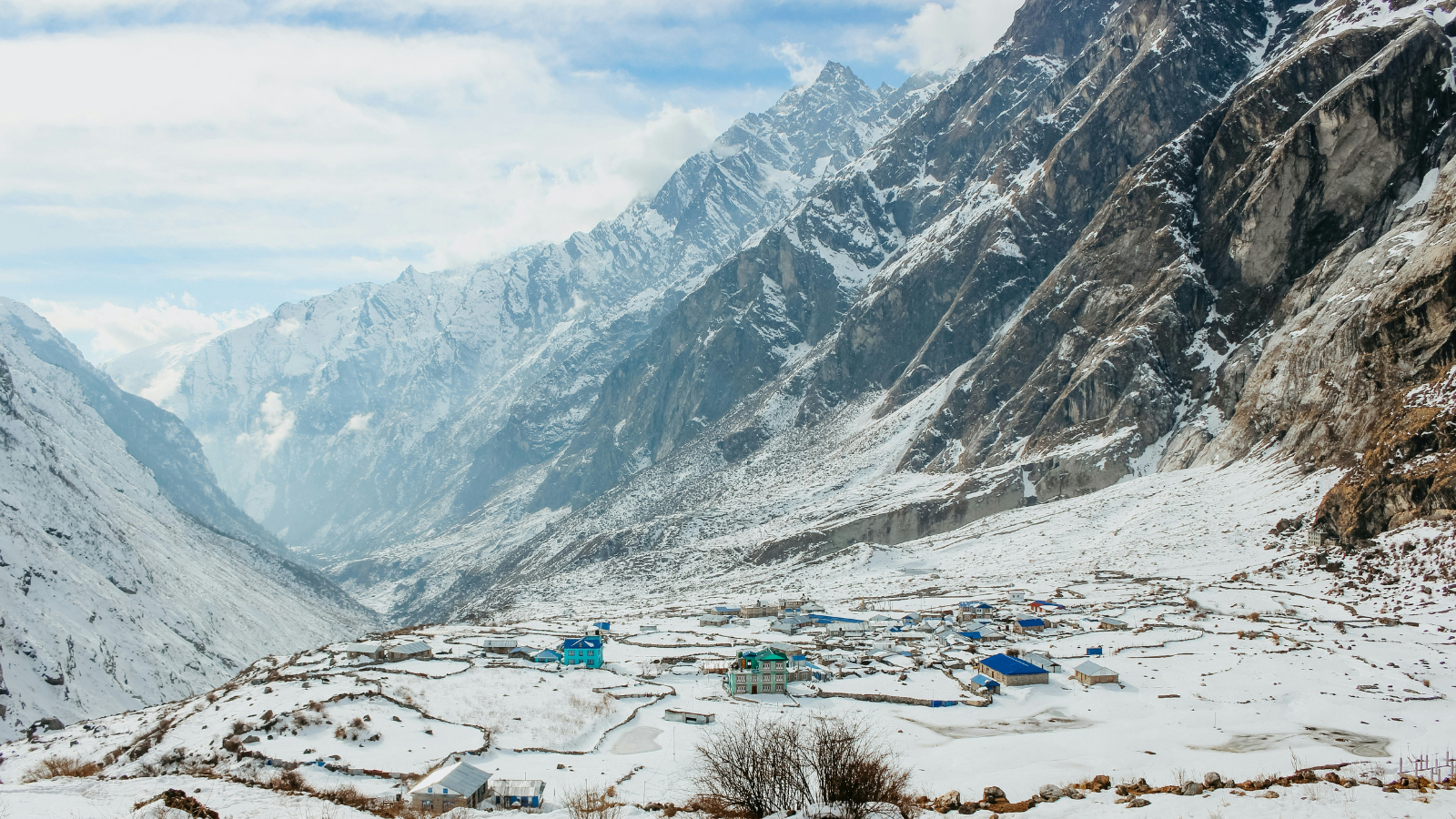
The route runs through Sagarmatha National Park, Khumbu Valley, and across the Khumbu Glacier moraine. Key stops include Namche Bazaar (3,440 m), Tengboche (3,860 m), Dingboche (4,410 m), Lobuche (4,940 m), and Gorak Shep (5,164 m). Two acclimatization days at Namche Bazaar and Dingboche are built into the standard 14-day itinerary. These rest days reduce acute mountain sickness risk from 30% to under 8%.
Distance does not define difficulty on this trek. Altitude does. A 9 km day at Lobuche (4,940 m) is harder than a 14 km day at Phakding (2,610 m). This page maps every segment, every altitude point, every daily distance, and every effort zone from Lukla to Kala Patthar.
What Is the Total Distance of the Everest Base Camp Trek?
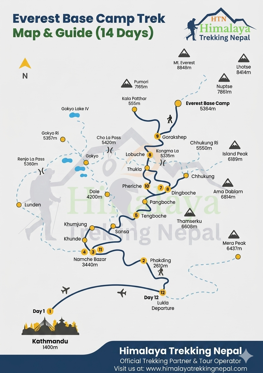
The Everest Base Camp trek is 130 km round trip (81 miles). One way, from Lukla to Everest Base Camp, is 65 km (40 miles). The trek begins at Lukla airport (2,860 m), reached by a 35-minute flight from Kathmandu. No trekking distance exists between Kathmandu and Lukla.
Total trekking distance varies by 10 to 15 km across itineraries. The variation depends on acclimatization routing, side hikes, and Kala Patthar inclusion. Standard 14-day itineraries include Kala Patthar (5,545 m). Shorter 12-day routes skip optional side hikes at Namche Bazaar and Dingboche.
Distance segments:
-
Lukla to Everest Base Camp: 65 km one way
-
Kala Patthar detour from Gorak Shep: 2.5 km extra each way
-
Full round trip including Kala Patthar: 130 km
Day-by-Day Everest Base Camp Distance and Altitude Chart
Each trekking day combines distance, elevation change, and walking duration. The chart below maps all 9 active trekking days. Two acclimatization days at Namche Bazaar (Day 3) and Dingboche (Day 6) are included separately.
Day 1: Kathmandu to Lukla to Phakding
-
Distance: 8 km
-
Start altitude: 2,860 m (Lukla)
-
End altitude: 2,610 m (Phakding)
-
Elevation change: 250 m descent
-
Trek duration: 3 to 4 hours
The day begins with the flight from Kathmandu (1,400 m) to Lukla (2,860 m). The trail descends along the Dudh Koshi River to Phakding. Terrain is moderate. This is the body's first exposure to altitudes above 2,500 m.
Day 2: Phakding to Namche Bazaar
-
Distance: 12 km
-
Start altitude: 2,610 m (Phakding)
-
End altitude: 3,440 m (Namche Bazaar)
-
Elevation gain: 830 m
-
Trek duration: 5 to 6 hours
The Namche ascent is the first high-effort section of the trek. The trail enters Sagarmatha National Park at Monjo (2,840 m). The final 600 m climb to Namche Bazaar takes 2 to 3 hours. Oxygen at 3,440 m is 67% of sea level volume. Fatigue increases sharply in this zone.
Day 3: Acclimatization Day in Namche Bazaar
-
Trekking distance: 0 km (overnight stay)
-
Optional hike distance: 4 to 8 km
-
Altitude: 3,440 m to 3,880 m (viewpoint)
-
Duration: 3 to 4 hours (optional)
Acclimatization at Namche Bazaar reduces acute mountain sickness risk. The recommended hike climbs to the Everest View Hotel (3,880 m) or Syangboche (3,780 m). Exposure to higher altitude during the day, then descent to sleep at 3,440 m, accelerates red blood cell production. Rest day does not mean zero movement.
Day 4: Namche Bazaar to Tengboche Monastery
-
Distance: 10 km
-
Start altitude: 3,440 m (Namche Bazaar)
-
End altitude: 3,860 m (Tengboche)
-
Elevation gain: 420 m net
-
Trek duration: 5 to 6 hours
The trail crosses a suspension bridge at 3,300 m before climbing to Tengboche (3,860 m). Ama Dablam (6,812 m) is visible throughout this section. Net gain is 420 m, but the trail drops 300 m and regains 600 m, making cumulative gain 900 m. Tengboche Monastery sits at the highest Buddhist monastery in Nepal at 3,860 m.
Day 5: Tengboche to Dingboche
-
Distance: 11 km
-
Start altitude: 3,860 m (Tengboche)
-
End altitude: 4,410 m (Dingboche)
-
Elevation gain: 550 m
-
Trek duration: 5 to 6 hours
The trail passes Pangboche (3,930 m) before crossing the Imja Khola valley. Above 4,000 m, oxygen drops to 60% of sea level volume. At this altitude, 11 km produces fatigue equal to 18 to 20 km at sea level. Dingboche sits in an open valley exposed to wind, which increases body temperature loss at night.
Day 6: Acclimatization Day in Dingboche
-
Trekking distance: 0 km (overnight stay)
-
Optional hike distance: 5 to 7 km
-
Altitude: 4,410 m to 5,100 m (Nagarkot Hill)
-
Duration: 4 to 5 hours (optional)
The second acclimatization day targets the 4,500 m to 5,000 m altitude zone. Hiking to Nagarkot Hill (5,100 m) gives the body exposure above the Dingboche sleeping altitude. Oxygen saturation readings with a pulse oximeter drop below 85% for most trekkers at this elevation. Monitoring readings here guides guide decisions on pace adjustment for Days 7 and 8.
Day 7: Dingboche to Lobuche
-
Distance: 9 km
-
Start altitude: 4,410 m (Dingboche)
-
End altitude: 4,940 m (Lobuche)
-
Elevation gain: 530 m
-
Trek duration: 4 to 5 hours
The trail passes the Thukla Pass memorial (4,620 m), built to honor Sherpa guides who died on Everest expeditions. Above 4,500 m, the human body enters the primary hypoxia zone. Fatigue rate at Lobuche altitude is 3 times higher than equivalent distance at Lukla. Breathing rate increases by 40 to 60% at 4,940 m compared to sea level.
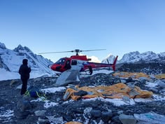
Day 8: Lobuche to Gorak Shep to Everest Base Camp
-
Distance: 14 km round trip (Lobuche to EBC and back to Gorak Shep)
-
Start altitude: 4,940 m (Lobuche)
-
Gorak Shep altitude: 5,164 m
-
Everest Base Camp altitude: 5,364 m
-
Elevation gain Lobuche to EBC: 424 m
-
Trek duration: 7 to 8 hours
This is the longest effort day of the trek. The trail crosses the Khumbu Glacier moraine from Gorak Shep to Everest Base Camp. Glacial terrain adds difficulty beyond simple distance. Oxygen at 5,364 m is 50% of sea level volume. The return to Gorak Shep (not Lobuche) is standard for an overnight stay before Kala Patthar.
Day 9: Gorak Shep to Kala Patthar and Descent
-
Kala Patthar distance from Gorak Shep: 2.5 km one way
-
Start altitude: 5,164 m (Gorak Shep)
-
Kala Patthar altitude: 5,545 m
-
Elevation gain: 381 m
-
Trek duration (Kala Patthar summit and back): 3 to 4 hours
-
Descent to Pheriche after: 11 km, 4 to 5 hours
Most trekkers summit Kala Patthar at sunrise (4:30 to 5:30 AM) for clear views of Everest (8,848 m). Kala Patthar is the highest point on the standard EBC trek, 181 m above Everest Base Camp. The summit temperature at dawn reaches minus 15°C in the peak October and November season.
Average Daily Walking Distance on the Everest Base Camp Trek
Daily trekking distance ranges from 8 to 15 km, with an average of 11 km per active day. The variation depends on terrain gradient, altitude zone, and trail surface type.
|
Trek Zone |
Altitude Range |
Avg Daily Distance |
Effort Index |
|
Lukla to Namche |
2,860 m to 3,440 m |
10 to 12 km |
Moderate |
|
Namche to Dingboche |
3,440 m to 4,410 m |
10 to 11 km |
Hard |
|
Dingboche to EBC |
4,410 m to 5,364 m |
9 to 14 km |
Extreme |
Days above 4,500 m require 5 to 8 walking hours per day despite shorter distances. At 5,000 m, walking pace drops 30 to 40% compared to pace at 3,000 m.
What Is the Distance Between Major Stops on the Everest Base Camp Route?
Each segment between major stops on the EBC route ranges from 5 to 14 km. The table below gives one-way trekking distance and elevation change per segment for quick reference.
|
Segment |
Distance |
Elevation Change |
|
Lukla to Phakding |
8 km |
250 m descent |
|
Phakding to Namche Bazaar |
12 km |
830 m gain |
|
Namche Bazaar to Tengboche |
10 km |
420 m net gain |
|
Tengboche to Dingboche |
11 km |
550 m gain |
|
Dingboche to Lobuche |
9 km |
530 m gain |
|
Lobuche to Gorak Shep |
5 km |
224 m gain |
|
Gorak Shep to Everest Base Camp |
4 km |
200 m gain |
These are one-way trail distances measured on foot. GPS readings vary by 20 to 30 m due to satellite angle and snow coverage variation at high altitudes.
How Far Is Everest Base Camp from Key Locations Along the Route?
Cumulative one-way distances from key checkpoints to Everest Base Camp (5,364 m) are fixed reference points for trekking pace planning.
|
Starting Point |
Altitude |
Distance to EBC |
|
Lukla |
2,860 m |
65 km |
|
Namche Bazaar |
3,440 m |
43 km |
|
Dingboche |
4,410 m |
24 km |
|
Lobuche |
4,940 m |
9 km |
|
Gorak Shep |
5,164 m |
4 km |
Trekkers who reach Namche Bazaar have completed 34% of the one-way distance. Trekkers at Dingboche have completed 63% of the one-way distance. Physical difficulty per remaining kilometer increases with altitude, not just distance.
What Is the Highest Altitude Reached on the Everest Base Camp Trek?
Kala Patthar (5,545 m / 18,192 ft) is the highest point on the standard Everest Base Camp trek. Everest Base Camp sits at 5,364 m (17,598 ft), which is 181 m lower than Kala Patthar.
The distinction matters for altitude planning:
-
Everest Base Camp (5,364 m): The trekking destination. Rests on the Khumbu Glacier moraine. No panoramic Everest summit view from this point.
-
Kala Patthar (5,545 m): A rocky peak above Gorak Shep. Provides direct Everest (8,848 m) summit view. The highest walking point on the trek.
Oxygen at 5,545 m is 49% of sea level volume. At sea level, oxygen is 209 ml per liter of air. At Kala Patthar, it is 102 ml per liter. The body compensates through increased breathing rate and red blood cell production, both triggered by acclimatization days built into the itinerary.
How Does Altitude Gain Progress Across the Everest Base Camp Trek?
The EBC trek begins at Lukla (2,860 m) and reaches a maximum of 5,545 m at Kala Patthar, a total net gain of 2,685 m. Cumulative elevation gain across the full round trip, including all ups and downs, is approximately 8,500 m.
Altitude progression:
|
Day |
Location |
Altitude |
Daily Gain |
|
Day 1 |
Phakding |
2,610 m |
250 m descent |
|
Day 2 |
Namche Bazaar |
3,440 m |
830 m gain |
|
Day 3 |
Namche (acclimatization) |
3,440 m |
0 m net |
|
Day 4 |
Tengboche |
3,860 m |
420 m gain |
|
Day 5 |
Dingboche |
4,410 m |
550 m gain |
|
Day 6 |
Dingboche (acclimatization) |
4,410 m |
0 m net |
|
Day 7 |
Lobuche |
4,940 m |
530 m gain |
|
Day 8 |
Gorak Shep |
5,164 m |
424 m gain to EBC |
|
Day 9 |
Kala Patthar |
5,545 m |
381 m gain |
Net vs cumulative gain difference: Net gain from Lukla to Kala Patthar is 2,685 m. Cumulative gain is 8,500 m because the trail repeatedly descends and regains elevation.
The steepest daily gain is Phakding to Namche Bazaar at 830 m over 12 km. The Namche Wall, the final 600 m climb into Namche, is the most demanding ascent per kilometer on the entire route.
How Do Distance and Altitude Affect Trek Duration?
The Everest Base Camp trek takes 12 to 14 days. Standard itineraries use 14 days. The 12-day option reduces or removes acclimatization hikes and rest periods at Namche Bazaar and Dingboche.
Distance alone does not define trek duration. Three factors determine total time:
1. Altitude-reduced walking speed. At 5,000 m, trekking pace drops to 1.5 to 2 km per hour. At 3,000 m, pace averages 2.5 to 3 km per hour. A 9 km day at Lobuche requires the same time as a 14 km day at Lukla.
2. Acclimatization days. The itinerary includes 2 full acclimatization rest days (Namche and Dingboche). These days add 2 days to total trek duration but reduce acute mountain sickness risk from 30% to under 8% in guided groups with structured protocols.
3. Terrain complexity. Glacial moraine between Gorak Shep and Everest Base Camp adds 45 minutes to 1 hour per 4 km compared to trail terrain at lower elevation.
Duration by fitness level:
-
Beginner trekker: 14 days minimum. No rushed sections. Full acclimatization at Namche and Dingboche.
-
Intermediate trekker: 12 to 14 days. Optional Kala Patthar side hikes included.
-
Advanced trekker: 12 days possible. Requires strong cardiovascular base and altitude experience above 4,000 m prior.
Key Distance and Altitude Insights for Everest Base Camp Trekkers
The hardest day by combined effort (distance plus altitude) is Day 8: Lobuche to Gorak Shep to Everest Base Camp and return. It combines 14 km round trip, 5,000 m plus altitude, glacial terrain, and 7 to 8 walking hours.
3 critical high-effort sections on the route:
Namche ascent (Day 2): 600 m gain over 3 km. The steepest single climb of the trek. Oxygen at 3,440 m is 67% of sea level. Most trekkers experience first-night headaches here.
Dingboche to Lobuche (Day 7): 530 m gain into the 4,500 m hypoxia zone. Thukla Pass at 4,620 m marks the entry into extreme altitude trekking conditions.
Gorak Shep to EBC moraine (Day 8): 200 m gain over glacial rock. Physical surface difficulty multiplies effort beyond what elevation numbers suggest.
Most demanding altitude zone: above 4,500 m. Above this threshold, oxygen saturation in blood drops below 85% for most trekkers without supplemental oxygen. Red blood cell count increases by 20 to 30% after 4 days above 3,500 m, partly compensating.
Distance vs altitude trade-off:
-
Short day at high altitude (9 km at 4,940 m) demands more energy than long day at low altitude (14 km at 2,860 m).
-
The effort equation: Distance × (1 + Altitude Factor) determines real daily workload, not kilometers alone
FAQs: Everest Base Camp Trek Distance and Altitude
How Many Kilometers Is the Everest Base Camp Trek?
The Everest Base Camp trek is 130 km round trip (81 miles). One-way distance from Lukla to EBC is 65 km. Daily walking ranges from 8 to 14 km. The Kathmandu to Lukla leg is a 35-minute flight, not a trekking segment.
What Is the Daily Walking Distance on the EBC Trek?
Daily walking distance averages 11 km per active trekking day. The range is 8 to 14 km. The shortest day is Lukla to Phakding at 8 km. The longest is Lobuche to EBC round trip at 14 km. Acclimatization days involve optional hikes of 4 to 7 km.
What Is the Highest Point of the Everest Base Camp Trek?
Kala Patthar (5,545 m / 18,192 ft) is the highest point on the trek. It sits 181 m above Everest Base Camp (5,364 m). EBC rests on the Khumbu Glacier moraine with no direct Everest summit view. Kala Patthar gives the clearest ground-level view of Everest (8,848 m).
How Much Elevation Gain Is Involved in the Trek?
Net elevation gain from Lukla to Kala Patthar is 2,685 m. Cumulative gain across the full round trip is 8,500 m. The steepest single day is Phakding to Namche Bazaar at 830 m gain over 12 km. Two acclimatization days at Namche and Dingboche allow physiological adaptation between major gain days.
Is the Distance of the Everest Base Camp Trek Suitable for Beginners?
Yes. The 130 km round trip is manageable for beginners on a 14-day itinerary. Daily distances of 8 to 14 km are within beginner range. Difficulty comes from altitude, not distance. Three months of cardiovascular training before departure reduces AMS risk below 8% on a structured guided itinerary.
How Long Does the Everest Base Camp Trek Take?
The standard Everest Base Camp trek takes 14 days. A 12-day option exists for trekkers with prior high-altitude experience. The 2 extra days in a 14-day itinerary are acclimatization days at Namche Bazaar and Dingboche, both above 3,440 m.
What Is the Altitude of Everest Base Camp?
Everest Base Camp sits at 5,364 m (17,598 ft). It is located on the Khumbu Glacier in the Khumbu trekking region within Sagarmatha National Park. Oxygen at this altitude is 50% of sea level volume. Kala Patthar at 5,545 m is the higher optional summit on the same day.
What Is the Hardest Day on the Everest Base Camp Trek?
Day 8, Lobuche to Gorak Shep to Everest Base Camp, is the hardest day. It combines 14 km round trip, glacial terrain, 5,000 m plus altitude, and 7 to 8 hours of walking. Oxygen at EBC (5,364 m) is 50% of sea level. The return to Gorak Shep adds a 4 km walk after the EBC reach.
How Does Altitude Affect Walking Speed on the Trek?
Walking pace drops 30 to 40% above 4,500 m compared to pace at 3,000 m. At 5,000 m, average trekking speed is 1.5 to 2 km per hour. At 3,000 m, pace averages 2.5 to 3 km per hour. Altitude reduces oxygen delivery to muscles, directly cutting speed and increasing recovery time between steps.
More About Author

Khilak Budhathoki
Travel Director
Khilak Budhathoki is the co-founder and lead trekking guide at Himalaya Trekking Nepal, a locally owned and operated adventure company based in Kathmandu. Born and raised in the foothills of Nepal, Khilak developed a deep love for the mountains from an early age. With over a deca...

USD$1,600 pp
Our Recommendation
Related Blogs