- 27, Aug 2026 | Khilak Budhathoki
The best monsoon treks in Nepal offer very different experiences during June through September, from dry high-altitude landscapes in the Himalayan rain shadow to lush valleys filled with waterfalls, rhododendrons, wildflowers, and alpine lakes. Upper Mustang, Upper Dolpo, Lower Dolpo, Nar Phu Valley, and the Manang–Muktinath section of the Annapurna Circuit provide the strongest options for trekkers seeking relatively dry trails and clear Himalayan views, while Langtang Valley, Khopra Danda, Tsum Valley, Helambu, and Panch Pokhari showcase Nepal's green monsoon landscapes, mountain villages, forests, sacred lakes, and seasonal wildlife. Each route differs in elevation, rainfall exposure, trail conditions, remoteness, and cultural character, making monsoon trekking in Nepal a distinct experience rather than simply a wetter version of the autumn trekking season.
Choosing the right monsoon trek depends on your available days, budget, altitude experience, tolerance for rain, and preference for accessibility or remote adventure. Helambu and Khopra Danda suit first-time trekkers and shorter itineraries, while Upper Mustang and the northern Annapurna Circuit combine rain-shadow conditions with Tibetan-influenced culture and major Himalayan panoramas. Tsum Valley and Langtang provide inner-Himalayan scenery and rich cultural experiences, whereas Nar Phu, Upper Dolpo, and Lower Dolpo demand greater time, logistical planning, and high-altitude trekking experience. This guide compares all 10 routes by elevation, duration, difficulty, monsoon conditions, permits, cost, accommodation, mountain views, cultural attractions, and accessibility to help you identify the best monsoon trek in Nepal for your specific travel goals.
1. Upper Mustang Trek
Upper Mustang Trek is a restricted-area trail in the Mustang District of Gandaki Province, Nepal. The route begins at Kagbeni (2,810 m) and ends at Lo Manthang (3,840 m), the walled capital of the ancient Kingdom of Lo. Total trek length is 180 km round trip, typically completed in 10 to 14 days.
Why Is Upper Mustang in the Rain Shadow?
Upper Mustang sits in a trans-Himalayan rain shadow zone because the Annapurna and Dhaulagiri massifs block most monsoon moisture from the Bay of Bengal before it reaches the valley. Nepal's Department of Hydrology and Meteorology's seasonal precipitation summaries confirm the stark north–south contrast this creates across Gandaki Province, with the Mustang plateau receiving only a fraction of the rainfall recorded at stations in Pokhara during the same monsoon months.
This rain shadow effect is geological. The Annapurna massif (8,091 m) and Dhaulagiri I (8,167 m) form a continuous east-west ridge wall at elevations exceeding 7,500 m. Moisture-laden clouds from the Bay of Bengal rise, cool, condense, and drop precipitation on the southern slopes, before reaching the Mustang plateau. The result is a semi-arid high-altitude desert at 3,500 to 4,200 m elevation with clear skies throughout July and August.
What most trekkers overlook: Upper Mustang's terrain is predominantly eroded sedimentary rock and wind-carved canyons. Trail erosion from rain is minimal compared to forested routes in the Annapurna foothills. Path quality remains consistent even during peak monsoon months.
What Can You See on the Upper Mustang Trek During Monsoon?
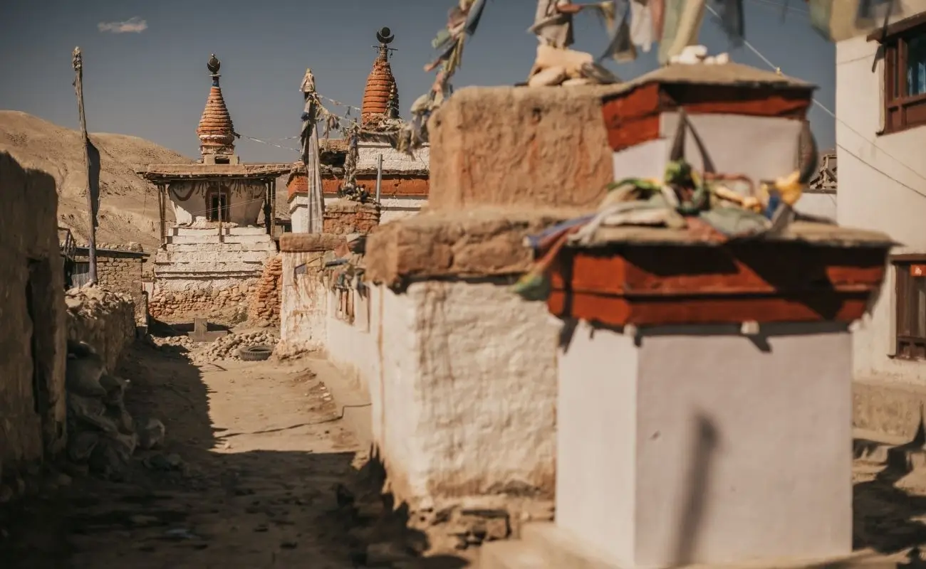
The Upper Mustang Trek during monsoon reveals Lo Manthang's ancient architecture, 55+ cave monasteries, sculpted badlands, and panoramic views of Nilgiri (7,061 m) and Tilicho Peak (7,134 m) under reliably clear skies.
Key attractions include:
-
Lo Manthang Walled City: A 600-year-old fortified town with Thubchen Gompa (15th century), Jampa Lhakhang, and Choede Monastery. Access requires the Upper Mustang Restricted Area Permit.
-
Chhoser Caves: Sky caves carved into 30-metre cliff faces, some inhabited 2,000 to 3,500 years ago.
-
Drakmar Village: Red-cliff formations and juniper forests with cliff-top meditation retreats.
-
Kagbeni: A medieval gateway village at the confluence of the Kali Gandaki and Jhong Khola rivers, home to Kag Chode Monastery.
-
Yara and Luri Gompa: A cave monastery containing 14th-century frescoes and ancient Tibetan texts.
During monsoon, mustard fields in the lower Mustang valley bloom yellow-gold against the terracotta canyon walls: a landscape that competitors' content rarely photographs or describes.
What Is the Best Time to Trek Upper Mustang?
The best time to trek Upper Mustang is June through September, which is Nepal's monsoon season. This counterintuitive timing works because the rain shadow climate keeps the region dry with daily sunshine averaging 8 to 10 hours. March to May is the secondary season, but winds can reach 70 km/h in spring.
Monsoon season advantages for Upper Mustang include:
-
Fewer trekkers: Tourist density drops 60% compared to October-November peak season.
-
Lower lodge costs: Accommodation prices decrease by 20 to 30% during June-September.
-
Festivals: Tiji Festival (May-June) and Yartung Horse Festival (August) take place during this window.
-
No dust: Spring winds create visibility problems; monsoon humidity eliminates dust.
Permit cost: A Restricted Area Permit (RAP) is mandatory. Since Nepal's Cabinet decision abolishing the flat $500 Upper Mustang fee took effect in December 2025, trekkers now pay USD 50 per person per day actually spent in the restricted zone, with no minimum-day requirement, and since March 2026, solo trekkers with a licensed guide may apply without a second travel companion. You will also need an Annapurna Conservation Area Permit (ACAP), officially priced by NTNC's e-permit portal at NPR 3,000 for foreign nationals (NPR 1,000 for SAARC nationals).
2. Khopra Danda Trek
Khopra Danda Trek is a community-managed trail in the Annapurna Conservation Area that reaches Khopra Ridge (3,660 m) and Khayer Lake (4,560 m). The route departs from Nayapul (1,070 m) and completes a 7 to 9-day circuit through Ghorepani, Chitre, and Swanta villages.
What Makes Khopra Danda Suitable for Monsoon?
Khopra Danda is monsoon-suitable because its main viewpoint, Khopra Ridge at 3,660 m, sits above the primary cloud layer, offering clear views of Dhaulagiri (8,167 m), Annapurna South (7,219 m), and Baraha Shikhar (7,647 m) for 3 to 5 hours each morning before afternoon clouds build.
The ridge acts as a weather divider. Trails south of Ghorepani receive heavy monsoon rain, but Khopra Ridge faces northwest toward the dry Mustang plateau. This orientation reduces precipitation on the upper section by approximately 40% compared to the Ghorepani Poon Hill route.
The 26 community-managed lodges along the Khopra Danda trail remain open year-round. Trail maintenance is active, the local Khopra Community Homestay Network repairs paths after major rainfall events within 48 hours. Leeches appear below 2,500 m elevation; gaiters and insect repellent resolve the issue effectively.
What Landscapes Can You Experience on the Khopra Danda Trek?
The Khopra Danda Trek during monsoon delivers 4 distinct landscape zones: rhododendron forests in bloom, terraced rice paddies, subalpine meadows, and glacial lake terrain at Khayer Lake.
Landscape breakdown by elevation:
-
1,070 to 2,000 m: Subtropical broadleaf forest with monsoon waterfalls and paddy terraces in active cultivation.
-
2,000 to 3,000 m: Temperate rhododendron and oak forests carpeted with moss and ferns, visually peak in July.
-
3,000 to 3,660 m: Open ridge meadows with Himalayan blue poppy (Meconopsis betonicifolia), Nepal's national flower, visible June through August.
-
3,660 to 4,560 m: Alpine terrain leading to Khayer Lake, a glacially-formed sacred lake at 4,560 m with a small Hindu shrine.
The Himalayan blue poppy is present only during July and August. This floral display is a monsoon-exclusive experience that no other season provides.
How Difficult Is the Khopra Danda Trek During Monsoon?
Khopra Danda Trek rates as moderate difficulty during monsoon. Daily elevation gain averages 600 to 800 m on ascent days. Maximum altitude is 4,560 m at Khayer Lake. Total walking time per day ranges from 5 to 7 hours.
Monsoon-specific challenges:
-
Wet trail surfaces below 2,500 m increase slip risk; trekking poles are essential.
-
Leech encounters from Nayapul to Ghorepani (1,070 to 2,874 m) are common in July-August.
-
River crossings between Swanta and Khopra swell during heavy rain; suspension bridges bypass most crossings.
No technical climbing is required. Khopra Danda is the most beginner-accessible rain shadow-adjacent monsoon trek in the Annapurna region.
3. Upper Dolpo Trek
Upper Dolpo Trek is a restricted-area expedition in the Dolpo District of Karnali Province. The route covers 230 km from Juphal (2,475 m) to Dunai (2,145 m), passing through Shey Phoksundo National Park, the Crystal Mountain pilgrimage site, and Shey Gompa (4,390 m). Standard itinerary length: 21 to 28 days.
How Does Upper Dolpo's Rain Shadow Climate Help During Monsoon?
Upper Dolpo receives fewer than 200 mm of annual rainfall because the Kanjiroba Himal (6,883 m) and Kagmara range create a continuous orographic barrier that deflects monsoon systems southward before they penetrate the Phoksundo and Shey valleys.
Peter Matthiessen documented this climate phenomenon in The Snow Leopard (1978), noting that Shey in August had "the dry cold of the Tibetan plateau." The valley floor elevation of 4,200 to 4,500 m places it above the moist lower atmosphere layer. Afternoon skies remain partially clear even during peak monsoon weeks. Morning visibility for views of Kanjiroba Himal consistently exceeds 40 km.
The monsoon period also marks the peak of wildflower season in the high alpine meadows. Over 300 plant species bloom between July and September in the Phoksundo basin, including Himalayan edelweiss, gentians, and primulas.
What Are the Main Attractions of the Upper Dolpo Trek?
The Upper Dolpo Trek encompasses 5 primary attractions: Phoksundo Lake, Shey Gompa, Crystal Mountain, the Bon Po monastery at Pungmo, and the ancient caravan route to Tibet.
-
Phoksundo Lake (3,611 m): The deepest lake in the Dolpo region at 145 m (second only to Rara Lake nationally), featuring striking turquoise water caused by suspended glacial minerals. No rivers drain from the lake; it feeds entirely through underground springs.
-
Shey Gompa (4,390 m): A 1,000-year-old Tibetan Buddhist monastery with crystal quartz outcropping used for ritual circumambulation. The annual Shey festival occurs in September.
-
Crystal Mountain: A 5,735-m peak circumambulated by Buddhist pilgrims; quartz crystal deposits visible on the surface at 4,800 m.
-
Ringmo Village: The only inhabited settlement on Phoksundo Lake's shore; a traditional Bon religion community.
-
Saldang: A high-altitude village at 3,770 m with apple orchards, barley cultivation, and centuries-old irrigation channels.
What Permits Are Needed for Upper Dolpo?
Upper Dolpo requires 3 mandatory permits: the Restricted Area Permit (RAP) at USD 500 per person for 10 days (USD 50/day thereafter), the Shey Phoksundo National Park Permit at NPR 3,000, and the TIMS card at NPR 2,000.
Permit specifications:
|
Permit |
Cost |
Where Issued |
|
Restricted Area Permit (Upper Dolpo) |
USD 500 (10 days) |
Department of Immigration, Kathmandu |
|
Shey Phoksundo National Park |
NPR 3,000 |
Issued at park entrance or Kathmandu |
|
TIMS Card |
NPR 2,000 |
Nepal Tourism Board, Kathmandu |
A licensed Nepali guide is mandatory for the Restricted Area Permit. Since Nepal's March 2026 Immigration Regulations reform, solo foreign trekkers with a licensed guide may now apply for the Upper Dolpo permit, the previous two-trekker minimum group requirement has been lifted.
4. Nar Phu Valley Trek
Nar Phu Valley Trek is a restricted inner valley route in the Annapurna Conservation Area, branching north from the Annapurna Circuit at Koto (2,600 m). The 180 km round-trip route reaches Nar village (4,110 m) and Phu Gaun (4,080 m). Standard duration: 12 to 16 days.
How Does Nar Phu Valley Stay Relatively Dry During Monsoon?
Nar Phu Valley remains drier than surrounding Annapurna regions during monsoon because the valley runs north-south, perpendicular to prevailing monsoon winds, and is enclosed by Pisang Peak (6,091 m), Kang Guru (6,981 m), and Cheo Himal (6,820 m) ridgelines that redirect precipitation eastward.
Meteorological data from the Manang weather station (3,519 m), 15 km west of the Nar Phu junction, records July rainfall of 78 mm, compared to 412 mm in Pokhara during the same month. The valley floor at Phu village receives approximately 35% less precipitation than Manang due to its enclosed north-facing configuration.
Trail quality in the upper valley above 3,500 m remains stable during monsoon. The lower section between Koto and Meta (3,560 m) crosses 3 suspension bridges over the Nar Khola river; all bridges are engineered for monsoon water volume.
What Cultural Experiences Does the Nar Phu Valley Trek Offer?
Nar Phu Valley Trek delivers 4 authentic Tibetan cultural experiences: ancient Narphu language communities (distinct from standard Tibetan), pre-Buddhist Bon shrines, sky burials practiced at Phu, and a biannual trading fair where Nar villagers exchange grain with Tibetan border communities.
Cultural highlights:
-
Nar Village: 45 permanent residents speaking Narphu, a language isolate related to but distinct from Tibetan. The village contains a 15th-century monastery with original thangka paintings.
-
Phu Gaun: An elevated settlement at 4,080 m with 4-storey stone structures and barley cultivation at the highest agricultural altitude in the Annapurna Conservation Area.
-
Luri Gompa: A cave monastery near Phu with 500-year-old murals depicting the Kalachakra mandala.
-
Yak herder encampments: Seasonal pasture camps at 4,500 to 5,000 m where nomadic herders graze yaks from June through September, exclusively visible during monsoon season.
How Difficult Is the Nar Phu Valley Trek?
Nar Phu Valley Trek rates as strenuous difficulty with a maximum elevation of 5,320 m at Kang La Pass. Total ascent over the full route exceeds 6,000 m. Altitude acclimatization days are mandatory at Meta (3,560 m) and Phu (4,080 m) before crossing Kang La.
The technical rating is non-technical, no ropes, fixed lines, or climbing equipment required. Strenuous classification comes from sustained high-altitude walking (3 consecutive days above 4,000 m) and the Kang La crossing, which involves 4 to 5 hours of steep uphill at altitude. Fitness requirement: prior trekking experience above 4,000 m is essential.
5. Langtang Valley Trek
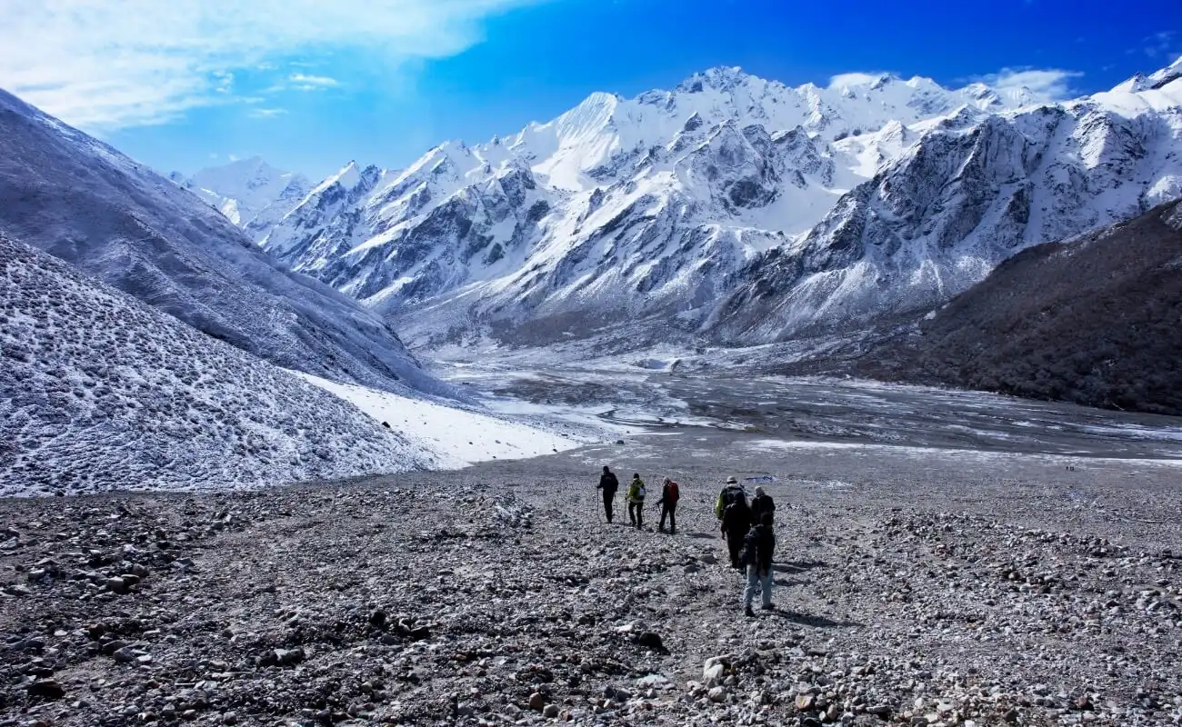 The Langtang Valley Trek is an accessible high-altitude route in the Langtang National Park, Rasuwa District. The trail runs from Syabrubesi (1,460 m) to Kyanjin Gompa (3,870 m), covering 65 km one way. The Langtang region was severely affected by the April 2015 earthquake and subsequent avalanche; full reconstruction was completed by 2019.
What Makes Langtang Valley Different During Monsoon?
Langtang Valley transforms into Nepal's most visually dramatic trekking corridor during monsoon because 14 named glaciers release meltwater, waterfalls appear on every cliff face, and rhododendron, maple, and bamboo forests reach maximum density, creating a lush green tunnel for the first 30 km of trail.
The valley's east-west orientation channels morning sun directly down the corridor between Langtang Lirung (7,227 m) and Yala Peak (5,500 m). Clear morning visibility is consistent from Kyanjin Gompa from 5:00 AM to 9:00 AM, before cloud buildup begins. Mountain photography in this window produces clear-sky summit shots even in peak monsoon months.
Trail width and infrastructure are above average for Nepal monsoon routes. The Langtang National Park Authority extensively upgraded the 22 km stretch of the primary valley trail from Syabrubesi up toward Kyanjin Gompa, including the crucial dense forest sections between Bamboo and Lama Hotel, following the 2015 earthquake. Path surfaces drain efficiently.
What Are the Main Highlights of the Langtang Valley Trek?
The Langtang Valley Trek features 5 major highlights: Kyanjin Gompa monastery, Langtang Cheese Factory, Tsergo Ri viewpoint (4,984 m), Gosainkunda Lakes (4,380 m), and Langtang Village memorial for the 2015 avalanche.
-
Kyanjin Gompa (3,870 m): A working monastery with butter-lamp offerings visible daily. The monastery's cheese factory produces hard yak cheese exported to Kathmandu markets.
-
Tsergo Ri (4,984 m): A day hike viewpoint from Kyanjin offering 360° views of Langtang Lirung, Dorje Lakpa (6,966 m), and the Tibetan plateau. Accessible on a clear monsoon morning.
-
Gosainkunda Lakes (4,380 m): A chain of 108 sacred alpine lakes, Hindu pilgrimage site, accessible via the Lauribina Pass (4,610 m) on the return circuit. Especially visited during Janai Purnima festival in August.
-
Bamboo Zone: 4 km of giant bamboo forest between 2,000 and 2,400 m, unique in Himalayan Nepal.
What Should You Expect From Weather on the Langtang Trek?
Langtang Valley receives 600 to 800 mm of rain during July and August, the highest rainfall of any route on this list. Morning windows of 4 to 6 hours with clear skies are reliable. Afternoons bring heavy rain at lower elevations below 3,000 m. The upper valley above Langtang Village receives 30% less precipitation due to its inner Himalayan position.
Practical weather expectations:
-
Rain starts between 11:00 AM and 1:00 PM at lower elevations.
-
Trail leeches appear from Syabrubesi to Bamboo (1,460 to 1,960 m).
-
High-quality waterproof gear is non-negotiable.
-
Kyanjin Gompa experiences morning snowfall 2 to 4 times per monsoon season.
Langtang is the most cloud-prone route on this list. It rewards early risers with spectacular views and punishes those who start walking at 10:00 AM.
6. Annapurna Circuit Trek
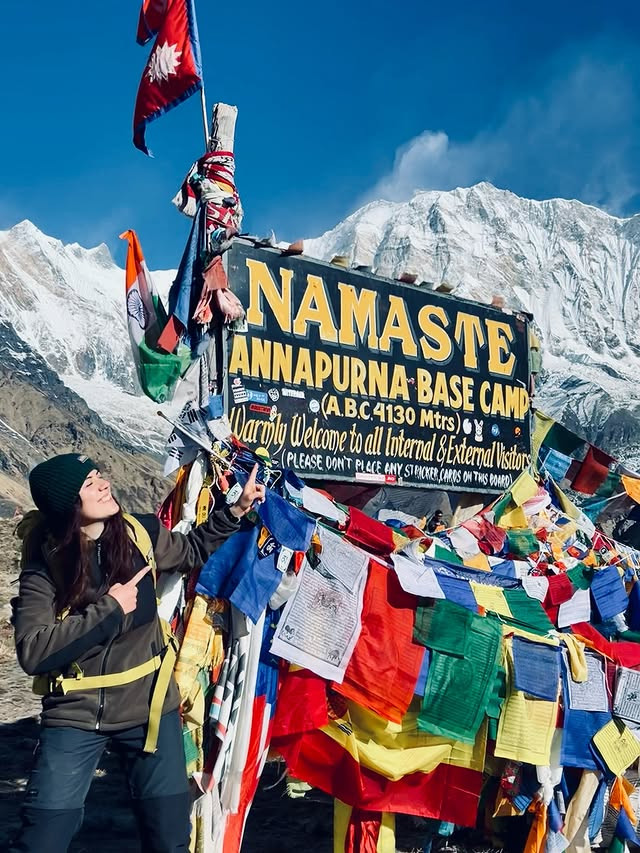
.webp) The Annapurna Circuit Trek is a 160 to 230 km loop trek in the Annapurna Conservation Area crossing 4 ecological zones from subtropical to alpine desert. The classic route crosses Thorong La Pass (5,416 m), the world's highest trekking pass regularly completed without technical equipment.
The Annapurna Circuit Trek is a 160 to 230 km loop trek in the Annapurna Conservation Area crossing 4 ecological zones from subtropical to alpine desert. The classic route crosses Thorong La Pass (5,416 m), the world's highest trekking pass regularly completed without technical equipment.
Why Is Manang–Muktinath Protected From Heavy Monsoon Rain?
The Manang-to-Muktinath section of the Annapurna Circuit sits in the rain shadow of the Annapurna massif, receiving fewer than 300 mm of precipitation annually, which makes this 4-day section trekable with clear mountain views even during peak monsoon.
The Annapurna I (8,091 m) and Gangapurna (7,454 m) summits act as a moisture dam. The dry valley corridor between Manang (3,519 m) and Muktinath (3,800 m) lies on the northern lee side of this barrier. Atmospheric models indicate that monsoon systems lose 80% of their moisture content before crossing the 6,000-m ridgeline into this valley.
The practical implication: trekkers who time their Annapurna Circuit to start at Besisahar and move quickly to Manang within 6 to 7 days gain access to the dry upper section during monsoon with the added visual bonus of cloud-sea formations rolling over the southern Annapurna slopes below them.
What Are the Highlights Between Manang and Muktinath?
The Manang-to-Muktinath section contains 6 key highlights: Ice Lake (4,620 m), Gangapurna Glacier, Thorong La Pass (5,416 m), Thorong La viewpoint at 5,450 m, Muktinath Temple, and the Mustang plateau descent toward Kagbeni.
-
Ice Lake (4,620 m): A glacially-formed alpine lake with clear turquoise water 4 hours above Manang, offering direct views of Annapurna III (7,555 m).
-
Thorong La Pass (5,416 m): The highest point on the trek. September crossing windows are longest; July crossings are possible but require 4:00 AM starts to avoid afternoon precipitation.
-
Muktinath Temple (3,800 m): One of the holiest Hindu and Buddhist shrines in Nepal; 108 water spouts and a natural gas flame that burns perpetually.
-
Kagbeni (2,810 m): The gateway to Upper Mustang, with a medieval walled town that predates 1400 CE.
How Does Monsoon Affect the Annapurna Circuit Trek?
Monsoon transforms the Annapurna Circuit into a split-experience trek: the southern section (Besisahar to Manang) is wet, green, and photographically rich, while the northern section (Manang to Jomsom) is dry, clear, and culturally Tibetan.
This dual experience is the Annapurna Circuit's greatest monsoon-season advantage. No other Nepal trek offers this dramatic climate transition within a single route. The leech zone ends definitively at Pisang (3,185 m). Above Manang, the climate shifts to sub-alpine steppe with daytime temperatures of 8 to 15°C and clear skies from dawn to early afternoon.
Permit requirement: Annapurna Conservation Area Permit (ACAP) at NPR 3,000 plus TIMS card at NPR 2,000.
7. Lower Dolpo Trek
Lower Dolpo Trek is a 180 km route in Shey Phoksundo National Park accessing Phoksundo Lake (3,611 m) without entering the restricted upper Dolpo zone. Trailhead is Juphal (2,475 m); the route returns to Juphal after 12 to 15 days.
What Makes Lower Dolpo a Monsoon-Friendly Trek?
Lower Dolpo is monsoon-friendly because it occupies the transitional climate zone between the wet midlands and the dry inner Himalaya, receiving 350 to 450 mm of rain during June-September, a 65% reduction compared to Pokhara, with morning clear-sky windows of 5 to 7 hours.
The Kagmara range (highest point: Kagmara Peak, 5,960 m) provides partial orographic protection. Lower Dolpo's trail network runs through gorges at 2,400 to 3,000 m where the canyon walls channel airflow and reduce effective precipitation on the trail surface. Water drainage is rapid on rocky canyon trails, keeping paths walkable within 2 to 3 hours of heavy rain.
The monsoon season activates the Phoksundo waterfall system. The main Phoksundo waterfall, a 107-metre vertical drop into the lake, runs at maximum volume from July through September, making this the best season for waterfall photography.
What Are the Highlights of the Lower Dolpo Trek?
Lower Dolpo's 4 signature highlights are Phoksundo Lake's turquoise water at 3,611 m, the 107-metre Phoksundo Waterfall, Ringmo Village's Bon religious community, and the high-pass crossing of Kagmara La (5,115 m).
-
Phoksundo Lake: Nepal's deepest freshwater lake (145 m depth) with bioluminescent blue-green color caused by suspended glacial minerals. The lake has no surface outlet; water drains underground.
-
Kagmara La (5,115 m): The main pass on the southern circuit variant, crossed in late July and August when snow coverage drops below 20 cm.
-
Chhepka and Rohagaon villages: Two traditional settlements with stone architecture unchanged for 300 years, subsisting on buckwheat, potato, and barley cultivation.
-
Suligad River Canyon: A 15-km gorge section with walls rising 600 m on both sides, carved by the Suligad river over 2 million years.
How Remote Is Lower Dolpo During the Monsoon?
Lower Dolpo receives fewer than 200 foreign trekkers per month during monsoon season, making it one of Nepal's least-crowded accessible trekking destinations during June through September. Juphal airport (IATA: JUL) operates daily flights from Nepalgunj, with a flight time of 45 minutes. Road access from Kathmandu requires 12 to 14 hours of driving via Surkhet.
Lodge infrastructure exists at 8 settlements along the main route. Teahouse accommodation provides basic but functional facilities, private rooms are available, food menus are limited to dal bhat, noodles, and basic pasta. Self-sufficient camping is an alternative for trekkers preferring more flexibility.
8. Tsum Valley Trek
Tsum Valley Trek is a 240 km round-trip route in the Gorkha District accessing the Tsum Valley, a sacred Himalayan pilgrimage valley with Tibetan Buddhist cultural continuity spanning 500 years. The valley entrance is at Chumling (2,386 m); maximum elevation is Ngule Dhojhyang (4,800 m) near the Tibetan border.
How Does Monsoon Weather Affect the Tsum Valley Trek?
Tsum Valley's inner position, enclosed by Ganesh Himal (7,422 m), Baudha Himal (6,672 m), and Himal Chuli (7,893 m), reduces monsoon precipitation to 400 to 500 mm during June-September, creating afternoon rain patterns that allow full morning and evening trekking windows without interruption.
The valley runs northeast from the Budhigandaki River confluence. The Greater Himalayan ridgeline to the north and east intercepts Tibetan high-pressure systems that counteract monsoon flow for 3 to 5 days at a time during August. Trekkers report average of 6 clear days per 10-day period in July and August within the upper valley.
Trail surfaces are stone-paved through most of the upper valley above Chumling, constructed by the local community over 200 years. Monsoon rain runs off stone paths within 30 minutes of each rain event. Unpaved sections exist between Arughat (597 m) and Sotikhola (714 m) where mud accumulation is the primary challenge.
What Cultural and Natural Attractions Can You Explore in Tsum Valley?
Tsum Valley contains 12 active gompas, 4 ancient chortens dating to the 13th century, rock inscriptions in Tibetan and Sanskrit, and a resident snow leopard population estimated at 22 to 28 individuals in the Nubri and Tsum conservation corridor.
Key attractions:
-
Mu Gompa (3,700 m): The most important monastery in Tsum Valley, housing 60 resident monks and a library of rare Tibetan Buddhist texts, some predating the 16th century.
-
Rachen Gompa: A nunnery at 3,840 m with 40 resident nuns; closed to male visitors except in common prayer areas.
-
Peng Village (3,090 m): A cluster of Mani walls (prayer-stone walls) extending 200 metres, one of the longest in Nepal.
-
Barpak: A Gurung village (the largest in Nepal, population 7,000) located on the approach route; a major community rebuilding site post-2015 earthquake.
How Difficult Is the Tsum Valley Trek?
Tsum Valley Trek rates as moderately difficult with a maximum altitude of 4,800 m and 13 to 17 days required for completion. Daily walking time averages 5 to 7 hours. Cumulative ascent on the full loop exceeds 5,200 m.
A Restricted Area Permit for Tsum Valley costs USD 30 per person per week during the monsoon season (December through August), rising to USD 40 per week during the autumn peak. The ACAP permit adds NPR 3,000. Two logistical advantages: Tsum Valley permits are cheaper than Upper Dolpo and Upper Mustang, and the approach from Arughat (accessible by bus from Kathmandu in 6 hours) eliminates the need for domestic flights.
Tsum Valley sits inside the same conservation corridor as neighboring Manaslu region treks, where the classic Larkya La circuit offers a longer high-pass alternative for trekkers with extra days and full acclimatization experience. Both routes share overlapping permits and the same Arughat trailhead, making it straightforward to combine a Tsum Valley detour with a full Manaslu Circuit itinerary.
9. Helambu Trek
Helambu Trek is a 95 km loop circuit in the Helambu region, Sindhupalchowk District, beginning and ending at Sundarijal (1,460 m), 15 km north of Kathmandu. Maximum elevation: Tharepati Pass (3,640 m). Duration: 5 to 7 days.
What Makes Helambu Accessible During Monsoon?
Helambu is the most logistically accessible monsoon trek in Nepal because the trailhead at Sundarijal is 40 minutes by road from Kathmandu, maximum elevation is 3,640 m (eliminating altitude sickness risk for most trekkers), and the trail circuit is fully serviced by lodges in 12 villages with road-accessible evacuation options.
Maximum precipitation during monsoon at Helambu's upper zone (Tharepati, 3,640 m) is 800 mm in July, comparable to London's annual rainfall spread over 4 months. This is higher than ideal for dry-weather trekking, but two factors compensate: trail quality is maintained by the Melamchi River watershed project, and the dense forests create a natural canopy that keeps paths clear of standing water.
Helambu sits within the Shivapuri Nagarjun National Park corridor, meaning protected forest trails are maintained year-round by national park staff. This infrastructure level is unavailable on more remote monsoon routes.
What Can You Experience on the Helambu Trek?
The Helambu Trek delivers 5 accessible monsoon experiences: Sherpa village culture, the Melamchi River valley in full monsoon flow, rhododendron and oak forest corridors, Gosainkunda Lakes access via Tharepati, and traditional Tamang and Sherpa homestay accommodation.
-
Tarkeghyang Village (2,590 m): A traditional Sherpa settlement with a 400-year-old Nyingma monastery, apple orchards, and cheese production.
-
Melamchi River: Runs at maximum volume in July-August; viewable from trail sections between Sermathang and Melamchi Pul Bazaar.
-
Tharepati (3,640 m): An overnight stop with panoramic views of Jugal Himal (6,830 m) on clear mornings; also a junction point for Gosainkunda Lakes trail.
-
Kakani Viewpoint: A 2,073-m ridge with views toward the Langtang range and Kathmandu valley.
How Does Helambu Compare With Other Monsoon Treks?
Helambu ranks lowest in elevation and permit complexity among all 10 monsoon treks, making it the fastest to organize and safest for acclimatization, but it also offers the fewest rain-shadow dry days and the lowest mountain view probability.
Comparison framework:
|
Factor |
Helambu |
Upper Mustang |
Langtang |
|
Distance from Kathmandu |
40 min drive |
8-hour drive + flight |
6-hour drive |
|
Maximum elevation |
3,640 m |
3,840 m |
3,870 m |
|
Permits required |
2 |
3 |
2 |
|
Dry days in monsoon |
40% |
85% |
50% |
|
Cost (7 days, USD) |
400–600 |
1,200–1,800 |
600–900 |
Helambu is the right choice for trekkers with fewer than 7 days available, limited monsoon budget, or no prior high-altitude experience.
10. Panch Pokhari Trek
Panch Pokhari Trek is a 140 km round-trip route in Sindhupalchowk District, northeast of Kathmandu, reaching the Panch Pokhari sacred lake complex at 4,100 m. Five glacially-formed lakes form the complex. Nearest trailhead: Chautara town (1,170 m), 3 hours by road from Kathmandu.
What Makes Panch Pokhari Suitable for Monsoon?
Panch Pokhari is monsoon-suitable because the lake complex sits on a northeast-facing ridge at 4,100 m that receives full sunlight from 5:00 AM to 11:00 AM before cloud build-up, and the Jugal Himal ridgeline to the north (highest point: Phurbi Chyachu, 6,637 m) deflects the main monsoon air mass southward before it reaches the lake basin.
Annual precipitation at Panch Pokhari is estimated at 550 mm, 30% lower than Helambu at comparable elevation. The ridge's northeast orientation means prevailing southwest monsoon winds travel across the ridge perpendicular rather than directly into the lake basin, reducing effective wet-weather exposure for trekkers.
Pilgrimage traffic peaks during Panch Pokhari Jatra, held annually during the August full moon (Shrawan Purnima). Hindu pilgrims from across Nepal's eastern Terai regions make the 3-day ascent to bathe in the sacred lakes. Trekkers visiting during this 3-day festival window witness one of Nepal's largest high-altitude religious gatherings, approximately 3,000 to 5,000 pilgrims per year.
What Can You See Around the Panch Pokhari Lakes?
The Panch Pokhari complex contains 5 named lakes, Panch Pokhari, Ama Pokhari, Raj Pokhari, Sar Pokhari, and Bhairab Pokhari, set in an alpine meadow at 4,100 to 4,200 m with views of Jugal Himal, Dorje Lakpa (6,966 m), and Phurbi Chyachu (6,637 m).
-
Panch Pokhari (main lake): The largest of the 5 at approximately 600 m in length; contains a small island with a Shiva shrine accessible only during low water periods.
-
Wildlife: Himalayan tahr, musk deer, and snow pigeons are observable during early morning hours at the lake basin. Snow leopard tracks are recorded annually by park rangers.
-
Lauribina ridge junction: The high trail at 4,300 m connects Panch Pokhari to the Gosainkunda circuit for experienced trekkers.
-
Wildflowers: 45 documented alpine flower species bloom between June and September at the lake basin, including purple primulas, yellow cinquefoil, and white edelweiss.
How Difficult Is the Panch Pokhari Trek During Monsoon?
Panch Pokhari Trek rates as moderately strenuous with 3 consecutive ascent days gaining 2,930 m of total elevation from Chautara to the lakes. Maximum altitude of 4,100 m is achievable without prior altitude experience, but the ascent rate is steep, averaging 900 m per day on days 2 and 3.
Monsoon-specific difficulty factors:
-
Trail sections between Phulpingkatti and Sherpa Gaun accumulate mud during heavy rain.
-
Porters are available from Chautara for NPR 1,200 to 1,500 per day.
-
Trekkers require a Langtang National Park Permit (NPR 3,000) or a Gaurishankar Conservation Area Permit depending on the exact trailhead, plus a local rural municipality fee.
-
Lodges are available at 3 points: Sherpa Gaun (2,870 m), Deurali (3,400 m), and Panch Pokhari itself.
How Can You Choose the Best Monsoon Trek in Nepal?
Choosing the best monsoon trek in Nepal depends on 4 decision variables: available budget, days available, prior altitude experience, and preference for rain shadow dryness versus lush monsoon landscapes.
Apply this framework:
-
Budget under USD 600 (7 days) → Helambu Trek or Panch Pokhari Trek. Standard, low-cost national park permits required (no expensive restricted area fees), road-accessible trailheads, minimal guide costs.
-
Budget USD 600–1,200 (10 days) → Khopra Danda Trek, Langtang Valley Trek, or Tsum Valley Trek. Moderate permits, accessible by road.
-
Budget USD 1,200–2,500 (14+ days) → Annapurna Circuit, Nar Phu Valley, or Upper Mustang Trek. Restricted area permits, guide required, internal flights.
-
Budget USD 3,000+ (21+ days) → Upper Dolpo or Lower Dolpo Trek. Maximum remoteness, highest permit cost, domestic flights to Juphal.
For a full season-by-season comparison across all of Nepal's trekking regions beyond monsoon, see our detailed guide to the best time to trek in Nepal.
Which Monsoon Trek Is Best for First-Time Trekkers?
Helambu Trek and Khopra Danda Trek are the 2 best monsoon treks for first-time trekkers. Both stay below 4,000 m (eliminating severe altitude sickness risk), use established lodge networks, and are accessible within 4 hours of Kathmandu. Khopra Danda offers the superior mountain view experience; Helambu offers the faster logistics and shortest commitment at 5 days minimum.
Khopra Danda is the recommendation for first-timers who want a genuine mountain experience with wildflower meadows, glacial lake visits, and Annapurna panoramas: without restricted area permits or technical altitude challenges.
Which Monsoon Trek Offers the Best Mountain Views?
Upper Mustang Trek offers the best mountain views during monsoon because its rain shadow location provides 85% clear-sky days with unobstructed sightlines to Annapurna I (8,091 m), Dhaulagiri I (8,167 m), Nilgiri North (7,061 m), and Tilicho Peak (7,134 m), 4 peaks above 7,000 m visible from a single ridge.
Second ranking: Nar Phu Valley (Kang Guru and Pisang Peak views) and Annapurna Circuit's Manang-Muktinath section (Annapurna III and Gangapurna). Both deliver consistent clear morning views for 60 to 70% of monsoon days.
Which Monsoon Trek Is Best for Remote Adventure?
Upper Dolpo Trek delivers the highest remote-adventure quotient among all 10 monsoon options, 21 to 28 days of walking, USD 500 restricted area permit, fewer than 150 foreign trekkers per season, no vehicle road access, and a minimum 45-minute domestic flight approach to Juphal. Upper Dolpo is the most demanding, most expensive, and least crowded trek in Nepal during any season.
Second in remoteness: Nar Phu Valley (restricted area, 200 trekkers/month during monsoon) and Lower Dolpo (500 to 700 trekkers/year total).
How Can Himalaya Trekking Nepal Help You Plan a Monsoon Trek?
Planning a monsoon trek in Nepal requires accurate permit sequencing, weather-aware itinerary design, and guide licensing, details that differ significantly from dry-season trekking logistics.
Can Himalaya Trekking Nepal Arrange Your Monsoon Trek in Nepal?
Himalaya Trekking Nepal organizes fully supported monsoon trekking packages across all 10 routes listed in this guide. Nepal's overall visitor arrivals have been climbing steadily, the Nepal Tourism Board's monthly Tourism Insights report recorded 15.7% year-on-year growth in arrivals for January 2026 alone, but trekking-specific monsoon traffic on routes like Upper Mustang still drops sharply against the October–November peak, which is exactly what creates the quieter trails and lower lodge costs described below. Services include:
-
Permit procurement: All permits (Restricted Area Permits, ACAP, National Park permits, TIMS) handled in Kathmandu before departure.
-
Licensed guide assignment: NATHM-certified guides with route-specific monsoon season experience on each trail.
-
Flexible itinerary design: Weather contingency days built into Upper Dolpo, Nar Phu Valley, and Upper Mustang itineraries.
-
Domestic flight booking: Coordination for Juphal, Jomsom, and Pokhara connections.
-
Teahouse reservation: Pre-booked accommodation on higher-demand routes like Langtang and Khopra Danda.
Package pricing starts at USD 380 per person for Helambu Trek (5 days, guide included) and reaches USD 3,200 per person for Upper Dolpo Trek (21 days, guide, permits, all logistics). Browse our full range of trekking packages in Nepal to compare monsoon-ready routes and book your preferred season.
What Are the Key Takeaways About the Best Monsoon Treks in Nepal?
The best monsoon treks in Nepal are concentrated in 3 geographic categories: rain shadow zones (Upper Mustang, Upper Dolpo, Lower Dolpo, Nar Phu Valley, Annapurna Circuit northern section), inner Himalayan valleys (Tsum Valley, Langtang Valley, Khopra Danda upper ridge), and accessible low-to-mid elevation circuits (Helambu, Panch Pokhari).
Key takeaways:
-
Upper Mustang delivers the most rain-free days (85% clear skies in monsoon) and the strongest combination of cultural heritage and mountain views.
-
Helambu and Panch Pokhari are the fastest to organize, requiring only standard entry permits rather than complex Restricted Area paperwork, keeping costs minimal.
-
Upper Dolpo is the most remote and expensive option, appropriate for experienced trekkers with 3+ weeks and a USD 500 restricted area permit budget.
-
Khopra Danda provides the best value among all 10 treks: moderate cost, genuine mountain views, and accessible logistics from Pokhara.
-
Langtang Valley offers the greenest monsoon landscape and the closest approximation to classic Himalayan trekking within 6 hours of Kathmandu.
-
Monsoon season trekking in Nepal rewards early starters, beginning each day at 5:00 to 6:00 AM captures the clear morning window available on all 10 routes.
-
Permit requirements vary from zero (Helambu, Panch Pokhari) to USD 500+ (Upper Dolpo). Budget and logistics complexity scale together.
Monsoon trekking in Nepal is not a compromise, it is an entirely different experience. The routes listed here are at their greenest, least crowded, and most culturally alive during June through September. Selecting the right trail from this list based on your budget, experience level, and desired landscape type is the only planning step that matters most.
More About Author

Khilak Budhathoki
Travel Director
Khilak Budhathoki is the co-founder and lead trekking guide at Himalaya Trekking Nepal, a locally owned and operated adventure company based in Kathmandu. Born and raised in the foothills of Nepal, Khilak developed a deep love for the mountains from an early age. With over a deca...
USD$1500 pp
Our Recommendation

USD$850 pp
Our Recommendation
Related Blogs