- 12, Apr 2026 | Khilak Budhathoki
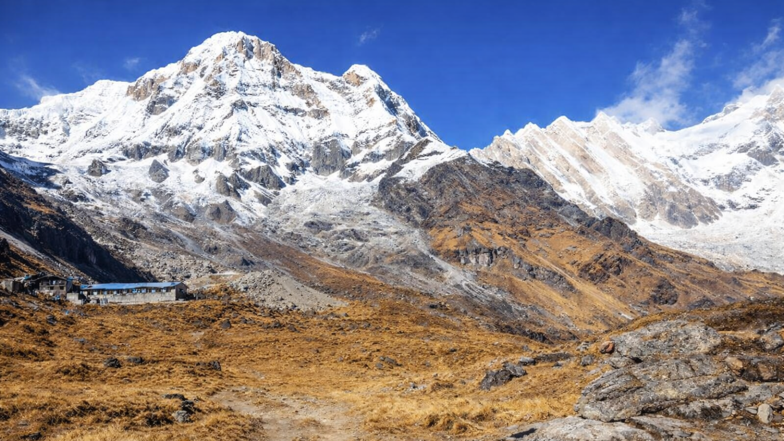
Everest Base Camp Trek altitude defines the elevation profile, physiological stress, and safety strategy of the Himalayan route to Mount Everest. This high-altitude trekking route spans from Lukla at 2,860 m to Kala Patthar at 5,544 m, with Everest Base Camp fixed at 5,364 m inside Sagarmatha National Park in Nepal’s Khumbu Valley. Everest Base Camp Trek altitude for high-altitude adaptation reduces available oxygen to ~50% of sea-level concentration above 5,300 m, directly impacting SpO₂ levels, endurance, and cognitive function.
Standard EBC itinerary distance covers 130 km round trip with a total elevation gain of 2,500 m across 12 to 14 days, following a controlled ascent rate of 300–500 m sleeping altitude per day above 3,000 m. Defined altitude stages include Lukla (2,860 m), Namche Bazaar (3,440 m), Dingboche (4,410 m), Lobuche (4,931 m), and Gorak Shep (5,164 m), forming a progressive acclimatization ladder. Everest Base Camp Trek altitude with hypoxia exposure triggers altitude illness risks above 2,500 m, including Acute Mountain Sickness (AMS), High Altitude Pulmonary Edema (HAPE), and High Altitude Cerebral Edema (HACE).
Evidence-based acclimatization protocols include staged ascent, hydration of 3–4 liters daily, acclimatization stops at Namche Bazaar and Dingboche, climb-high sleep-low cycles, and immediate descent upon severe symptoms. Everest Base Camp Trek altitude compared to routes like Annapurna Base Camp (4,130 m) and Manaslu Circuit (5,160 m) presents higher sustained elevation exposure, making altitude management the primary determinant of safety, itinerary design, and trekking success.
What is the altitude of Everest Base Camp, and why does it matter?
Everest Base Camp (South, Nepal side) stands at 5,364 m / 17,598 ft. At this elevation, every breath delivers roughly half the oxygen available at sea level. The body responds with increased ventilation rate, elevated heart rate, and erythropoietin (EPO) production to compensate for hypoxia. Altitude determines every decision on this route, from daily distance to acclimatization stops.
South EBC, at 5,364 m, sits 3,484.86 m / 11,433 ft below the Mount Everest summit at 8,848.86 m / 29,031.7 ft. EBC represents approximately 60% of Everest's total height. North Everest Base Camp (Tibet side) occupies a lower position at 5,150 m / 16,900 ft, is located on the Tibetan plateau, and sits 3,698.86 m / 12,131 ft below the summit.
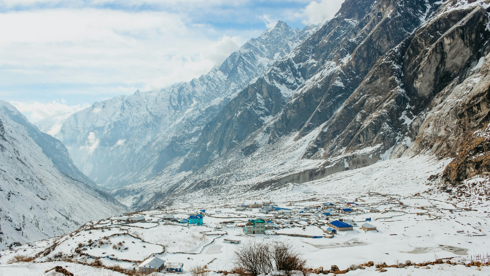
The Khumbu region Everest trekking area encompasses the entire trekking corridor from Lukla through Namche Bazaar, Tengboche, Dingboche, Lobuche, Gorak Shep, and finally EBC. Mount Everest carries 3 names: Sagarmatha in Nepali, Chomolungma in Tibetan, and Mount Everest in English, named after surveyor George Everest. Sagarmatha National Park protects the entire high-altitude ecosystem through which the route passes.
Kala Patthar, at 5,544 m / 18,192 ft, stands higher than EBC and delivers the best 360-degree panoramic view of Mount Everest on the entire route. Kala Patthar, which translates to Black Rock, is the highest point accessible without a special climbing permit.
What Are the Altitude Levels at Each Stop on the EBC Route?
The EBC route climbs from Lukla at 2,860 m through 8 major elevation stages to reach Gorak Shep at 5,164 m before the final approach to EBC. Each stage gains between 400 m and 800 m of elevation. Sleeping altitude at each stop determines acclimatization progress more than hiking elevation.
The following table shows the altitude profile for each key stop on the classic Lukla to Everest Base Camp trekking route.
|
Stop |
Altitude (meters) |
Altitude (feet) |
|
Lukla / Tenzing-Hillary Airport |
2,860 m |
9,383 ft |
|
Phakding |
2,610 m |
8,727 ft |
|
Monjo |
2,804 m |
9,200 ft |
|
Namche Bazaar |
3,440 m |
11,286 ft |
|
Everest View Hotel |
3,962 m |
13,000 ft |
|
Tengboche |
3,867 m |
12,687 ft |
|
Pangboche |
3,901 m |
12,799 ft |
|
Dingboche |
4,410 m |
14,173 ft |
|
Lobuche |
4,931 m |
16,302 ft |
|
Gorak Shep |
5,164 m |
16,995 ft |
|
Everest Base Camp (South) |
5,364 m |
17,598 ft |
|
Kala Patthar |
5,544 m |
18,192 ft |
Phakding actually sits lower than Lukla, at 2,610 m, because the trail descends into the Dudh Koshi River Valley before climbing sharply toward Namche Bazaar. The day 1 descent covers 315 m before regaining the equivalent elevation, creating a deceptive early effort. The total elevation gain from Lukla to EBC measures 2,500 m spread across 9 ascending days.
Namche Bazaar at 3,440 m functions as the Sherpa capital and the first major acclimatization stop. The Everest View Hotel at 3,962 m, one of the highest-altitude hotels in the world, offers a clear line of sight to the Everest massif and serves as an acclimatization hike destination from Namche. Tengboche at 3,867 m hosts the largest monastery in the Khumbu region; Pangboche at 3,901 m holds the oldest monastery in the Solukhumbu region.
Gorak Shep, at 5,164 m, is the last human settlement before EBC. EBC itself sits a 2-hour hike beyond Gorak Shep across loose rock and glacial moraine. Gorak Shep was the original Everest Base Camp until 1953, when climbing expeditions relocated to the current position.
How Does Altitude Affect the Body During the Everest Base Camp Trek?
High altitude triggers hypoxia, a state in which the body receives insufficient oxygen at the tissue level, because barometric pressure drops with elevation and each breath contains fewer oxygen molecules. At 5,364 m, the body works significantly harder than at sea level to maintain basic functions.
The physiological response progresses in 3 stages. Within the first 0 to 12 hours at altitude, the breathing rate increases and the heart rate elevates as the body attempts to compensate. Between 12 and 72 hours, EPO production rises to stimulate red blood cell generation, which improves oxygen-carrying capacity over days to weeks. Beyond 72 hours, full acclimatization to a given altitude requires consistent sleeping elevation without rapid ascent.
Daily elevation gain of 400 m to 800 m pushes the body to its acclimatization limit. Gains exceeding 500 m per day above 3,000 m significantly increase the risk of AMS. The real challenge of the EBC trek is not trail difficulty but the body's adaptation to altitude.
At the Death Zone, defined as elevations above 8,000 m, oxygen concentration falls to approximately 33% of sea level. Camp I on Everest sits at 6,065 m / 19,900 ft, where oxygen measures approximately 47% of sea level. Camp II sits at 6,400 m / 21,000 ft at 43% of sea-level oxygen. Camp III at 7,162 m / 23,500 ft delivers 38% of sea-level oxygen. Camp IV, also known as South Col, at 7,950 m / 26,085 ft, provides only 33% of sea-level oxygen, equivalent to the Death Zone threshold. Most Everest climbers use supplemental oxygen above 7,000 m.
What Are the Symptoms and Stages of Altitude Sickness on This Trek?
Altitude sickness on the EBC trek presents across 3 defined medical conditions: Acute Mountain Sickness (AMS), High Altitude Pulmonary Edema (HAPE), and High Altitude Cerebral Edema (HACE), each with distinct symptom progressions and emergency thresholds.
AMS is the most common condition among EBC trekkers. Its 6 primary symptoms are headache, nausea or vomiting, dizziness or lightheadedness, fatigue, shortness of breath, and loss of appetite. Secondary AMS symptoms include difficulty sleeping, rapid pulse, and fainting. AMS onset occurs within 6 to 12 hours of arriving at a new altitude without adequate acclimatization.
HAPE, defined as fluid accumulation in the lungs at high altitude, is potentially fatal without immediate treatment. Its 4 defining symptoms are chest tightness, persistent cough, frothy or pink-tinged sputum, and severe shortness of breath at rest. HAPE develops most commonly on the second night at a new altitude.
HACE, defined as cerebral edema caused by hypoxia, is rare but grave. Its 4 distinguishing symptoms are confusion or loss of coordination, inability to walk in a straight line, hallucinations, and unconsciousness. Neglecting HACE symptoms without immediate descent leads to death. The combination of lack of hydration, poor sleep quality, and contaminated food intake accelerates AMS progression into HAPE and HACE.
What are normal SpO₂ levels at different altitudes on the trek?
SpO2, or blood oxygen saturation, measures the percentage of hemoglobin saturated with oxygen. At sea level, normal SpO₂ ranges from 95% to 100%. At Namche Bazaar (3,440 m), acclimatized trekkers typically measure 85% to 90% SpO₂. At EBC (5,364 m), readings of 70% to 80% are common and expected. SpO2 below 70% at any altitude indicates a medical emergency requiring immediate descent.
Guide-led teams carry pulse oximeters on every licensed trek. Oximeter readings at altitude require 60 seconds of stillness for accuracy. No SpO₂ reading replaces symptom assessment; trekkers with readings above 80% can still develop HAPE or HACE if the ascent rate is excessive.
Why Does Altitude Sickness Occur on the Everest Base Camp Trek?
AMS occurs when the ascent rate exceeds the body's acclimatization capacity, causing inadequate oxygen delivery to tissues and triggering the cascade of vascular, neurological, and pulmonary responses that define altitude illness.
The safe ascent rate above 3,000 m limits sleeping altitude gain to 300 m to 500 m per day. The standard 12-day EBC itinerary builds this rate into the schedule. The 3 physiological factors that determine individual AMS risk are genetic predisposition to hypoxic ventilatory response (HVR), physical fitness level, and prior altitude exposure. Physical fitness does not confer immunity from AMS. Trekkers in excellent cardiovascular condition develop AMS at the same rate as those with average fitness when ascent rates are equal.
Group pressure is a documented risk multiplier. Trekkers who conceal symptoms to avoid slowing a group significantly increase their probability of progressing from AMS to HAPE or HACE. Guide-led treks with oximeter monitoring reduce this risk because guides identify declining SpO₂ before trekkers self-report symptoms.
How Many Acclimatization Days Are Required for a Safe EBC Trek?
A safe EBC trek requires a minimum of 2 mandatory acclimatization days: 1 day at Namche Bazaar (3,440 m) and 1 day at Dingboche (4,410 m). The standard 12-day itinerary includes both. The extended 14-to-16-day itinerary adds a second night at Namche and a second acclimatization day at Dingboche for trekkers with higher AMS risk.
The acclimatization protocol follows the climb-high, sleep-low rule. At Namche, trekkers hike to the Sherpa Museum, Shangboche Hill, or the Everest View Hotel at 3,962 m before returning to sleep at 3,440 m. At Dingboche, the acclimatization hike ascends to Nangkartshang Peak before returning to sleep at 4,410 m. These day hikes elevate sleeping altitude stress without committing to a higher camp.
The 48-to-72-hour acclimatization window at each stop allows the body to produce additional red blood cells, adjust cerebral blood flow, and stabilize ventilation patterns. Skipping acclimatization days doubles AMS incidence on the subsequent stages.
Is a 12-Day or 14-Day EBC Itinerary Safer for Altitude Adaptation?
The 14-day EBC itinerary is safer than the 12-day version for trekkers with no prior high-altitude experience above 3,500 m because it includes 3 nights in Namche Bazaar and 2 nights in Dingboche, reducing the daily altitude gain on critical stages.
The 12-day itinerary moves from Namche (3,440 m) to Tengboche (3,867 m) on day 5 and reaches Dingboche (4,410 m) on day 7. The 14-day itinerary inserts a second acclimatization day at Namche and slows the Dingboche-to-Lobuche transition. The maximum itinerary reaches 21 days with a Jiri-to-EBC overland start, replacing the Lukla flight. The minimum itinerary is 3 days using Everest Base Camp helicopter return trek option to the Everest region, though this carries extreme AMS risk without prior acclimatization.
The Jiri-to-EBC route adds approximately 5 days to the standard itinerary by beginning the trek at Jiri rather than flying to Lukla, allowing the body to acclimatize progressively from lower elevations. Helicopter access, which completes a Kala Patthar flyover in under 4 hours with a 10-minute maximum stop at altitude, is only appropriate for sightseeing and not for trekkers planning to walk to EBC.
How Can You Prevent Altitude Sickness on the EBC Trek?
Altitude sickness prevention on the EBC trek relies on 6 evidence-based strategies: gradual ascent within the safe rate of 300 to 500 m of sleeping altitude gain per day; 3 to 4 liters of water daily; mandatory acclimatization days; the climb-high, sleep-low protocol; avoidance of alcohol and smoking; and immediate descent when severe symptoms appear.
Diamox (Acetazolamide)
Diamox reduces AMS incidence by approximately 50% in clinical trials by stimulating ventilation. It requires a prescription and carries 2 common side effects: tingling in the fingers and increased urination. Trekkers begin Diamox 24 hours before the first high-altitude camp. Diamox is a prophylactic aid, not a substitute for proper acclimatization.
4 Behaviors That Increase AMS Risk
-
Alcohol consumption above 3,000 m, which suppresses the hypoxic ventilatory response
-
Overexertion on ascent days beyond the 5 km per hour pace target
-
Eating meat at altitude, which demands more digestive effort under hypoxic conditions
-
Ignoring early AMS symptoms such as headache and nausea
Boiled water is the most convenient and cleanest hydration source on the route. Water purification tablets reduce plastic bottle waste above Namche.
What to Carry in Your Daypack?
Trekkers carry a 6-kilogram daypack on each trekking day. The pack contains 2 liters of water, rain gear, sun cream rated above SPF 50, a camera, high-energy snacks, a personal medical first aid kit, and an extra thermal layer. Porters carry large bags up to 30 kilograms, removing load stress from trekkers at altitude.
Emergency Evacuation
Emergency helicopter evacuation covers the entire Khumbu region. Trekking insurance with high-altitude helicopter evacuation coverage is a non-negotiable requirement; evacuation costs exceed USD 5,000 without coverage.
When Should You Stop Ascending or Descend Immediately at Altitude?
Trekkers stop ascending when any of the 3 severe AMS warning signs appear: SpO₂ below 70%, inability to walk a straight 10-meter line, or severe headache unresponsive to ibuprofen combined with nausea. Immediate descent is the only effective treatment for HAPE and HACE once moderate to severe symptoms appear.
A descent of 300 m to 500 m resolves most AMS cases within 1 to 2 hours. Waiting at altitude for symptoms to improve without descending dramatically increases the risk of progression to HAPE or HACE. No guide or group pressure justifies continuing ascent when severe symptoms are present.
Supplemental oxygen administered via portable canister reduces HAPE and HACE severity while organizing evacuation but does not substitute for descent. Guides carry supplemental oxygen above Dingboche on responsible operator itineraries.
What Behaviors Increase Altitude Risk During the Trek?
4 documented behavioral risk factors increase AMS incidence on the EBC route: hiding symptoms from guides or teammates, excessive physical exertion on ascent days, rapid pace over suspension bridges and steep uphill sections, and ascending with active illness.
Hidden symptoms represent the leading nonphysiological cause of altitude emergencies. Trekkers conceal headaches and nausea because of social pressure within group trekking dynamics. Licensed guides trained by the Nepal Mountain Academy recognize objective signs of AMS, including gait instability and cyanosis, even when trekkers deny symptoms.
Overexertion on the trail between Dingboche and Lobuche (4,931 m), which gains 521 m over 12 km, is a high-risk behavior. The trail passes through Thukla and ascends to Thukla Pass, where the Mount Everest Memorial stands as a sobering landmark. Trekkers push the pace at Thukla Pass because the memorial creates a psychological urgency to continue. Pacing at a 5 km per hour average across the full route is the standard target.
Carbon monoxide poisoning from poorly ventilated yak-dung-burning stoves in teahouses is a hidden risk that mimics AMS symptoms, including headache and nausea. Cheyne-Stokes breathing, a pattern of periodic apnea during sleep at altitude, disrupts sleep quality above 4,000 m and accelerates fatigue. Both conditions are misattributed to AMS without careful assessment.
What Is the Full Day-by-Day Altitude Profile of the EBC Trek?
The 15-stage EBC itinerary progresses from Kathmandu through 13 trekking stops and returns via Lukla, with altitude increasing systematically over 9 ascent days and recovering over 3 descent days.

.png)
Day 1: Kathmandu (1,400 m): Arrival and Briefing
Kathmandu serves as the trek starting point. Day 1 covers the pre-trek briefing, gear check, and permit processing. No trekking distance is covered on this day.
Day 2: Lukla (2,860 m) to Phakding (2,610 m): 9 to 13 km, 3 to 6 Hours
The 30-minute domestic flight from Kathmandu lands at Tenzing-Hillary Airport in Lukla, a technically demanding airstrip at 2,860 m, a village described by experienced guides as having a nerve-racking but thrilling landing. The trail descends 460 m overall to Phakding at 2,610 m through the Dudh Koshi River Valley.
Day 3: Phakding (2,610 m) to Namche Bazaar (3,440 m): 8 to 12 km, 4 to 6 Hours
The trail gains 780 m, crossing suspension bridges over the Dudh Koshi River Valley and entering Sagarmatha National Park at Monjo (2,804 m) and Jorsale before the final steep climb to Namche Bazaar.
Day 4: Namche Bazaar (3,440 m): Mandatory Acclimatization Day
The acclimatization hike ascends 440 m to the Sherpa Museum and Everest View Hotel (3,962 m) before returning to sleep at 3,440 m. This follows the climb-high, sleep-low protocol.
Day 5: Namche Bazaar (3,440 m): Optional Second Acclimatization Day
The extended 14-to-16-day itinerary adds a second acclimatization day with the Shangboche Hill hike. The 12-day itinerary proceeds directly to Tengboche on this day.
Day 6: Namche Bazaar (3,440 m) to Tengboche (3,867 m): 10 to 12 km, 6 Hours
The trail passes through Upper Pangboche and Pangboche Village with direct views of Ama Dablam, one of the most photographed peaks in the Khumbu region. Net elevation gain is 427 m.
Day 7: Tengboche (3,867 m) to Dingboche (4,410 m):12 km, 6 Hours
The route crosses the Imja Valley and gains 543 m to reach Dingboche, the second mandatory acclimatization stop. Pangboche Monastery, at 3,901 m, is passed in this stage.
Day 8: Dingboche (4,410 m): Mandatory Acclimatization Day
The acclimatization hike ascends 763 m to Nangkartshang Peak before returning to sleep at 4,410 m. This day is non-negotiable for safe progression to Lobuche and EBC.
Day 9: Dingboche (4,410 m) to Lobuche (4,931 m): 12 km, 5 to 7 Hours
The trail passes through Thukla (4,620 m) and ascends Thukla Pass, where the Mount Everest Memorial stands. Net elevation gain is 521 m. This stage crosses into the high-altitude zone above 4,500 m.
Day 10: Lobuche (4,931 m) to Gorak Shep (5,164 m) to EBC (5,364 m): 10 to 15 km, 7 to 8 Hours
Trekkers depart Lobuche at 7:00 am, reach Gorak Shep by mid-morning, and arrive at EBC by midday. Time at EBC is typically 10 to 20 minutes. The return to Gorak Shep is completed by 4:00 pm. This is the highest walking day of the standard itinerary.
Day 11: Gorak Shep (5,164 m) to Kala Patthar (5,544 m) to Pheriche (4,288 m): 13 to 18 km, 7 to 8 Hours
The ascent to Kala Patthar begins before sunrise; dawn is the best time for clear 360-degree panoramic Everest views. The subsequent descent covers 1,394 m of total loss to Pheriche, the largest descent day of the entire trek.
Day 12: Pheriche (4,288 m) to Namche Bazaar (3,440 m): 14 to 22 km, 8 Hours
The descent covers 810 m of net loss. Hot showers are available at Namche upon return. The return journey moves significantly faster than the outward journey because acclimatization pressure is removed.
Day 13: Namche Bazaar (3,440 m) to Lukla (2,860 m): 15 to 21 km, 8 Hours
The final trekking day descends 590 m net. The target is Lukla by early evening to allow rest before the morning flight.
Day 14: Lukla (2,860 m) to Kathmandu: 30-Minute Flight
The return domestic flight from Lukla to Kathmandu takes 30 minutes. This flight completes the trekking circuit.
Day 15: Kathmandu: Departure
The outward journey to EBC takes 9 days. The return from EBC to Lukla takes 3 days. The outward journey is intentionally longer to allow progressive acclimatization at each elevation stage.
What Peaks Are Visible from the EBC Route?
8 named peaks are visible from various points on the EBC route, with Kala Patthar providing the definitive 360-degree panoramic view of Mount Everest that the route is named for.
Mount Everest (Sagarmatha/Chomolungma) at 8,848.86 m is not fully visible from EBC itself because Lhotse, described as a silvery wall, blocks the Everest summit from the base camp's position. The Khumbu Icefall and Khumbu Glacier are visible from EBC, connecting the camp to the South Col and the climbing route above.
Lhotse at 8,516 m is the fourth-highest mountain in the world. Cho Oyu at 8,188 m and Makalu at 8,461 m are 2 of the 3 other 8,000-meter peaks inside or adjacent to Sagarmatha National Park. Nuptse at 7,861 m, Pumori at 7,161 m, Ama Dablam at 6,812 m, and Changtse are all visible from points along the route. Ama Dablam stands as one of the most photographed peaks in Nepal.
Island Peak at 6,189 m and Mera Peak at 6,476 m, both within the Solukhumbu region, serve as combined-route extensions for trekkers seeking a peak climbing component after the EBC trek. Lobuche East Peak at 6,119 m is a further technical extension option.
What Cultural and Natural Highlights Define the EBC Trek?
The EBC route passes through the heart of Sherpa territory, connecting 4 significant cultural landmarks, 2 ancient monasteries, and the alpine ecosystem of Sagarmatha National Park.
Namche Bazaar: The Sherpa Capital
Namche Bazaar (3,440 m) is the commercial and cultural center of the Khumbu region. The Sherpa Museum houses a Hall of Fame displaying photographs from the 1953 Everest Expedition, in which Sir Edmund Hillary and Tenzing Norgay Sherpa became the first confirmed summiteers of Mount Everest on 29 May 1953. The Sherpa community, a uniquely high-altitude-adapted people, provides guiding, porterage, and logistical expertise for all Everest expeditions. Khumjung Village, a short hike from Namche, holds a local monastery and the Khumjung School, built with Hillary's support in 1960.
Monasteries Along the Route
Tengboche Monastery at 3,867 m is the largest monastery in the Khumbu Valley. It hosts the Mani Rimdu Festival, a 19-day Tibetan Buddhist celebration held annually from mid-October to mid-November. Pangboche Monastery, at 3,901 m, is the oldest monastery in the Solukhumbu region. Both monasteries allow trekkers to observe active Buddhist practice and speak with resident monks.
Trail Culture and Natural Environment
Prayer flags, mani walls, and chortens mark every trail junction in the Khumbu Valley, reflecting the Tibetan Buddhist culture of the Sherpa community. Vegetation transitions from subtropical forest below Namche to alpine flora above Tengboche and from bare moraine to Khumbu Glacier ice above Lobuche. Gorak Shep's dry grassland is the last natural terrain before the glacier moraine trail to EBC. Trekkers who time the route with the spring climbing season from April to late May encounter active Everest expeditions at base camp.
What Logistics and Permits Are Required for the EBC Trek?
Every EBC trekker requires 2 permits: a Sagarmatha National Park entry permit and, since April 1, 2023, a mandatory licensed trekking guide, as solo trekking is banned across Nepal's protected trekking areas.
The licensed guide requirement, enforced since April 1, 2023, removed the option of independent trekking in the Khumbu region. Guide-led treks with 1 porter per trekker are the standard format; porters carry large bags weighing up to 30 kilograms, while trekkers carry a 6-kilogram daypack. Yaks and mules carry gear above Namche on many commercial itineraries.
Teahouse accommodation provides communal dining rooms, shared sleeping quarters, and hot showers that are sometimes unavailable above 4,000 m due to freezing water pipes at night. Temperature drops rapidly after sunset at high altitudes. A 4-season sleeping bag rated to minus 20 degrees Celsius, a sleeping bag liner, a warm down jacket, gloves, a beanie, rain gear, trekking poles, and crampons for peak ascensions are standard gear items.
Thamel in Kathmandu is the primary gear shopping district, stocking both authentic and replica high-altitude equipment. Nepal Tourism Board (NTB) accreditation, TAAN (Trekking Agencies Association of Nepal) accreditation, and Nepal Mountain Academy (NMA) accreditation are the 3 primary licensing standards for trekking operators in Nepal.
Dal bhat, the traditional Nepali meal of rice and lentils, is the main food on the trek. Pasta and soups, energy bars, and calorie-dense, high-carbohydrate foods support the 3,500 to 4,000 daily calories burned on ascent days. Trekkers drink 3 to 4 liters of water per day; boiled water is the most convenient and cleanest option. Connectivity on the route is limited, with mobile signal weak and location-specific; Everest Link provides Wi-Fi via solar ISP at EBC during expedition season, accessible with a prepaid card.
The minimum age guideline for EBC trekking is 10 years old, though no official age restriction exists under Nepal law.
What Are the Best Seasons for the EBC Trek by Altitude and Risk?
The 2 prime trekking seasons for EBC are March to May (spring) and September to November (autumn), corresponding to Nepal's 2 stable weather windows when trail conditions and mountain visibility are optimal.
Spring (March to May) coincides with the main Everest climbing season Everest Base Camp weather, which begins in April and peaks in the third and fourth weeks of May. This season offers the highest probability of clear summit views from Kala Patthar and the opportunity to observe Everest expedition activity at EBC. Trail traffic is highest in this period, reducing navigation uncertainty.
Autumn (September to November), and specifically October and November, offers stable weather and post-monsoon clarity. The Mani Rimdu Festival at Tengboche Monastery draws cultural visitors in October and November. December and January trekking are possible, but snow-covered trails above Namche and risks of frostbite increase; temperature at altitude can reach minus 60 degrees Celsius with wind chill at summit level, though EBC itself typically records minus 15 to minus 20 degrees Celsius in winter.
The monsoon season from June to August, with July carrying the highest precipitation, is universally avoided by EBC trekkers due to trail flooding, leech infestation below Namche, cloud cover blocking mountain views, and elevated landslide risk in the Khumbu Valley. February marks the beginning of the pre-season trekking window with manageable cold and reduced crowd levels.
How Does EBC Trek Altitude Compare to Other Nepal Treks?
EBC (South) at 5,364 m is the highest non-technical, non-permit-climbing trek in Nepal and ranks as one of the highest walkable treks globally.
The following table shows altitude comparisons between EBC and 5 other major Nepal trekking routes.
|
Trek |
Maximum Altitude |
Classification |
|
Everest Base Camp (South) |
5,364 m / 17,598 ft |
Highest standard trek |
|
Three Passes Trek (Everest region) |
5,535 m (Kongma La) |
Technical extension |
|
Annapurna Circuit (Larkya La Pass) |
5,160 m / 16,929 ft |
High pass |
|
Manaslu Circuit Trek |
5,160 m / 16,929 ft |
High pass |
|
Annapurna Base Camp |
4,130 m / 13,550 ft |
Standard trek |
|
Langtang Valley Trek |
3,210 m / 10,531 ft |
Lower altitude |
|
Annapurna Panorama Trek |
3,870 m / 12,697 ft |
Mid-altitude |
North EBC (Tibet side) sits at 5,150 m / 16,900 ft, making it slightly lower than South EBC by 214 m. The North EBC route passes through Tingri (4,350 m) and the open, expansive Tibetan Plateau before arriving at Rongbuk Monastery (4,980 m), the highest monastery in the world. and continuing to North EBC. North EBC carries less tourist traffic than South EBC and offers open valley terrain distinct from the glacier-dominated Khumbu approach.
What Physical Training Is Required Before the EBC Trek?
A minimum 2-to-3-month training program focused on cardiovascular endurance, leg strength, and pack-weighted hiking is the standard preparation for EBC.
Effective EBC preparation combines 5 training modalities: cardiovascular base building through running and cycling, stair climbing with increasing weight, loaded hiking on uneven terrain, strength training targeting squats and planks, and multi-day backpacking trips. Single-day hikes do not replicate the multi-day cumulative fatigue of 8 to 9-hour trekking days repeated over 13 days.
The training backpack weight target is double the load carried on the trail. Trekkers carry 6 kg on the trail; training with 12 kg builds the muscle memory and postural endurance needed for sustained trekking. The combined physical challenge of a 6 kg load, 400 to 800 m daily elevation gain, and reduced oxygen above 3,000 m requires systematic adaptation, not merely cardiovascular fitness.
Yoga for flexibility reduces injury risk from uneven terrain, suspension bridges, and descent sections where knee strain and balance control are primary concerns. Elevation gain calculation is essential for training planning; matching the 400 m to 800 m daily EBC gain in training sessions prepares the aerobic system for the route's demands.
What Route Variations Extend or Modify the Classic EBC Trek?
6 established route variations extend, combine, or replace the classic Lukla-to-EBC-and-back format, offering altitude profiles from 4,130 m to over 5,535 m.
The Everest Base Camp with Gokyo Lake Trek branches west from Namche into the Gokyo Valley, reaching the Ngozumpa Glacier and Gokyo Ri at 5,357 m for alternative Everest views. The Three Passes Trek (Everest Three High Passes) crosses the Renjo La, Cho La, and Kongma La passes above 5,300 m, representing the most physically demanding route variation in the region. The Cho La Pass extension connects the Gokyo and Khumbu valleys and is frequently added to the standard EBC itinerary for trekkers with 16 to 21 days.
Island Peak climbing at 6,189 m combines with the EBC route to add a technical peak climbing component using crampons and the fixed rope/Jumar technique on the Khumbu Icefall approach system. Mera Peak at 6,476 m and Lobuche East Peak at 6,119 m are 2 additional technical peak options within the Solukhumbu region. The Everest Views Trek is a shorter, lower-altitude alternative reaching the Everest View Hotel at 3,962 m, suitable for trekkers unable to commit to the full EBC itinerary. The Jiri-to-EBC trek replaces the Kathmandu-to-Lukla flight with a 5-to-7-day overland approach from Jiri at 1,905 m, the original trekking start used by the 1953 Everest Expedition.
Everest Base Camp Trek Altitude: Key Facts Summary
Everest Base Camp Trek altitude spans from Lukla at 2,860 m / 9,383 ft to Kala Patthar at 5,544 m / 18,192 ft across a 130 km / 80-mile round-trip route through Nepal's Khumbu Valley and Sagarmatha National Park. The 12-day standard itinerary gains 2,500 m / 8,200 ft of total elevation with mandatory acclimatization stops at Namche Bazaar (3,440 m) and Dingboche (4,410 m). Oxygen at EBC measures 50% of sea-level concentration. AMS prevention relies on the 300 to 500 m safe daily sleeping altitude gain rule, 3 to 4 liters of water daily, and the climb-high, sleep-low protocol enforced at every acclimatization stop. Guide-founded trek operators with licensed NTB and TAAN accreditation, named guides with 15-plus years of Himalayan experience, transparent pricing, and emergency evacuation protocols represent the safest route to Everest Base Camp.
More About Author

Khilak Budhathoki
Travel Director
Khilak Budhathoki is the co-founder and lead trekking guide at Himalaya Trekking Nepal, a locally owned and operated adventure company based in Kathmandu. Born and raised in the foothills of Nepal, Khilak developed a deep love for the mountains from an early age. With over a deca...

USD$1,600 pp
Our Recommendation
Related Blogs