- 12, Nov 2025 | Khilak Budhathoki
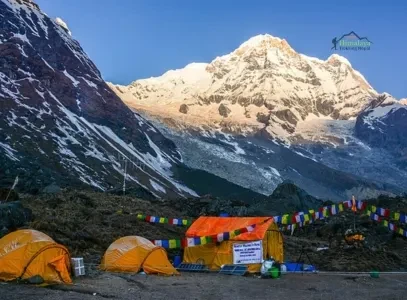
Annapurna Base Camp is a high-altitude Himalayan destination where extraordinary mountain scale, glacial geology, biodiversity, and living mountain culture converge within the Annapurna Sanctuary. At 4,130 meters, the base camp places trekkers inside a natural amphitheater surrounded by towering Himalayan peaks, including Annapurna I, Annapurna South, Annapurna III, Gangapurna, Hiunchuli, and Machapuchare. The surrounding landscape is shaped by the dramatic relief of the Annapurna massif, the Modi Khola valley, glacial formations, alpine moraines, and the narrow sanctuary entrance at Deurali. That enclosed geography creates a rare sense of immersion, where massive rock and ice walls dominate the horizon rather than appearing as distant mountain scenery.
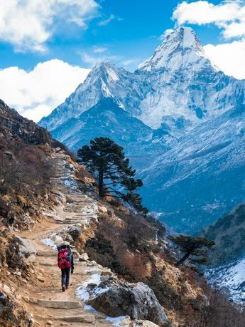
The beauty of the Annapurna Base Camp trek develops long before reaching the sanctuary. The route crosses terraced hillsides and Gurung and Magar villages, passes through rhododendron and mixed forests, follows waterfalls and mountain streams, and gradually transitions into subalpine and high-alpine terrain. Each elevation reveals different vegetation, architecture, wildlife, geological features, and mountain perspectives, while spring rhododendron blooms, autumn clarity, winter snow, and monsoon greenery continually transform the landscape. From cultural settlements and forest trails to Machapuchare Base Camp, glacial landscapes, and the 360-degree panorama at Annapurna Base Camp, the trek's visual character comes from the continuous interaction of mountains, ecosystems, geology, culture, and season.
What Makes the Annapurna Base Camp Landscape So Beautiful?
The Annapurna Base Camp landscape is beautiful because it places the trekker inside a closed glacial cirque surrounded by 360 degrees of peaks above 6,000 meters. No viewpoint is distant or framed through a valley gap. The mountains enclose you completely, creating an immersive scale that photographs cannot fully convey.
How Do the Annapurna Mountains Shape the Scenery?
The Annapurna massif shapes the scenery through sheer vertical scale and geometric concentration. The range includes 14 peaks above 7,000 meters within a 55-kilometer stretch, the densest cluster of ultra-high peaks in the Himalayas. Annapurna I, standing at 8,091 meters (26,545 feet), is the 10th highest mountain on Earth and the anchor of the entire landscape.
What makes this mountain architecture particularly striking is the contrast in relief. The base of the approach valley, the Modi Khola river corridor, begins at approximately 1,000 meters near Pokhara. The peaks visible from the camp rise to over 8,000 meters. That 7,000-meter vertical gain occurs within a horizontal distance of roughly 40 kilometers, creating wall-like faces that dominate the entire sky.
The southern faces of Annapurna South (7,219 m), Hiunchuli (6,441 m), and the west-facing wall of Machapuchare (6,993 m) channel the approach route. Trekkers walk toward these walls for 3 days before they converge into the sanctuary entrance, a narrow gorge at Deurali (3,230 m), which then opens into the full amphitheater panorama. That reveal at the sanctuary entrance is one of the most dramatic transitions in Himalayan trekking.
Why Are the Mountain Views at Annapurna Base Camp So Impressive?
Mountain views at Annapurna Base Camp are impressive because the camp sits directly inside the Annapurna Sanctuary, providing an unobstructed 360-degree panorama of 13 identifiable peaks without any foreground ridgelines blocking the view.
The peaks visible from base camp include: Annapurna I (8,091 m), Annapurna South (7,219 m), Annapurna III (7,555 m), Gangapurna (7,455 m), Glacier Dome (7,193 m), Khangsar Kang (7,485 m), Hiunchuli (6,441 m), and Machapuchare (6,993 m). Most trekking destinations offer views of 2 to 4 peaks. Annapurna Base Camp delivers a continuous wall of summits in every compass direction.
The elevation of the camp amplifies the visual impact. At 4,130 meters, the horizon sits above the mid-altitude haze layer that obscures peaks from lower viewpoints. Air clarity at this elevation, particularly in October and November, allows trekkers to identify individual glacial seracs and rock bands on faces 3 to 5 kilometers away.
How Does the Annapurna Sanctuary Create a Unique Landscape?
The Annapurna Sanctuary is a high-altitude glacial basin formed by glacial erosion over approximately 2 million years during the Pleistocene epoch. The sanctuary is defined geologically as a cirque, a bowl-shaped depression carved when glaciers retreated, leaving vertical headwalls on three sides.
This geological structure creates 3 distinct aesthetic conditions. First, the cirque walls block prevailing westerly winds, creating pockets of unusual stillness at the base camp that intensify the visual silence of the peaks. Second, the flat glacial floor of the sanctuary provides a stable, level vantage point from which all surrounding peaks appear simultaneously. Third, the inward-facing geology creates a natural sound amphitheater, glacial ice cracks and seracs calve with an acoustic clarity that reinforces the scale of the environment.
The sanctuary entrance at Deurali is intentionally narrow, approximately 200 meters wide, because two glacier tongues converge there. This narrowing creates the distinctive contrast between the enclosed forest approach and the sudden panoramic opening that every trekker experiences when they cross into the sanctuary proper.
How Does the Natural Environment Make Annapurna Base Camp Beautiful?
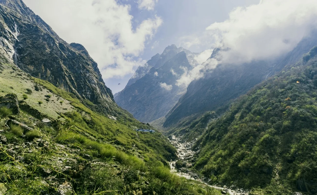
The natural environment makes Annapurna Base Camp beautiful through 5 sequential ecological zones that the trail traverses from subtropical forest to high-alpine tundra, producing a completely different landscape every 400 to 600 meters of altitude gain. No other trekking route in the Annapurna Conservation Area delivers this ecological range within a single itinerary.
What Makes the Rhododendron Forests Along the Annapurna Trail Beautiful?
Rhododendron forests along the Annapurna trail are beautiful because Nepal hosts 33 of the world's 1,025 known rhododendron species, and the ABC trail passes through concentrated stands of 6 of those species between 2,000 and 3,500 meters altitude. The Annapurna Conservation Area, covering 7,629 square kilometers, protects the largest rhododendron-forested trekking corridor in Asia.
Between Chhomrong (2,170 m) and Bamboo (2,310 m), the trail enters temperate broadleaf forest dominated by Rhododendron arboreum, the tree rhododendron that reaches 12 meters in height and produces dense crimson blooms. Between Himalaya Hotel (2,920 m) and Deurali (3,230 m), Rhododendron barbatum and Rhododendron campanulatum take over, producing pink and lavender flower clusters that arch over the trail.
During peak bloom from late February through mid-April, the combined canopy produces a tunnel effect, the overhanging branches and flowers reduce visible sky to narrow slits of blue, creating a visual intensity that surprises most trekkers who associate the route primarily with mountain views. This forest section is, for many trekkers, the single most photographed portion of the trail.
What competitors rarely mention: the rhododendron color sequence changes with altitude. At 2,000 meters, red dominates. At 2,800 meters, pink predominates. At 3,200 meters, white rhododendrons (Rhododendron arboreum var. cinnamomeum) appear. Trekking upward in spring produces a gradient of bloom across 3 distinct color temperatures within a single day of walking.
How Do Waterfalls and Mountain Streams Enhance the ABC Trek?
The Modi Khola river, the primary drainage channel of the Annapurna Sanctuary, and its tributaries generate more than 40 named waterfalls along the ABC trail, with the highest concentration between Bamboo (2,310 m) and Deurali (3,230 m). These waterfalls are not incidental features. They are structurally significant because the steep-walled gorge of the Modi Khola forces the trail to cross and recross the river on 6 suspension bridges between Chomrong and the sanctuary.
Three waterfalls stand out for their visual impact. The Jhinu Danda waterfall near the natural hot springs at 1,760 meters drops 35 meters into a pool directly beside the trail. The waterfall series above Bamboo drops across moss-covered black gneiss cliffs, creating curtains of white water against dark stone, a contrast intensified by the forest canopy overhead. The glacial meltwater streams above Deurali run milky white from suspended glacial flour, a color that signals the proximity of the sanctuary and creates a visual cue that the landscape is transitioning.
The sound environment these water features generate is equally significant. Trekkers working through the narrow gorge below Himalaya Hotel walk inside a constant acoustic cascade that masks wind and creates a meditative quality that many describe as the most psychologically distinct part of the trek.
How Do Glacial Landscapes Contribute to the Scenery?
Glacial landscapes contribute to the Annapurna Base Camp scenery through 3 visible features: the South Annapurna Glacier, terminal moraine ridgelines, and periglacial rock formations that cover the upper sanctuary floor.
The South Annapurna Glacier descends from Annapurna I's south face and terminates approximately 400 meters above the base camp. Its lower tongue, a mass of grey glacial ice punctuated by blue crevasses and boulder-scale seracs, is visible from camp with the naked eye. The glacier surface changes color across the day. At dawn, the ice face reflects pink and orange alpenglow. By midday, it shows grey-white under direct sun. At dusk, it transitions to deep violet shadow before the last light turns the upper ice fields amber.
Terminal moraines, ridges of glacially deposited rock, ring the sanctuary floor at 3,900 to 4,000 meters and give the base camp its characteristic boulder-dotted terrain. These moraine features are geologically active: new rock falls from the headwalls occur during afternoon warming, and the sound of these rockfalls is audible from the tea houses at base camp throughout the warmer months.
What Makes the Changing Landscapes Along the Annapurna Trail Special?
The Annapurna trail is special because it traverses 5 complete ecological zones in 6 to 7 days of ascent: subtropical forest (below 1,500 m), temperate broadleaf forest (1,500–2,500 m), upper temperate mixed forest (2,500–3,500 m), subalpine scrub (3,500–4,000 m), and high-alpine rock and ice (above 4,000 m). This vertical ecological compression, driven by the rapid altitude gain of the Modi Khola valley, means the visual landscape changes completely every 24 hours of walking.
What makes this transition functionally different from other high-altitude treks: the transitions are abrupt rather than gradual. The trail exits subtropical paddy terraces near Tolka (1,700 m) and enters dense rhododendron forest within 90 minutes of walking. It exits that forest and enters the glacially scoured sanctuary within another 3 days. These abrupt transitions amplify the perception of visual novelty and reduce the psychological monotony that affects longer, altitude-gradual approaches on other routes.
Why Are the Villages and Culture Part of Annapurna Base Camp's Beauty?
Villages and culture are part of Annapurna Base Camp's beauty because the route passes through 14 inhabited settlements between Nayapul and the sanctuary, each with distinct Gurung or Magar architectural styles, agricultural traditions, and Buddhist or animist ritual landscapes that transform the trek from a mountain walk into a living cultural transect.
How Do Traditional Gurung and Magar Villages Enhance the Trek?
Gurung and Magar villages enhance the ABC trek because both ethnic communities have inhabited the Annapurna foothills for more than 700 years, developing settlement patterns, agricultural terracing systems, and architectural styles calibrated to the terrain and altitude of their specific locations.
The Gurung people, numbering approximately 450,000 across Nepal, occupy the mid-altitude settlements between 1,500 and 2,500 meters, including the major trekking hubs of Ghandruk (1,940 m) and Chhomrong (2,170 m). Ghandruk is recognized as one of the 3 largest Gurung villages in Nepal and retains original slate-roofed stone architecture despite the presence of trekking infrastructure. The village sits on a ridge with unobstructed sightlines to Annapurna South and Hiunchuli, a setting that makes it the most photographed inhabited settlement on any Nepal trekking route.
Magar villages, including Landruk (1,565 m) and Tolka (1,700 m) on the approach trail, are characterized by white-plastered stone houses with painted geometric patterns on exterior walls, a decorative tradition that distinguishes Magar settlements visually from Gurung stone architecture. Trekkers who want to understand this heritage before setting out can explore the Magar villages of Nepal in more depth.
What Makes the Local Architecture Interesting to See?
Local architecture on the Annapurna trail is interesting because it demonstrates 3 altitude-specific building technologies developed independently by Gurung and Magar communities before any modern construction material reached the region.
Below 2,000 meters, traditional construction uses hand-cut sandstone blocks with clay mortar and thick walls (typically 50–70 cm) that provide thermal mass against monsoon humidity and winter cold. Roofs use locally quarried slate laid in overlapping courses without adhesive, a system that has survived earthquake loads exceeding 7.0 magnitude.
Between 2,000 and 3,000 meters, the dominant building material shifts to schist, a metamorphic rock that splits naturally into flat planes suitable for wall construction without cutting tools. Schist walls are identifiable by their silver-grey color and layered texture. Above 3,000 meters, construction uses a combination of stone and corrugated zinc sheeting, the zinc transported by porter over the same trail trekkers use, representing one of the most labor-intensive supply chains in Himalayan infrastructure.
Integrated into the settlement fabric throughout the route are mani walls, elongated stone structures engraved with Buddhist mantras (Om Mani Padme Hum), and chortens (stone stupas), which mark trail junctions, pass entrances, and village boundaries. Trekking protocol requires passing these structures to the left, keeping them on the right. This navigational tradition means that every significant landscape transition on the trail is physically marked by ritual architecture.
How Does Himalayan Culture Add to the Annapurna Experience?
Himalayan culture adds to the Annapurna experience through 3 observable cultural expressions: Buddhist ritual practice, agricultural landscape design, and the Gurung tradition of jhankri (shamanic healing), which remains active in village communities along the route.
Ghandruk hosts a Gurung Museum, established in 1994, that documents traditional dress, farming tools, musical instruments, and the history of Gurung military service in the British and Indian Gurkha regiments. Entry costs NPR 200 (approximately USD 1.50). The museum provides specific cultural context that transforms Ghandruk from a rest stop into a historically legible settlement.
Agricultural terracing, carved into 40-degree hillsides over centuries, creates the layered green geometry visible from every ridge viewpoint between Pokhara and the sanctuary entrance. These terraces are not decorative; they are functional rice and millet paddy systems irrigated by mountain streams diverted through stone-lined channels. In autumn, post-harvest terraces glow amber with cut grain stubble. In spring, they reflect the silver-blue of flooded paddy water. Both conditions produce landscape photography that rivals the mountain panoramas above.
When Is Annapurna Base Camp Most Beautiful?
Annapurna Base Camp is most beautiful during 2 primary trekking windows: spring (mid-March to mid-May) and autumn (mid-September to mid-November). Each season produces a completely different landscape character. Spring delivers rhododendron bloom and alpine wildflowers. Autumn delivers the clearest mountain visibility of the year.
How Does Spring Transform the Annapurna Base Camp Trail?
Spring transforms the Annapurna Base Camp trail through rhododendron bloom cycles that begin at 1,800 meters in late February and advance upward at approximately 100 meters per week, reaching maximum display at 3,000–3,500 meters by early April. This means the bloom season at any given altitude lasts 3 to 4 weeks, but the complete spring transformation of the trail spans 10 weeks across all elevations.
Beyond rhododendrons, spring activates 4 additional wildflower communities: primroses (Primula spp.) bloom in blue and yellow around glacial meltwater streams above 3,500 meters from April onward; Himalayan blue poppies (Meconopsis betonicifolia) appear on rocky slopes above 3,800 meters in May; cushion plants and alpine asters cover moraine surfaces in the sanctuary from late April; and wild strawberries (fruiting in June) line trail margins at 2,000–2,500 meters.
Spring also brings increased bird activity. The Annapurna Conservation Area supports over 518 bird species, 23 of which are raptors. From April, Himalayan griffon vultures (wingspan: 2.6 meters) ride thermal updrafts above the gorge, providing aerial scale references against the peak headwalls that convey the canyon depth more effectively than any map elevation profile.
What Makes Autumn Ideal for Mountain Views?
Autumn is ideal for mountain views because the post-monsoon atmosphere between mid-September and mid-November delivers the lowest particulate density of the year, producing visibility ranges that allow trekkers to identify individual rocky ridgelines on peaks 25 to 30 kilometers away.
The monsoon season (June–August) deposits atmospheric moisture that takes 4 to 6 weeks to dissipate after the rains end. By October, the atmosphere above 3,000 meters reaches its annual clarity peak. Mountain photography at Annapurna Base Camp in October records peak sharpness at distances where spring images show atmospheric haze. The difference is visible to the naked eye: in spring, peaks at 30 kilometers appear slightly gauzy; in October, the same peaks show individual rock features in crisp definition.
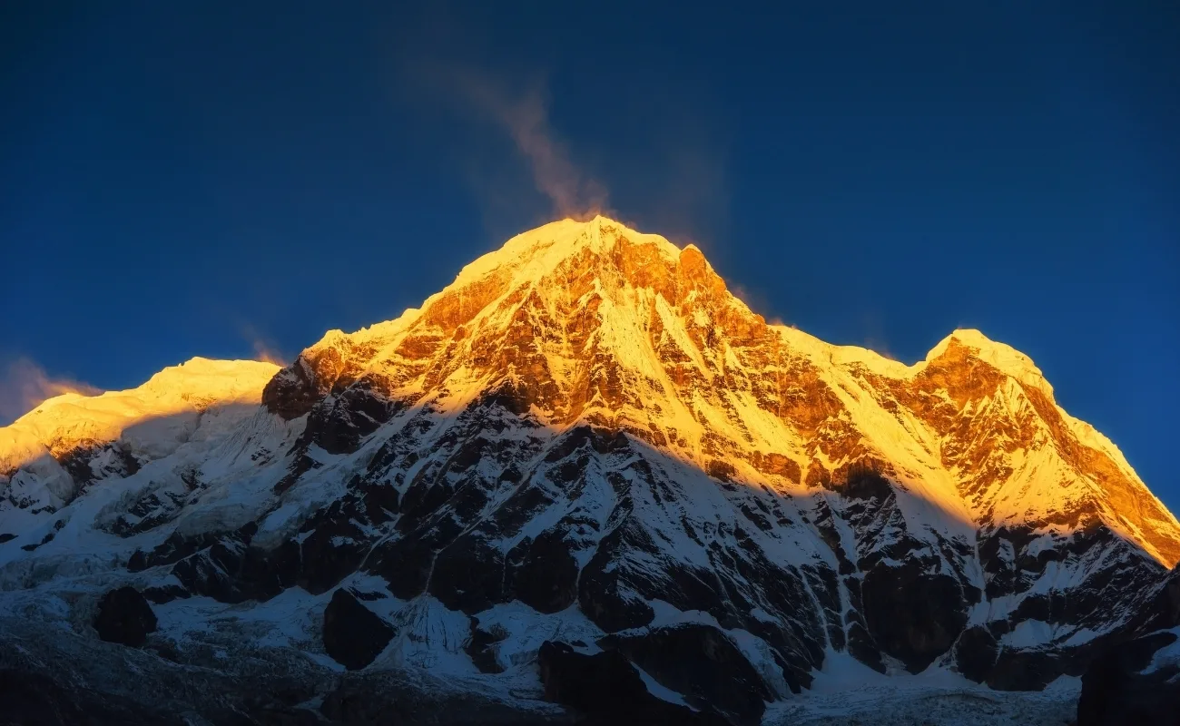
Autumn also produces the most reliable sunrise color sequences. Clear post-monsoon skies allow alpenglow, the pink and orange refraction of low-angle sunlight on snow and ice, to develop fully on the Annapurna headwall each morning for 15 to 25 minutes before direct sunlight reaches the summit faces. This is the photographic window that produces the images most associated with the camp's reputation.
How Does Winter Change the Appearance of Annapurna Base Camp?
Winter (December through February) changes the appearance of Annapurna Base Camp through total snow coverage above 2,500 meters, which eliminates the color variation of exposed rock and vegetation and replaces it with a high-contrast monochromatic landscape of white snow fields against blue-black sky.
Snowfall frequency increases to 8 to 12 precipitation events per month at base camp in January, with individual snowfalls accumulating 20 to 60 centimeters within 24 hours. Tea houses at Machapuchare Base Camp (3,700 m) and Annapurna Base Camp operate during winter but with reduced capacity, typically 3 to 5 of the 8 operating tea houses remain open. Trail conditions require crampons and gaiters above Deurali from December onward.
The visual payoff of winter trekking is significant: fewer than 3,000 trekkers complete the ABC route in December and January combined, compared to 15,000 to 20,000 during October and November. The sanctuary in winter is functionally unoccupied. Photographs taken in winter show undisturbed snow surfaces, absence of human figures in the landscape, and the complete visual silence of the high peaks without cloud formations. For trekkers who prioritize isolation over color, winter is the optimal season.
What Can You Expect From the Landscape During the Monsoon?
The monsoon landscape (June to August) delivers a dramatically different visual character: continuous low cloud cover below 2,500 meters, persistent mist in the rhododendron forests, fast-flowing brown glacial meltwater in the Modi Khola, and intensely green vegetation across all lower-altitude sections.
Mountain visibility from base camp during monsoon is limited, peak summits remain cloud-covered for 70 to 80% of daylight hours. However, the lower and mid-altitude sections of the trail produce specific visual conditions not available in other seasons. Waterfalls reach peak volume in July and August, with several normally seasonal falls becoming sustained cascades. The rhododendron and oak forests drip with moss and lichen growth that reaches its maximum extension in monsoon humidity. Terraced fields show saturated green from actively growing rice paddy, a color intensity not present in spring or autumn.
Most guides and experienced trekkers position the monsoon as a specialty season for botanical and forest photography rather than mountain photography. The Annapurna Conservation Area receives approximately 3,500–4,000 millimeters of annual rainfall, most of which falls between June and September. Leech activity is significant below 2,500 meters from June through August and requires trail footwear preparation.
What Are the Most Beautiful Experiences on the Annapurna Base Camp Trek?
The 4 most visually impactful experiences on the Annapurna Base Camp trek are the sanctuary entrance reveal, sunrise at base camp, the Machapuchare view from Machapuchare Base Camp, and the panoramic ridgeline view from Poon Hill, each delivering a distinct visual condition at a different point in the itinerary. For a full breakdown of these and other panoramas, see our guide to the best Annapurna range viewpoints.
Where Can You See the Best Mountain Views Along the Annapurna Trail?
The 5 most productive mountain viewpoints on the ABC trail, in order of visual impact, are:
-
Poon Hill (3,210 m): Provides the widest panorama of the Dhaulagiri and Annapurna ranges from a freestanding ridgeline viewpoint accessible via the Ghorepani route. The viewpoint covers 200 kilometers of Himalayan ridgeline from a single fixed position.
-
Chhomrong ridge (2,170 m): Delivers the first direct sightline to Annapurna South and Machapuchare from the main trail, giving trekkers their initial scale reference for the mountains ahead.
-
Himalaya Hotel viewpoint (2,920 m): A clearing above the tea house that frames Machapuchare's west face directly above the Modi Khola gorge, with foreground forest canopy providing depth framing.
-
Machapuchare Base Camp (3,700 m): The first position inside the sanctuary. The Machapuchare peak appears overhead at a viewing angle of approximately 70 degrees, the steepest visual angle to any high peak on the entire route.
-
Annapurna Base Camp (4,130 m): The complete 360-degree amphitheater view described above.
Why Is Sunrise at Annapurna Base Camp So Memorable?
Sunrise at Annapurna Base Camp is memorable because the 360-degree surrounding peaks produce simultaneous alpenglow on 8 to 10 visible summit faces over a 20-minute period, beginning with the east-facing walls of the Annapurna massif, such as Annapurna I and Annapurna South, at approximately 5:45 AM (October) and concluding when direct sunlight reaches the camp floor.
The sequence is architecturally predictable but never identical. Cloud formations at 5,500 to 6,000 meters scatter and redirect light differently each morning. The Gangapurna ice cliff, south-facing and exposed at 7,455 meters, sometimes receives alpenglow 3 to 4 minutes before neighboring Annapurna III due to its higher elevation. Hiunchuli's eastern profile catches light last because its lower elevation and orientation keep it temporarily shadowed by the surrounding massif.
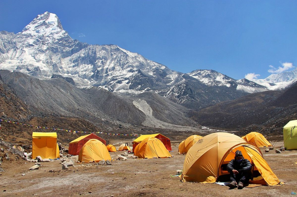
Most trekkers wake at 5:00 AM to reach the dedicated sunrise viewing area, a flat moraine platform 150 meters north-northwest of the main tea house cluster. Night temperatures at base camp in October range from -5°C to -12°C, requiring down insulation and wind protection. The physical discomfort of the predawn walk across frozen moraine is consistently cited by trekkers as the element that makes the subsequent sunrise more emotionally impactful.
How Does the Machapuchare View Enhance the Annapurna Base Camp Trek?
Machapuchare, the sacred Fishtail Mountain, enhances the Annapurna Base Camp trek because its distinctive twin-summit profile at 6,993 meters is visible from 14 separate identifiable viewpoints between Pokhara and the sanctuary, making it the visual thread that connects the entire route.
The peak is sacred to the Hindu god Shiva and has been closed to mountaineering since 1964, following a 1957 attempt by a British team that came within 50 meters of the summit before turning back voluntarily. No permits for a summit attempt have been issued since. This protected status means Machapuchare carries no summit flags, fixed ropes, or residual mountaineering infrastructure, it appears exactly as it did before trekking infrastructure reached the region. The aesthetic purity of an unclimbed peak is visually distinct from the crampon-polished routes visible on Everest or other frequently ascended Himalayan peaks.
From Machapuchare Base Camp (3,700 m), the peak rises 3,293 meters directly overhead, a vertical face-to-summit distance that creates the most vertiginous single-point mountain view accessible on a standard Nepal trekking itinerary.
What Makes the Annapurna Sanctuary Experience Unique?
The Annapurna Sanctuary experience is unique because entry to the sanctuary is controlled by a single geological bottleneck at Deurali (3,230 m), where the trail passes through a 200-meter-wide gap between two converging glacier tongues. This physical constraint means the sanctuary is one of the few high-altitude environments in the Himalayas where the transition from forested approach to open alpine basin is instantaneous rather than gradual.
Approximately 70,000 trekkers enter the sanctuary each year, but distribution is heavily skewed toward autumn (September–November: 35,000) and spring (March–May: 25,000). This concentration means that outside these windows, the sanctuary floor sees fewer than 100 trekkers per day, creating access to a 13-peak glacial amphitheater with minimal human presence.
The sanctuary also hosts brown bears, snow leopards, and Himalayan tahr within the conservation area boundary. Wildlife sightings are rare but documented, the sanctuary's position as a protected natural basin limits hunting pressure and maintains ungulate populations that support the predator food chain. Tahr (Himalayan wild goat) are the most commonly observed large mammal, visible on the rocky moraines above base camp in early morning.
How Can You Experience the Beauty of Annapurna Base Camp With Our Trekking Agency?
Our trekking agency designs Annapurna Base Camp itineraries that maximize each seasonal visual condition through route timing, acclimatization scheduling, and guide-led viewpoint access at the 5 highest-impact locations along the trail. We do not offer a single standard itinerary. We match the route structure to the specific season, group size, and visual priorities of each trekker.
For spring trekkers, we structure the ascent to reach the rhododendron-dense section between Chhomrong and Deurali during the peak bloom window for the specific departure date, a window we calculate from 10 years of on-trail phenology records. For autumn trekkers, we time the sanctuary arrival for a 2-night stay at base camp, allowing one guaranteed predawn sunrise position at the moraine viewpoint.
Our guides are Gurung-speaking Annapurna region specialists who grew up in the villages along the route. They provide cultural interpretation that transforms village transits from rest stops into structured encounters with Gurung agricultural practice, Buddhist ritual geography, and traditional architecture. This cultural layer, largely absent from self-guided or standard group itineraries, elevates the trek from a mountain walk to a complete landscape and cultural experience.
Can Our Trekking Agency Help You Experience Annapurna Base Camp Safely?
Our trekking agency provides full altitude safety support on the ABC route through 4 operational protocols: daily pulse oximetry monitoring above 3,000 meters, emergency descent planning with pre-identified weather windows, satellite communication devices carried by every lead guide, and TIMS and ACAP permit management that keeps trekkers within legal conservation area boundaries.
The most common safety issue on the ABC trek is altitude-related illness between Deurali (3,230 m) and base camp (4,130 m). This 900-meter gain covers roughly 10 kilometers of trail and is frequently underestimated. Our standard itinerary includes an acclimatization night at Machapuchare Base Camp (3,700 m) before the final push to 4,130 meters, a schedule that reduces acute mountain sickness incidence to below 5% among our trekking clients.
We handle all trekking permits, the Trekkers' Information Management System (TIMS) card and the Annapurna Conservation Area Permit (ACAP), directly. Current ACAP entry fees stand at NPR 3,000 (approximately USD 22) for international trekkers. Our team manages permit processing in Kathmandu or Pokhara before the trek begins.
What Are the Key Takeaways About What Makes Annapurna Base Camp Beautiful?
Annapurna Base Camp's beauty is the product of 6 converging geographic, ecological, cultural, and seasonal factors that no single other destination in Nepal replicates:
-
Mountain scale: A 360-degree glacial amphitheater ringed by 13 peaks above 6,000 meters, including Annapurna I at 8,091 meters, creates complete visual immersion at 4,130 meters altitude.
-
Ecological diversity: 5 distinct vegetation zones traversed in 6 to 7 days of ascent produce a constantly changing landscape, from subtropical forest to high-alpine rock and ice, showcasing a heavy concentration of Nepal's 33 native rhododendron species in bloom across a 10-week spring window.
-
Geological drama: A single-entry glacial cirque with a 200-meter entrance gap at Deurali creates an instantaneous landscape transition from forest to open basin, delivering one of the most impactful reveals in Himalayan trekking.
-
Cultural depth: 14 inhabited Gurung and Magar settlements between Nayapul and the sanctuary preserve 700-year-old architectural traditions, agricultural terracing systems, and Buddhist ritual landscapes that frame the mountain approach with human history.
-
Seasonal transformation: Spring rhododendron bloom, autumn atmospheric clarity, winter snow immersion, and monsoon botanical intensity each produce a landscape character distinct enough to merit separate trek plans for repeat visitors.
-
Machapuchare's unique status: One of Nepal's only major Himalayan peaks above 6,000 meters permanently closed to summit attempts, maintaining an aesthetic purity visible from 14 separate trail viewpoints across the full route.
The Annapurna Base Camp trek rewards trekkers who treat it as a complete landscape system rather than a destination. The beauty is not only at the camp, it accumulates across every ecological transition, cultural encounter, and elevation gain from the first morning in the Modi Khola valley to the predawn walk across frozen moraine at the sanctuary.
Plan your Annapurna Base Camp trek with a team that knows every one of those transitions. Contact our agency to build an itinerary calibrated to the specific season, pace, and visual priorities that match your goals.
More About Author

Khilak Budhathoki
Travel Director
Khilak Budhathoki is the co-founder and lead trekking guide at Himalaya Trekking Nepal, a locally owned and operated adventure company based in Kathmandu. Born and raised in the foothills of Nepal, Khilak developed a deep love for the mountains from an early age. With over a deca...
USD$1,400 pp
Our Recommendation