- 15, Jul 2026 | Khilak Budhathoki
Mount Everest is the highest mountain on Earth and the most prominent peak in the Himalayan mountain range, standing at an official elevation of 8,848.86 meters (29,031.7 feet) above sea level. Located on the international border between Nepal and the Tibet Autonomous Region of China, Everest is more than a single point on a map. Its position within the Mahalangur Himal subrange defines one of the world's most significant landscapes, where active tectonic forces, extreme altitude, diverse ecosystems, and centuries of Sherpa culture converge. Understanding where Mount Everest is located means exploring its exact geographic coordinates, surrounding mountain system, administrative regions, and the natural and political boundaries that shape access to the world's highest summit.
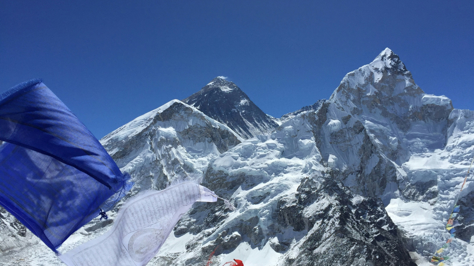 This guide provides a complete overview of Mount Everest's location from both global and regional perspectives. It explains the mountain's position within the Himalayas, the countries that share its summit, nearby landmarks such as Everest Base Camp, Namche Bazaar, and Sagarmatha National Park, as well as the routes used to reach Everest from Nepal and Tibet. You'll also learn how Everest's unique location influences its climate, biodiversity, mountaineering history, border significance, and the best seasons to visit, giving you a comprehensive understanding of why the world's tallest mountain is one of the most remarkable geographic landmarks on Earth.
Where Is Mount Everest Located on the World Map?
Mount Everest sits in South Asia, in the central Himalayan mountain chain, on the Nepal–China (Tibet) border. On a world map, it falls in the northern hemisphere at approximately 28°N latitude and 87°E longitude, roughly 135 kilometers northeast of Kathmandu, Nepal.
Placed on a continental scale, Mount Everest occupies the southern edge of the Tibetan Plateau, where the Indian subcontinent's tectonic plate collides with the Eurasian plate. This ongoing collision, which the U.S. Geological Survey measures at a relative convergence rate of 40–50 millimeters per year, not only continues to push Everest's elevation upward but also makes the Himalaya one of the most seismically active regions on Earth.
From a global perspective, Mount Everest is positioned between 2 major Asian gateway cities: Kathmandu, Nepal (approximately 135 km southwest) and Lhasa, Tibet (approximately 350 km northeast). Both cities serve as primary departure points for those planning a visit.
Which Countries Share Mount Everest?
2 countries share Mount Everest: Nepal and the People's Republic of China (Tibet Autonomous Region). The mountain straddles the international boundary that separates these two nations along the high Himalayan ridge.
Nepal administers the southern face, including the Khumbu Glacier, the Khumbu Icefall, and the South Col route, the most frequently used climbing corridor in the world. China administers the northern face through Tibet, which includes the Rongbuk Glacier, the North Col, and the Northeast Ridge route.
Both countries operate their own permit systems, base camps, and access regulations independently. Nepal issued a record 478 climbing permits in the 2023 spring season alone, while Tibet's permit numbers are significantly lower due to more restrictive access policies enforced by Chinese authorities.
What Are the Exact Coordinates of Mount Everest?
The exact coordinates of Mount Everest's summit are 27°59′17″N latitude and 86°55′31″E longitude, which in decimal degrees equals 27.9881°N, 86.9250°E.
These coordinates place the summit precisely on the Nepal–China border ridge, within the Mahalangur Himal subrange. The coordinates were established through a combination of traditional surveying and modern GPS measurements. The most recent and authoritative measurement was conducted jointly by the Survey of Nepal and China's National Surveying and Mapping Institute in 2020, confirming the official height of 8,848.86 meters (29,031.7 feet), 86 centimeters higher than the previously accepted measurement of 8,848 meters.
The 2020 remeasurement used GNSS (Global Navigation Satellite System) technology, gravimetric measurements, and trigonometric surveying from 11 ground stations across Nepal and Tibet, the most comprehensive elevation verification in the mountain's documented history.
Which Mountain Range Is Mount Everest Part Of?
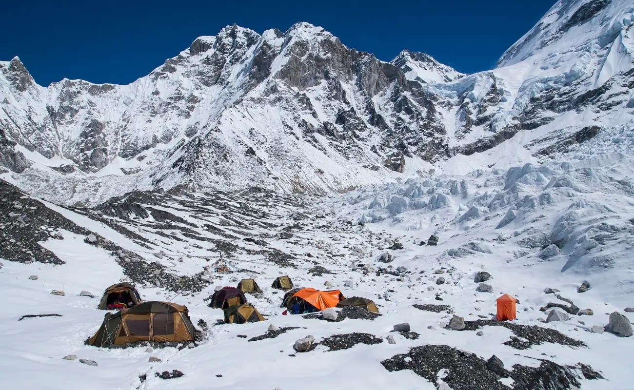 Mount Everest is part of the Himalayan mountain range, specifically within the Mahalangur Himal subrange. The Himalayas stretch approximately 2,400 kilometers across 6 countries, India, Nepal, Bhutan, China, Pakistan, and Afghanistan, forming the world's highest and most extensive mountain system.
What Is the Himalayan Mountain Range?
There are 14 peaks globally that exceed 8,000 meters (26,247 feet) in elevation. Ten of these are located in the Himalayan mountain range (including Everest, Kangchenjunga, Lhotse, and Makalu), while the remaining four, including K2 (8,611 m), are located in the adjacent Karakoram range.
The Himalayas formed approximately 50 million years ago when the Indian tectonic plate collided with the Eurasian plate following the closure of the ancient Tethys Sea. The resulting compression and uplift produced the highest mountain terrain on Earth, a process geologists confirm continues today.
Why Is the Mahalangur Himal Important?
The Mahalangur Himal subrange is home to 4 of the world's 14 eight-thousanders: Everest (8,848.86 m), Lhotse (8,516 m), Makalu (8,485 m), and Cho Oyu (8,188 m), the highest concentration of extreme-altitude peaks in any single subrange globally.
"Mahalangur" translates from Sanskrit as "Great Monkey," referencing Hindu and Buddhist mythological traditions tied to the Himalayan landscape. The subrange extends roughly 100 kilometers along the Nepal–Tibet border, forming a near-continuous wall of high-altitude terrain that defines the landscape of eastern Nepal's Khumbu region.
Where Is Mount Everest Located in Nepal?
Mount Everest is located in Nepal's Solukhumbu District, within the Koshi Province (Province No. 1), on the northern boundary of the country adjacent to Tibet. The mountain's southern face, base camp, and primary trekking routes all fall within Nepali territory.
Nepal refers to Mount Everest as "Sagarmatha" (सगरमाथा), a Nepali name meaning "Goddess of the Sky" or "Forehead of the Sky", coined in 1938 by historian Baburam Acharya. The mountain is a symbol of national identity, featured in the country's national emblem and central to Nepal's cultural heritage.
Which National Park Protects Mount Everest?
Sagarmatha National Park protects Mount Everest and the surrounding Khumbu region. Established in 1976 and designated a UNESCO World Heritage Site in 1979, the park covers 1,148 square kilometers (443 square miles) at elevations ranging from 2,845 meters to the summit of Everest at 8,848.86 meters. Nepal's Survey Department confirmed the 8,848.86-meter measurement using GNSS, gravimetric, and trigonometric survey data gathered from Nepali ground-control stations, jointly verified with a parallel Chinese survey team in 2020.
The park encompasses the entire upper Khumbu Valley and protects ecosystems ranging from sub-alpine forests of birch, rhododendron, and juniper at lower elevations to permanent snow and ice fields above 6,000 meters. It is home to 118 bird species including the Himalayan Monal (Nepal's national bird) and 28 mammal species including the Snow Leopard (Panthera uncia), Himalayan Tahr (Hemitragus jemlahicus), and Red Panda (Ailurus fulgens).
What most general overviews omit: the park also contains culturally significant religious sites including Tengboche Monastery (established in 1916 at 3,867 meters) and Pangboche Monastery, both integral to the Sherpa community's Buddhist heritage and standing for centuries within the park's boundaries.
Which District Is Mount Everest Located In?
Mount Everest is located in Solukhumbu District, one of the 77 administrative districts of Nepal, within the Koshi Province. The district covers 3,312 square kilometers and has a population of approximately 105,000 people, predominantly from the Sherpa, Rai, and Magar ethnic groups.
Solukhumbu District spans elevations from approximately 1,500 meters in its southern valleys to 8,848.86 meters at Everest's summit, an elevation range found in no other single administrative district on Earth. Nepal's 2021 census shows Solukhumbu is the least densely populated district in Koshi Province, at just 32 people per square kilometer, a reflection of how much of the district's land area sits above the elevation where permanent settlement is possible.
What Is the Nearest Town to Mount Everest?
Namche Bazaar is the nearest established town to Mount Everest, located approximately 40 kilometers south of the summit at an elevation of 3,440 meters (11,286 feet). It serves as the administrative headquarters of Solukhumbu District and the primary commercial hub of the Khumbu region.
Namche Bazaar is accessible via a 2-day trek from Lukla, the small mountain airport that receives most trekkers flying from Kathmandu (flight duration: approximately 30 minutes). The town provides trekkers with accommodation, gear shops, bakeries, internet connectivity, medical facilities, and altitude acclimatization resources before progressing toward Everest Base Camp.
Other significant nearby settlements include:
-
Gorak Shep (5,164 m): the last permanent (seasonal) settlement before Everest Base Camp, located 5 kilometers from Base Camp
-
Lobuche (4,940 m): a village on the Khumbu Glacier moraine, approximately 14 kilometers from Base Camp
-
Dingboche (4,410 m): a key acclimatization stop in the Imja Valley, approximately 27 kilometers from Base Camp
Where Is Mount Everest Located in Tibet?
On the Tibetan side, Mount Everest is located in Tingri County, within the Shigatse Prefecture of the Tibet Autonomous Region of China. Tibet refers to the mountain as "Chomolungma" (ཇོ་མོ་གླང་མ), a Tibetan name meaning "Goddess Mother of the World" or "Holy Mother", rooted in Tibetan Buddhist cosmology and recognized by China as the official name on its maps.
The Tibetan base camp lies in the Rongbuk Valley, one of the highest inhabited valleys in Tibet. Rongbuk Monastery, situated at 4,980 meters (16,340 feet) approximately 8 kilometers from North Base Camp, is the highest Buddhist monastery in the world and has served as a spiritual waypoint for climbers since the first British expeditions of the 1920s.
How Can You Reach Mount Everest from Tibet?
Travelers reach Mount Everest from Tibet via the Friendship Highway (G318), which connects Lhasa to the Nepal border at Zhangmu/Gyirong. From Lhasa, the drive to the Everest North Base Camp (Rongbuk Base Camp) covers approximately 700 kilometers and takes 2 to 3 days by 4WD vehicle, depending on road conditions and permit checkpoints. Travelers planning this route can consult our detailed Everest North Base Camp guide for permit requirements and costs.
Access from Tibet requires 3 mandatory permits:
-
Chinese Visa: obtained at a Chinese embassy before arrival
-
Tibet Travel Permit: issued by the Tibet Tourism Bureau in Lhasa
-
Aliens' Travel Permit for Shigatse and Tingri: issued at the Shigatse Public Security Bureau
Independent travel in Tibet is not permitted for most foreign nationals. All visitors must travel with a licensed Chinese tour operator and a government-approved Tibetan guide throughout their stay.
What Is the North Side of Mount Everest Like?
The north side of Mount Everest is characterized by open terrain, dramatic ridgelines, and a significantly drier climate compared to the Nepal side. The Rongbuk Glacier extends approximately 22 kilometers from the mountain's base and is one of the longest glaciers in Tibet.
The North Base Camp sits at 5,150 meters (16,900 feet), 214 meters lower than Nepal's South Base Camp at 5,364 meters. Despite easier vehicle access, the North Face route is technically more demanding than the South Col route, with fewer supplemental oxygen points and a more exposed summit ridge. Only experienced high-altitude climbers typically choose the northern approach.
Why Does Mount Everest Lie on the Nepal–China Border?
Mount Everest lies on the Nepal–China border because it occupies the high ridge of the Himalayan watershed, the natural boundary that separates the Tibetan Plateau (historically under Chinese administration) from the Nepali lowlands and hills to the south.
How Was the International Border Determined?
The international border along the Everest ridge was formally established through the Nepal–China Boundary Treaty signed on October 5, 1961. This treaty demarcated the entire 1,415-kilometer Nepal–China border following Nepal's recognition of Chinese sovereignty over Tibet in the 1950s.
Prior to 1961, the border at Everest's location existed as an informal demarcation with no precise legal definition. The 1961 treaty ended a period of diplomatic uncertainty that had developed after China's annexation of Tibet in 1950, which transformed Nepal's northern neighbor from an independent buffer state into a directly administered region of the People's Republic of China.
Which Country Has the Summit of Mount Everest?
The summit of Mount Everest is shared between Nepal and China. Under the 1961 Nepal–China Boundary Treaty, the international boundary line is drawn directly through the summit point. China administers the northern slopes, Nepal administers the southern slopes, and both nations share ownership of the single highest geographic point on the ridge.
This distinction has practical implications for mountaineering permits: climbers reaching the summit from the north (Tibet) require a Chinese permit issued through Tibet, while climbers from the south (Nepal) require a Nepali climbing permit. As of 2025, Nepal charges $15,000 USD per foreign climber per spring season for an Everest climbing permit, a rate that remains in effect for 2026 expeditions, generating significant annual revenue for the Nepali government. According to the Department of Tourism's official 2024 mountaineering report, Nepal has now recorded 8,285 successful Everest summits through the end of 2023, with the 2023 spring season alone accounting for 478 of the climbing permits issued that year.
How Can You Reach Mount Everest?
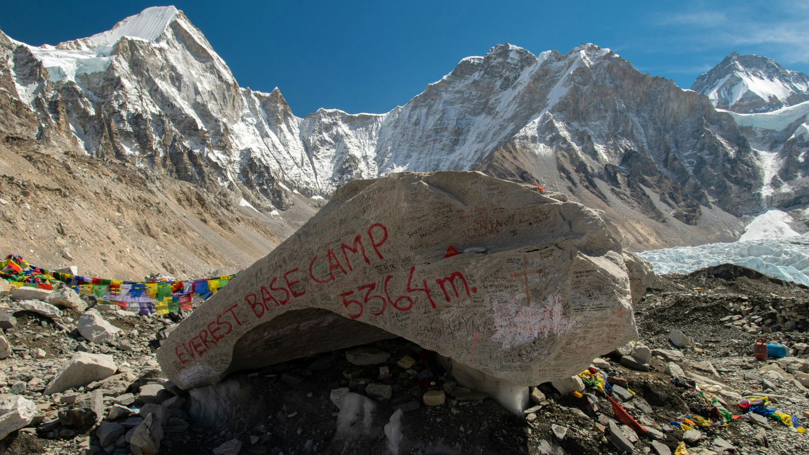 4 primary access methods connect travelers to Mount Everest: trekking from Nepal via Lukla, driving from Tibet via the Friendship Highway, helicopter travel from Kathmandu to higher Khumbu elevation points, and a combination approach using flight to Lukla followed by a trek.
What Is the Most Popular Route from Nepal?
The Everest Base Camp trek via the Lukla–Namche Bazaar corridor is the most popular route, followed by approximately 50,000 to 60,000 trekkers annually in recent seasons. The classic itinerary covers approximately 130 kilometers round trip over 12 to 16 days and passes through the villages of Phakding, Namche Bazaar, Tengboche, Dingboche, Lobuche, and Gorak Shep.
The typical elevation gain across the trek progresses as follows:
|
Location |
Elevation |
Approximate Day from Lukla |
|
Lukla |
2,860 m (9,383 ft) |
Day 1 |
|
Namche Bazaar |
3,440 m (11,286 ft) |
Day 3 |
|
Tengboche |
3,867 m (12,687 ft) |
Day 5 |
|
Dingboche |
4,410 m (14,468 ft) |
Day 7 |
|
Lobuche |
4,940 m (16,207 ft) |
Day 9 |
|
Gorak Shep |
5,164 m (16,942 ft) |
Day 10 |
|
Everest Base Camp |
5,364 m (17,598 ft) |
Day 11 |
The table above reflects standard acclimatization schedules. Rushing this timeline increases the risk of acute mountain sickness (AMS), high-altitude pulmonary edema (HAPE), and high-altitude cerebral edema (HACE), 3 altitude-related conditions that cause fatalities on the approach trek every season.
How Do Travelers Reach Everest Base Camp?
Travelers reach Everest Base Camp by trekking the Khumbu Valley trail from Lukla, the mountain airstrip accessed via a 30-minute flight from Kathmandu's Tribhuvan International Airport or a 7-to-10-day drive from Kathmandu via Salleri. The trail requires no technical climbing equipment, no ropes, harnesses, or crampon experience are needed. Physical fitness, acclimatization time, and mental endurance define the challenge. For a full breakdown of routes, permits, seasons, and costs, see our complete guide on how to reach Everest Base Camp.
What most standard guides overlook: the Everest Base Camp trek requires no prior mountaineering experience, but trekkers with cardiovascular conditions, anemia, or respiratory problems face elevated risk at altitudes above 4,000 meters. A pre-trek medical consultation with a physician familiar with high-altitude physiology is a practical requirement, not an optional precaution.
Can You Visit Mount Everest Without Climbing It?
Yes, the vast majority of Everest visitors never climb the mountain. Visitors experience Everest in 4 non-climbing ways:
-
Everest Base Camp trek: reaches 5,364 meters and offers direct views of the Khumbu Icefall and surrounding peaks
-
Kala Patthar viewpoint (5,644 m): a recognized short hike above Gorak Shep providing the most photographed view of Everest's summit from the Nepali side, see our Kala Patthar sunrise guide for timing, gear, and photography tips
-
Helicopter tours: depart Kathmandu and land at high-altitude points such as Kala Patthar or Everest Base Camp, completing the Everest experience in 4 to 5 hours
-
Scenic mountain flights: aerial view services from Kathmandu offer photographs of Everest and the Himalayan chain without landing
The Tibetan side offers a comparable non-climbing experience. Travelers drive to Rongbuk Base Camp at 5,150 meters and photograph the North Face, a perspective most trekkers from Nepal never access.
What Makes Mount Everest's Location Unique?
Mount Everest's location is unique because it occupies the intersection of 3 defining geographic systems: the highest tectonic collision zone on Earth, the primary weather barrier between the Indian monsoon and Central Asian climate systems, and the center of the world's most concentrated zone of extreme-altitude biodiversity.
How Does Its Location Affect the Climate?
Mount Everest's location at 28°N latitude and 8,848 meters elevation creates a climate governed by 2 dominant systems: the Southwest Indian Monsoon from June to September, and the dry, cold Central Asian winter airmass from November to March.
At summit elevation, year-round conditions include:
-
Average temperature: −36°C (−33°F)
-
Winter low temperatures: −60°C (−76°F)
-
Wind speeds: regularly exceeding 200 km/h (124 mph) due to the jet stream passing directly over the summit during winter months
-
Oxygen availability: approximately 33% of sea-level oxygen at the summit, a physiological threshold that makes unassisted breathing functionally impossible for most acclimatized humans beyond 60 to 90 minutes
The jet stream, a high-altitude westerly wind band at 8,000–12,000 meters, intersects with Everest's summit ridge from October through May, creating the primary weather window constraints that define climbing seasons.
Why Is the Region Rich in Biodiversity?
The Khumbu region surrounding Everest supports biodiversity across 5 distinct altitude zones, from lower-montane forest at 2,500 meters to the nival (permanent snow) zone above 5,500 meters. This elevation gradient, spanning over 6,300 meters vertically within a horizontal distance of roughly 30 kilometers, produces conditions equivalent to traveling from a temperate forest to the Arctic tundra within a single trek.
Species documented within Sagarmatha National Park include:
-
Snow Leopard (Panthera uncia): estimated 3 to 5 individuals within the park boundaries; critically elusive and rarely photographed by trekkers
-
Himalayan Black Bear (Ursus thibetanus): present in forested lower elevations below 3,500 meters
-
Himalayan Griffon (Gyps himalayensis): the largest bird in the Himalayan ecosystem, with a wingspan reaching 260 cm, observed soaring at elevations above 7,000 meters
-
Pika (Ochotona spp.): small lagomorphs found at elevations up to 5,500 meters, serving as primary prey for raptors and Snow Leopards at altitude
How Does High Altitude Influence Weather Conditions?
High altitude creates 4 primary weather effects at Everest's location: orographic precipitation, jet stream exposure, dramatic temperature inversion, and extreme solar radiation.
Orographic precipitation occurs when moisture-laden monsoon air from the Bay of Bengal rises against the Himalayan wall, cools, and deposits rainfall (and at altitude, snowfall) on the southern slopes. This produces Nepal's monsoon season (June–September), during which Everest's southern approach receives 80–90% of its annual precipitation and visibility drops to near zero for extended periods.
Temperature inversion at altitude means valley floors near Namche Bazaar can be 15°C warmer than ridgelines at equal horizontal distances, a practical difference that affects clothing decisions, route planning, and campsite selection throughout the trek.
What Are the Most Important Places Near Mount Everest?
5 key locations define the geographic and cultural landscape surrounding Mount Everest: Everest Base Camp, Namche Bazaar, Tengboche Monastery, the Khumbu Glacier, and Kala Patthar viewpoint. Each plays a distinct role in how travelers experience the mountain.
Where Is Everest Base Camp Located?
Everest Base Camp (Nepal side) is located at 5,364 meters (17,598 feet) elevation, at the foot of the Khumbu Icefall on the Khumbu Glacier's lateral moraine, within Sagarmatha National Park. Its coordinates are approximately 28°0′26″N, 86°51′32″E.
The base camp occupies a temporary settlement on glacial moraine and operates during 2 main climbing seasons: spring (April–May) and autumn (September–October). At peak spring season, the camp houses up to 1,000 people including climbers, Sherpa support teams, liaison officers, and media personnel across more than 30 expedition teams.
The Tibet side's North Base Camp sits at 5,150 meters (16,900 feet) in the Rongbuk Valley. It is accessible by vehicle via a dirt track from the Friendship Highway, a logistical advantage that makes supply delivery significantly easier than on the Nepal side, where all supplies above Lukla travel by porter or yak.
What Is the Khumbu Region?
The Khumbu region is a high-altitude valley system in Solukhumbu District, Nepal, extending from Lukla (2,860 m) northward to the base of Mount Everest (5,364 m). It encompasses the Khumbu, Imja, and Gokyo valleys and is the traditional homeland of the Sherpa people.
The Sherpa community, approximately 150,000 people globally, with around 3,500 to 4,000 residing in the Khumbu, are Tibetan-origin Buddhists who migrated to the Khumbu valley approximately 400 to 600 years ago. Sherpa expertise in high-altitude work, glacial navigation, and cold-weather endurance made the first successful summit of Everest possible. Tenzing Norgay Sherpa and Sir Edmund Hillary reached Everest's summit on May 29, 1953, the most significant date in the mountain's recorded human history.
Which Nearby Peaks Surround Mount Everest?
6 major peaks surround Mount Everest within a 50-kilometer radius, collectively defining one of the most concentrated zones of extreme altitude on Earth:
|
Peak |
Elevation |
Distance from Everest |
Country |
|
Lhotse |
8,516 m (27,940 ft) |
~3 km SE |
Nepal/China |
|
Makalu |
8,485 m (27,838 ft) |
~19 km SE |
Nepal/China |
|
Cho Oyu |
8,188 m (26,864 ft) |
~20 km W |
Nepal/China |
|
Nuptse |
7,861 m (25,791 ft) |
~3 km SW |
Nepal |
|
Pumori |
7,161 m (23,494 ft) |
~7 km NW |
Nepal/China |
|
Ama Dablam |
6,812 m (22,349 ft) |
~15 km S |
Nepal |
Ama Dablam (6,812 m), while not among the highest peaks, is recognized as one of the most visually dramatic mountains in the world. Its steep ridgelines and distinctive pendant shape, "dablam" in Tibetan refers to a container for holy relics, make it the most photographed peak in the Khumbu after Everest itself.
When Is the Best Time to Visit Mount Everest?
The best time to visit Mount Everest falls within 2 distinct seasonal windows: the spring season (mid-March to late May) and the autumn season (late September to late November). These 2 windows represent the periods when the jet stream lifts above the summit and precipitation is at its annual minimum, creating the most stable conditions for both trekking and climbing.
Which Seasons Offer the Best Views?
The spring and autumn seasons offer the clearest and most unobstructed views of Mount Everest. Pre-monsoon spring (April–May) delivers the warmest temperatures of the 2 windows, with daytime highs at base camp reaching −5°C to 2°C, compared to autumn's −10°C to −3°C range.
Spring is the primary climbing season: approximately 75% of all Everest summit attempts occur in May. The clearest summit views from trekking viewpoints like Kala Patthar typically occur in early to mid-May, when the weather windows are most predictable and atmospheric clarity is highest before monsoon moisture begins building.
Autumn (October–November) offers superior photographic light, fewer trekkers than spring, and freshly snow-dusted peaks from the recently ended monsoon. Many experienced trekkers prefer this window precisely because trail density is approximately 30–40% lower than during peak spring season.
How Does Weather Vary Throughout the Year?
Mount Everest's weather follows a 4-season cycle directly tied to the Indian monsoon and Tibetan high-pressure system:
-
Winter (December–February): The jet stream covers the summit with sustained winds above 150 km/h. Summit temperatures drop below −50°C. No commercial climbing activity occurs. Trekking is possible at lower elevations but becomes challenging above 4,500 m due to snow accumulation and extreme cold.
-
Spring (March–May): The jet stream intermittently lifts, creating climbing windows of 2 to 5 days. Temperatures rise progressively. This is the busiest and most favorable season for both trekking and summiting.
-
Monsoon (June–September): Heavy precipitation, dense cloud cover, and trail flooding make trekking significantly more difficult. High avalanche risk exists on the mountain. Visibility at Everest drops to near zero for days or weeks. A small number of adventurous trekkers visit in this period and experience the Khumbu's greenest landscapes.
-
Autumn (October–November): Post-monsoon clarity with stable high-pressure systems. Excellent visibility and lower temperatures than spring. The second most popular trekking and climbing window.
How Can You Experience Mount Everest with Our Trekking Agency?
Our trekking agency designs custom and group itineraries for the Everest Base Camp trek, Gokyo Lakes route, Cho La Pass crossing, and helicopter return options, tailoring each journey to trekkers' fitness levels, available time, and experience backgrounds.
Working with a specialist Nepal-based trekking company provides 5 practical advantages over independent planning:
-
Permit acquisition: The Khumbu Pasang Lhamu Rural Municipality permit (which replaced the TIMS card in this region), Sagarmatha National Park entry fees, and restricted area permits are processed before departure.
-
Acclimatization-optimized scheduling: itineraries are structured to reduce AMS risk using proven elevation gain guidelines (no more than 300–500 meters of sleeping elevation gain per day above 3,000 meters)
-
Experienced Sherpa guides: local knowledge of trail conditions, emergency evacuation protocols, and cultural customs that enrich the experience and improve safety
-
Logistics management: accommodation booking, porter coordination, meal planning, and gear checks handled by specialists
-
Emergency protocols: established relationships with Himalayan Rescue Association clinics at Pheriche and Kunde, helicopter evacuation services, and altitude sickness response procedures
What Are the Key Takeaways About Where Mount Everest Is Located?
Mount Everest's location is the convergence of geography, geology, politics, culture, and ecology at the highest point on Earth. The essential facts are clear:
-
Geographic location: Solukhumbu District, Nepal (south) and Tingri County, Tibet, China (north), on the border ridge of the Mahalangur Himal subrange of the Himalayan mountain range.
-
Exact coordinates: 27°59′17″N, 86°55′31″E, at an official elevation of 8,848.86 meters (29,031.7 feet) as established by the Nepal–China joint survey in 2020.
-
Political status: The mountain straddles 2 sovereign jurisdictions. The summit is shared between both nations under the 1961 Nepal–China Boundary Treaty. Both countries administer their own access, permits, and base camps independently.
-
Access: The southern Nepali approach via Lukla and the Everest Base Camp trek route is the most popular access method globally. The northern Tibetan approach via Lhasa and the Friendship Highway offers vehicle access to North Base Camp. Trekkers weighing their options can browse our full lineup of Everest region treks to compare itineraries and difficulty levels.
-
Best timing: Spring (mid-March to late May) and autumn (late September to late November) offer the most favorable conditions for trekking and viewing.
-
Nearest town: Namche Bazaar (3,440 m), approximately 40 kilometers south of the summit, is the primary commercial and administrative center of the Khumbu region.
-
Protected area: Sagarmatha National Park (1,148 sq km), designated a UNESCO World Heritage Site in 1979, protects the entire Nepali side including the base camp area, Khumbu Glacier, and surrounding peaks and valleys.
According to the Department of National Parks and Wildlife Conservation's State of Conservation report on Sagarmatha National Park, the park's core zone and buffer area protect one of the highest concentrations of rare high-altitude species in the Himalaya, including the snow leopard and red panda. Where Mount Everest is located has a precise geographic answer, but the deeper significance of its location encompasses two nations' identities, millennia of Sherpa cultural history, some of the world's most complex geopolitical boundary-making, and a natural environment found nowhere else on the planet. Understanding the location means understanding the full context in which the world's highest mountain exists, not just as a coordinate on a map, but as a place where geology, climate, culture, and human ambition converge at the top of the world. Ready to experience it firsthand? Explore our guided Everest Base Camp trek and start planning your journey to the foot of the world's highest mountain.
More About Author

Khilak Budhathoki
Travel Director
Khilak Budhathoki is the co-founder and lead trekking guide at Himalaya Trekking Nepal, a locally owned and operated adventure company based in Kathmandu. Born and raised in the foothills of Nepal, Khilak developed a deep love for the mountains from an early age. With over a deca...

USD$1,600 pp
Our Recommendation
Related Blogs

Oct 17, 2025
Manaslu Trek Permit Cost in Nepal: Fees & Rates

Jan 07, 2026
Budget for Annapurna Base Camp Trek: Full Guide 2026