- 17, Jul 2026 | Khilak Budhathoki
Nepal is home to the world's greatest collection of Himalayan trekking routes, offering everything from short scenic hikes to demanding high-altitude expeditions across the Everest, Annapurna, Langtang, Manaslu, Mustang, and Kanchenjunga regions. The country's diverse trail network passes through UNESCO World Heritage Sites, national parks, conservation areas, traditional mountain villages, alpine forests, glaciers, high mountain passes, and the base camps of some of the highest peaks on Earth. Whether you want to trek to Everest Base Camp, cross Thorong La Pass, explore the hidden valleys of Upper Mustang, or enjoy the sunrise from Poon Hill, Nepal offers trekking experiences for every fitness level, budget, and adventure goal.
.webp) Choosing the best trek in Nepal depends on more than the destination alone. Trek duration, maximum elevation, trail difficulty, acclimatization needs, permit requirements, seasonal weather, and the type of scenery or cultural experience you prefer all influence which route is the right fit. This complete guide compares the 10 best treks in Nepal for 2026, covering each trail's highlights, difficulty, itinerary, best trekking season, permits, and planning considerations, helping first-time visitors and experienced trekkers confidently select the Himalayan adventure that matches their time, experience, and travel objectives.
Choosing the best trek in Nepal depends on more than the destination alone. Trek duration, maximum elevation, trail difficulty, acclimatization needs, permit requirements, seasonal weather, and the type of scenery or cultural experience you prefer all influence which route is the right fit. This complete guide compares the 10 best treks in Nepal for 2026, covering each trail's highlights, difficulty, itinerary, best trekking season, permits, and planning considerations, helping first-time visitors and experienced trekkers confidently select the Himalayan adventure that matches their time, experience, and travel objectives.
1. Everest Base Camp Trek
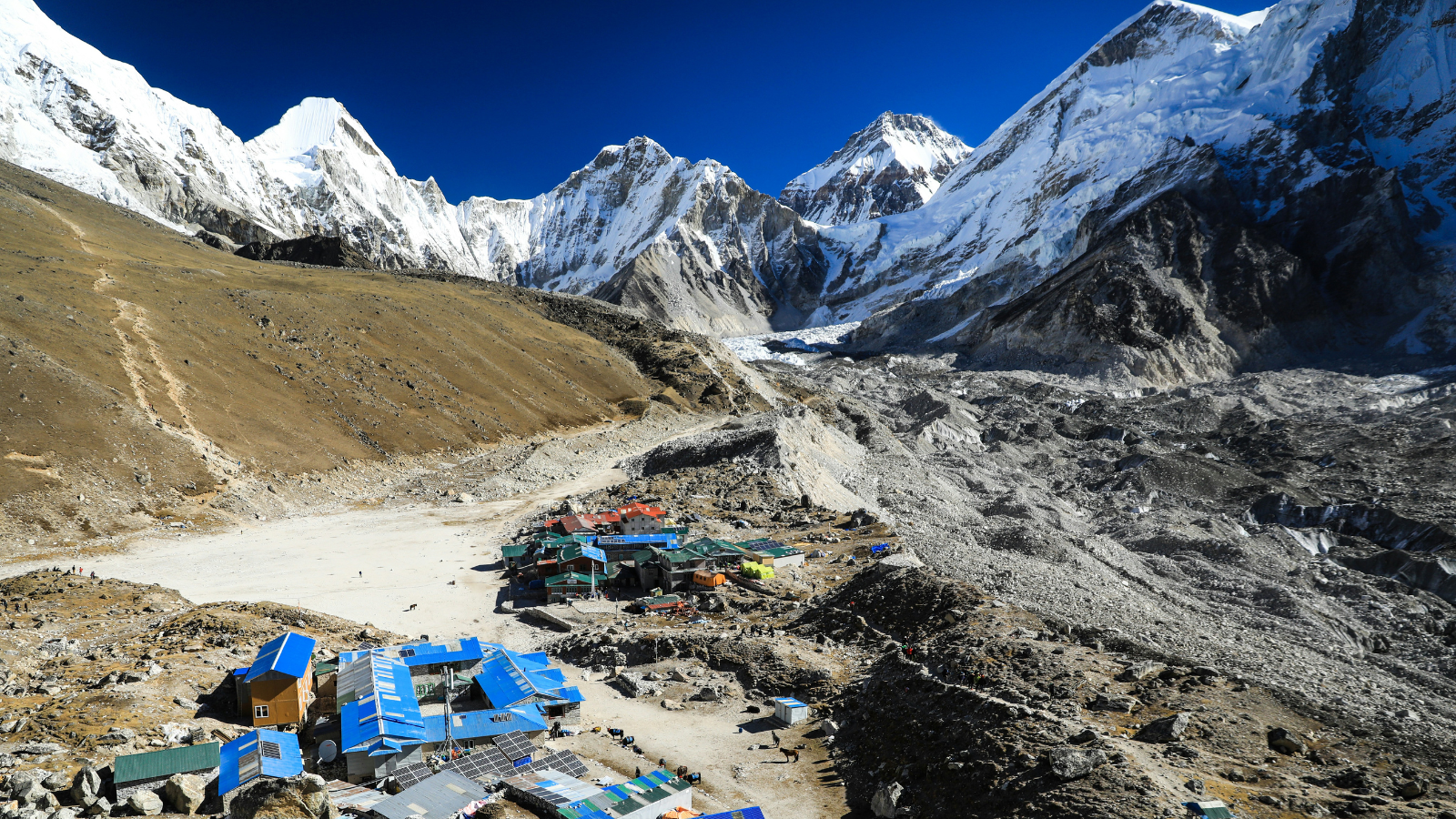 The Everest Base Camp Trek reaches the foot of the world's tallest mountain at 5,364 meters (17,598 ft) in the Khumbu region of northeastern Nepal. It is the single most recognized trekking route on Earth: Sagarmatha National Park recorded 52,499 foreign visitors in 2023 (Nepal Tourism Statistics 2023, Ministry of Culture, Tourism & Civil Aviation), and arrivals continue climbing as the region's post-pandemic recovery accelerates.
Why Is Everest Base Camp Trek So Popular?
The Everest Base Camp Trek is popular because it delivers a verified Himalayan high-altitude experience without requiring mountaineering skills. Trekkers walk through Sherpa villages, cross the Khumbu Glacier moraine, and stand at the same location where Everest expeditions establish their first staging point, all within a structured 12-to-14-day itinerary.
During peak trekking seasons (March–May, October–November), the trail begins with a 4-hour midnight drive from Kathmandu to Ramechhap (Manthali) Airport, followed by an 18-minute mountain flight to Lukla Airport (2,860 m). Off-season flights still occasionally run directly from Kathmandu. This aerial approach eliminates weeks of road travel and immediately immerses trekkers in the Sagarmatha National Park ecosystem, a UNESCO World Heritage Site established in 1976 spanning 1,148 km².
The cultural dimension separates this trek from purely alpine routes. The Sherpa community, Tibetan-origin inhabitants who settled the Khumbu valley around the 16th century, maintain 17 active gompas (Buddhist monasteries) along the trail, including the landmark Tengboche Monastery at 3,867 meters.
What Are the Major Highlights of the Route?
The route delivers 6 distinct experiential milestones, each offering different scenic and cultural value:
-
Namche Bazaar (3,440 m): The Sherpa capital and the trek's primary acclimatization hub, featuring the Sagarmatha National Park Museum and a weekly Saturday market
-
Tengboche Monastery (3,867 m): The largest gompa in the Khumbu, framing views of Ama Dablam (6,812 m), the most photographed peak in Nepal
-
Dingboche (4,410 m): A high-altitude farming settlement where trekkers experience the first significant altitude effects, with views of Lhotse's south face
-
Kala Patthar (5,545 m): The highest point on the standard itinerary, 181 meters above Base Camp, offering the clearest unobstructed view of Everest's summit pyramid
-
Everest Base Camp (5,364 m): The actual destination, a rocky glacier moraine littered with the colorful tents of Everest climbing expeditions between March and May
-
Khumbu Glacier: The world's highest glacier, descending from the Western Cwm of Everest at a rate of approximately 1 meter per day
How Difficult Is the Trek?
The Everest Base Camp Trek is rated moderate-to-strenuous, with altitude, not terrain, as the primary challenge. Trail grades remain largely manageable: 85% of the route follows stone-paved or compacted dirt paths with no technical climbing sections. The critical difficulty factor is sustained elevation gain above 3,500 meters, where oxygen levels drop to approximately 60% of sea-level concentrations.
Acute Mountain Sickness (AMS) is a serious risk on this route: a peer-reviewed study of trekkers ascending to 5,300 m recorded AMS in 73.5% of participants, with just over half experiencing moderate-to-severe symptoms (Physiological Reports, PubMed Central). The itinerary builds in 2 mandatory acclimatization days to reduce this risk. The itinerary builds in 2 mandatory acclimatization days, one at Namche Bazaar (3,440 m) and one at Dingboche (4,410 m), to reduce AMS risk. Trekkers ascending too quickly above 3,000 meters without acclimatization days face a 65% higher probability of requiring emergency evacuation.
Daily walking hours average 5–7 hours across 10–15 km per day, with a total round-trip distance of approximately 130 km.
When Is the Best Time to Trek?
The 2 optimal trekking seasons are pre-monsoon (March to May) and post-monsoon (October to November). Each offers distinct conditions:
-
October–November: Clearest skies, stable trail conditions, daytime temperatures at Base Camp between -5°C and 5°C. Peak season with highest trail traffic, Namche Bazaar teahouses fill by early afternoon.
-
March–May: Rhododendron forests bloom below 3,500 m. Climbing expeditions on Everest are active, making Base Camp more visually dramatic. Afternoon cloud build-up occurs more frequently than in autumn.
-
December–February: Cold but clear. Temperatures at Base Camp drop to -20°C at night. Trail sections above 4,500 m experience ice and snow. Only experienced winter trekkers attempt this season.
-
June–September: Monsoon season with heavy rainfall, leeches below 3,000 m, and reduced visibility. Not recommended.
How Many Days Does the Trek Take?
The standard Everest Base Camp itinerary requires 12 to 14 days from Lukla to Lukla, including 2 acclimatization days. A 12-day schedule suits physically fit trekkers with prior high-altitude experience. A 14-day itinerary is the safer choice for first-time Himalayan trekkers, adding a rest day at Lobuche (4,940 m) to reduce altitude stress.
Combining the Everest Base Camp route with Gokyo Lakes via the Cho La Pass (5,420 m) extends the trek to 18–21 days and adds a Grade 4 scrambling section requiring crampons in winter conditions.
2. Annapurna Circuit Trek
 The Annapurna Circuit Trek circumnavigates the Annapurna massif, a 55 km range featuring 7 peaks above 7,000 meters, through a 160-to-230 km loop in north-central Nepal's Gandaki Province. The trail crosses the Thorong La Pass at 5,416 meters (17,769 ft), one of the highest and most famous trekking pass crossings in the world passable without technical mountaineering equipment.
What Makes the Annapurna Circuit Unique?
The Annapurna Circuit is unique because it crosses 5 distinct climate zones in a single continuous route, from subtropical lowlands at 800 meters to alpine desert at 5,416 meters. No other established trek in Nepal delivers this degree of ecological and cultural transition within one itinerary.
The circuit enters the rain-shadow zone north of the Himalayas after crossing the Manang Valley, shifting abruptly from lush temperate forests to high-altitude Tibetan-plateau landscape. Mustang Zone, the northern portion of the circuit, receives less than 200 mm of annual rainfall, making it trekable even during the June–September monsoon season.
What Are the Main Attractions Along the Trail?
The circuit encompasses 7 primary attractions across 3 ecological zones:
-
Manang Village (3,500 m): The largest settlement on the high circuit, offering glacier views of Gangapurna (7,455 m) and a mandatory acclimatization day
-
Thorong La Pass (5,416 m): The crossing point between the Manang Valley and Mustang, completed between 5:00 AM and 10:00 AM before afternoon winds make conditions hazardous
-
Muktinath Temple (3,710 m): A sacred Hindu and Buddhist pilgrimage site with 108 water spouts and an eternal flame, visited by approximately 100,000 pilgrims annually
-
Marpha Village (2,670 m): The apple brandy capital of Nepal, a whitewashed stone-paved settlement producing 12 documented varieties of apple-based products
-
Tilicho Lake (4,919 m): One of the world's highest freshwater lakes, accessible via a 2-to-3-day side trip from Manang requiring an overnight stay at Tilicho Base Camp.
-
Poon Hill (3,210 m): The circuit's southern sunrise viewpoint, offering a 180-degree panorama across 14 named Himalayan peaks
-
Annapurna Conservation Area: A protected ecosystem spanning 7,629 km², the largest conservation area in Nepal and home to more than 100,000 residents (National Trust for Nature Conservation, Annual Report 2024)
How Challenging Is the Trek?
The Annapurna Circuit is rated moderate-to-strenuous, with the Thorong La Pass crossing classified as the single most physically demanding day on any standard Himalayan trek. The pass ascent involves a 1,700-meter elevation gain over 7 km in 4–5 hours, typically attempted in pre-dawn darkness to avoid afternoon weather windows closing.
Total daily walking varies between 4 and 8 hours. The lower sections of the circuit, particularly the Marsyangdi Valley between Besisahar (760 m) and Chame (2,710 m), are motorable by jeep, reducing the traditional loop by 3–4 days for trekkers who opt to skip them.
What Is the Best Season?
October and November form the prime Annapurna Circuit season, with October delivering the clearest post-monsoon skies and November offering colder but equally stable conditions. March and April are the second-best window, with rhododendron forests below 3,500 m in full bloom.
The circuit's northern rain-shadow section between Manang and Jomsom treks safely during the monsoon (June–September), though the lower sections in the Marsyangdi Valley become muddy and leech-infested.
How Long Is the Itinerary?
The complete Annapurna Circuit requires 15 to 21 days depending on the entry and exit points chosen. A 15-day itinerary starts at Besisahar by jeep and ends at Nayapul near Pokhara, covering the core circuit including Thorong La. A 21-day full itinerary includes the Tilicho Lake side trip, the Poon Hill extension, and the original walking stages from Besisahar.
3. Annapurna Base Camp Trek
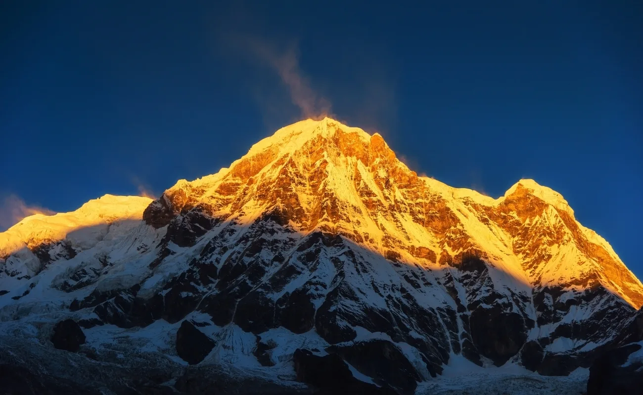 The Annapurna Base Camp trek reaches the inner sanctuary of the Annapurna massif at 4,130 meters (13,550 ft), surrounded by a horseshoe of 7 peaks above 6,000 meters including Annapurna I (8,091 m), the 10th highest mountain on Earth.
Why Should You Choose Annapurna Base Camp?
The Annapurna Base Camp Trek delivers 360-degree high Himalayan views at a moderate altitude, making it the best choice for trekkers seeking base camp immersion without the extended acclimatization demands of the Everest region. The sanctuary sits within a glacial cirque, a bowl-shaped valley formed by glacial erosion, where trekkers stand fully enclosed by the Annapurna range's southern walls.
The trail passes through Gurung and Magar ethnic communities, 2 indigenous groups whose settlement patterns in the Modi Khola valley date back over 600 years. Chhomrong Village (2,170 m), the gateway to the inner sanctuary, represents one of the best-preserved Gurung settlements in Nepal.
What Scenic Highlights Can You Expect?
The route delivers 5 distinct visual milestones between Pokhara and the sanctuary:
-
Ghorepani (2,860 m): A ridge-top village with rhododendron forests spanning 15 km and sunrise views over Dhaulagiri (8,167 m)
-
Poon Hill (3,210 m): A 45-minute predawn hike above Ghorepani, offering the clearest panoramic view of the Annapurna and Dhaulagiri ranges combined
-
Machapuchare Base Camp (3,700 m): The approach to the inner sanctuary, framing the iconic fishtail summit of Machapuchare (6,993 m), a peak never summited and permanently closed to climbing
-
Annapurna Base Camp (4,130 m): The inner sanctuary amphitheater, encircled by Annapurna South (7,219 m), Hiunchuli (6,441 m), Annapurna I (8,091 m), and Gangapurna (7,455 m)
-
Bamboo Forest Sections (below 2,500 m): Dense bamboo groves along the Modi Khola gorge, home to red pandas and the endangered Himalayan black bear
What Is the Difficulty Level?
The Annapurna Base Camp Trek is rated moderate, accessible to trekkers with basic fitness and no prior Himalayan experience. The maximum elevation of 4,130 meters stays below the threshold where severe AMS becomes a statistically significant risk for properly acclimatized trekkers. Daily walking averages 5–6 hours across 10–14 km.
The trail between Chhomrong and Deurali involves steep stone-step descents and re-ascents that generate more knee fatigue than altitude stress. Trekking poles reduce knee impact by an estimated 25% on these sections.
What Is the Ideal Trekking Season?
October through November and March through April are the 2 ideal seasons. October offers post-monsoon clarity with temperatures at Base Camp between 0°C and 8°C during the day. March and April introduce rhododendron bloom along the Ghorepani ridge, adding a secondary attraction to the approach route.
December and January are cold but clear, temperatures at Base Camp drop to -10°C at night, and trail snow above 3,000 m requires crampons. The monsoon season (June–September) is not recommended due to landslide risk along the Modi Khola gorge.
4. Manaslu Circuit Trek
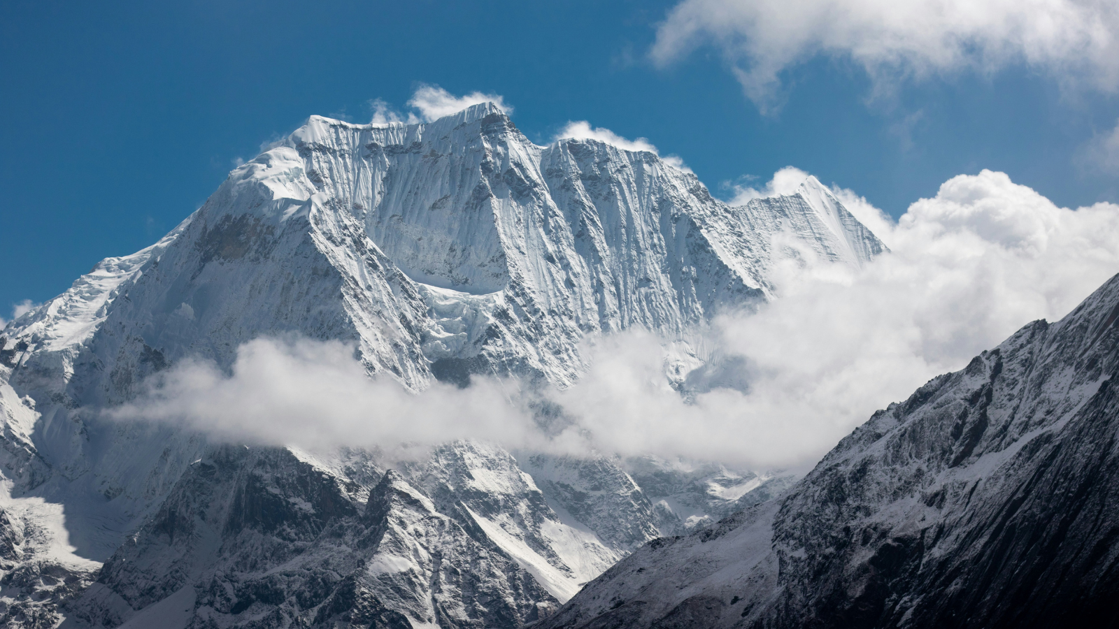 The Manaslu Circuit Trek encircles Mount Manaslu (8,163 m), the 8th highest mountain in the world, through a restricted trekking area in Gorkha District, 64 km northwest of Kathmandu by road. The circuit crosses the Larkya La Pass at 5,106 meters (16,752 ft), comparable in altitude to the Thorong La but with fewer trekkers.
Why Is the Manaslu Circuit Worth Trekking?
The Manaslu Circuit delivers an equivalent Himalayan circuit experience with far fewer trekkers: in 2023, Manaslu Conservation Area recorded 8,413 foreign visitors against 107,880 in the Annapurna Conservation Area, roughly 92% fewer (Nepal Tourism Statistics 2023, Ministry of Culture, Tourism & Civil Aviation). The restricted area permit system, which limits daily entry numbers, preserves trail conditions, teahouse quality, and cultural authenticity at levels the Annapurna Circuit's main season no longer maintains.
The circuit passes through 12 distinct ethnic settlements including Nubri and Tsum communities, Tibetan-origin groups who maintain pre-Buddhist Bon religious practices alongside Tibetan Buddhism. Tsum Valley, a side valley accessible from the main circuit, is home to 12 active chortens (Buddhist stupas) and 3 cliffside monasteries predating the 12th century.
What Makes This Restricted Area Special?
The Manaslu Conservation Area, spanning 1,663 km², is a restricted zone requiring special permits, which limits annual trekker numbers and maintains ecological integrity uncommon in open-access Himalayan regions. The area contains 33 documented mammal species including snow leopard, Himalayan wolf, red panda, and musk deer.
The trail offers direct glacier views of Manaslu's north face from Samagaun Village (3,530 m), a proximity to an 8,000-meter peak that most Himalayan treks cannot match. The Manaslu Glacier, 15 km long and Nepal's 5th largest glacier, descends directly toward the trail at Samagaon.
What Permits Are Required?
The Manaslu Circuit requires 3 separate permit documents, and understanding the full Manaslu permit costs in advance helps avoid budget surprises:
-
Manaslu Restricted Area Permit (RAP): USD 100 per person for the first 7 days (September–November), USD 75 per person for the first 7 days (December–August), plus USD 15 per day for additional days
-
Manaslu Conservation Area Permit (MCAP): NPR 3,000 (approximately USD 23) per person
-
Annapurna Conservation Area Permit (ACAP): NPR 3,000 (approximately USD 23) per person, required for the southern section connecting to the Annapurna region
-
All trekkers require a licensed guide; unguided (independent) trekking is strictly prohibited by law across all national parks, conservation zones, and restricted areas in Nepal.
What Is the Best Time to Visit?
March to May and September to November are the 2 prime windows. The Larkya La Pass is closed from December to February due to deep snowpack making the crossing dangerous. October delivers the clearest skies and most stable crossing conditions on the pass, with daytime temperatures at 5,000 meters between -5°C and 2°C.
5. Langtang Valley Trek
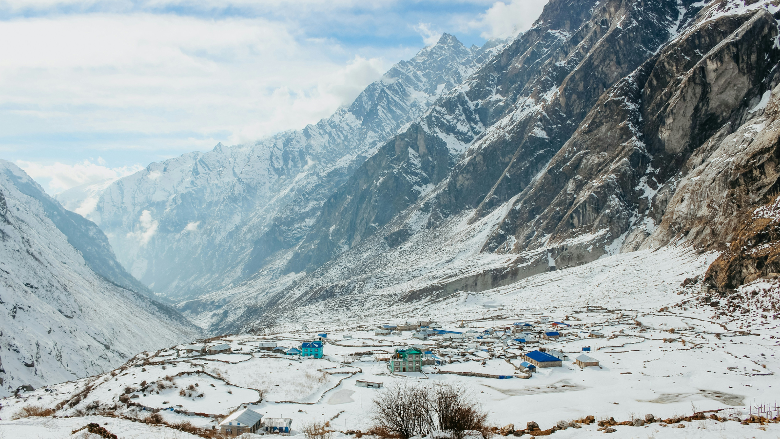 The Langtang Valley Trek enters the Langtang National Park, Nepal's first Himalayan national park, established in 1976, to reach the Kyanjin Gompa at 3,870 meters, just 70 km north of Kathmandu. This makes it the closest major Himalayan trek to Nepal's capital.
Why Is Langtang Valley Perfect for Nature Lovers?
The Langtang Valley Trek is ideal for nature-focused trekkers because the trail passes through 5 documented forest types, subtropical, temperate, subalpine, alpine, and nival, within a single 7-to-10-day itinerary. The valley contains the highest concentration of red panda habitat in Nepal, with 250 individually documented animals in the national park.
The 2015 Gorkha earthquake triggered a catastrophic rock-ice avalanche that destroyed Langtang Village; peer-reviewed reconstructions put the death toll at more than 350 residents and trekkers (Communications Earth & Environment, Nature Portfolio, 2024). The rebuilt community, now called New Langtang Village (3,430 m), demonstrates remarkable cultural resilience. The rebuilt community, now called New Langtang Village (3,430 m), demonstrates remarkable cultural resilience, with 68 teahouses and lodges reconstructed by 2023. Trekking here directly supports earthquake-affected communities.
What Are the Main Attractions?
Langtang Valley concentrates 5 primary attractions within a geographically compact 35 km trail:
-
Langtang National Park: A 1,710 km² protected area covering sub-alpine meadows, rhododendron forests, and glacial terrain
-
Kyanjin Gompa (3,870 m): An active monastery with 400-year origins, surrounded by yak pastures and the Kyanjin cheese factory producing Nepal's highest-altitude cheese
-
Tserko Ri (4,984 m): An optional day hike above Kyanjin offering panoramic views of Langtang Lirung (7,227 m), Ganesh Himal, and the Tibetan plateau
-
Langtang Glacier: A 20 km glacier descending from the peaks above Kyanjin, accessible by foot from the monastery
-
Gosainkunda Lakes (4,380 m): A sacred alpine lake cluster reachable via a 4,380-meter ridge crossing, sacred to Hindus and home to a major Janai Purnima festival each August
How Difficult Is the Trek?
The Langtang Valley Trek is rated easy-to-moderate, with the standard Kyanjin Gompa route accessible to trekkers with basic fitness. Daily walking averages 4–6 hours. The trail from Syabrubesi (1,550 m) to Kyanjin Gompa gains 2,320 meters over 5 days, a gradual profile that minimizes AMS risk.
The optional Tserko Ri climb (4,984 m) elevates the trek's difficulty to moderate-strenuous for the day, requiring an early 5:00 AM departure to summit before afternoon cloud cover. For a full budget breakdown, see our Langtang Valley trek cost guide.
When Should You Go?
October and November offer the clearest conditions with post-monsoon stability and temperatures at Kyanjin between 5°C and 15°C during the day. March and April bring spring bloom and lower trail traffic than autumn. The Gosainkunda route is best attempted in September–October when the high passes clear of monsoon snow.
6. Upper Mustang Trek
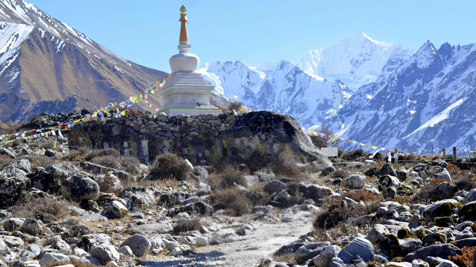 The Upper Mustang Trek traverses the former Kingdom of Lo, an independent Tibetan principality that maintained sovereignty until 2008, reaching the medieval walled city of Lo Manthang at 3,840 meters (12,598 ft) in the rain-shadow desert north of the Annapurna range.
What Makes Upper Mustang Different from Other Treks?
Upper Mustang differs from all other Nepal treks because the landscape is a high-altitude Tibetan desert plateau, receiving less than 250 mm of annual rainfall, making it the premier major Nepal trek designed entirely within a rain-shadow zone, allowing it to remain fully operational during the June–September monsoon season. The geological formations, eroded sandstone cliffs, red-and-white banded canyon walls, cave-riddled escarpments, exist nowhere else on the Nepal trekking circuit.
Nepali-controlled territory only since 1951, Lo Manthang preserves a living Tibetan cultural ecosystem that the Chinese Cultural Revolution eliminated across the border. The city's 4 major monasteries, Jampa Lhakhang, Thubchen Gompa, Choedhe Gompa, and the Royal Palace, contain pre-15th century murals restored through a joint US-Nepal conservation project completed in 2019.
What Cultural and Historical Sites Will You Visit?
Upper Mustang concentrates 6 UNESCO-level cultural assets in a geographically restricted 100 km corridor:
-
Lo Manthang Walled City: A 14th-century mud-brick fortress city with 4 active gompas and a resident population of 1,000 Loba people
-
Chungsi Cave Monastery: A cliff-carved meditation cave used continuously since the 11th century
-
Drakmar Cliffs: Red sandstone escarpments containing 10,000-year-old cave dwellings used by a pre-Tibetan Bronze Age civilization
-
Ghar Gompa: The oldest monastery in Mustang, founded in the 8th century CE, requiring a 2-day side trek from Lo Manthang
-
Sky Caves of Mustang: A network of 10,000 cave chambers carved 155 meters above the canyon floor, containing mummies, manuscripts, and artifacts dating to 1000 BCE
-
Muktinath Temple: The southern gateway sanctuary sacred to both Hindu and Buddhist traditions, marking the circuit exit
What Permits Are Needed?
Upper Mustang requires 2 specific restricted area permits beyond standard Nepal trekking documents:
-
Upper Mustang Restricted Area Permit: USD 50 per person per day
-
Annapurna Conservation Area Permit (ACAP): NPR 3,000 (approximately USD 23) per person
-
A licensed guide accompanies all trekkers by legal requirement; independent trekking above Kagbeni is prohibited
When Is the Best Time to Trek?
May through October is the optimal Upper Mustang trekking window, with the rain-shadow location making the route accessible even during July and August monsoon. The trail is blocked by snow from November to April on the northern passes approaching Lo Manthang. June and July offer mild temperatures (15°C–25°C) and complete absence of monsoon conditions in the desert plateau.
7. Gokyo Lakes Trek
The Gokyo Lakes Trek reaches the Gokyo Ri viewpoint at 5,357 meters (17,575 ft) in the Ngozumpa Glacier basin of the Khumbu region, passing 6 high-altitude glacial lakes, the highest freshwater lake system in the world, before the final ascent.
Why Should You Visit the Gokyo Lakes?
The Gokyo Lakes are 6 glacial lakes at elevations between 4,700 and 5,000 meters, formed by glacial moraine damming, and offer the most visually distinct alternative to the Everest Base Camp route in the Khumbu region. The turquoise color of Gokyo Lake (4,790 m), the largest of the 6, results from glacial sediment suspended in meltwater, producing a color intensity absent from standard mountain lakes.
The Ngozumpa Glacier, at 36 km, Nepal's longest glacier, descends between Gokyo and the western approach to Cho Oyu (8,188 m), the 6th highest mountain in the world. Trekkers walk alongside this glacier for 3 hours on the approach to the higher lakes.
How Does It Compare to Everest Base Camp?
The Gokyo Lakes Trek and Everest Base Camp Trek occupy the same Khumbu region but deliver fundamentally different experiences across 4 comparison points:
-
Summit views: Gokyo Ri (5,357 m) provides a clearer view of the Everest summit than Kala Patthar (5,545 m) because the angle eliminates the obscuring foreground ridgeline
-
Trail traffic: Gokyo sees approximately 40% fewer trekkers than the EBC route during peak season
-
Lake scenery: Gokyo adds glacier-lake landscapes absent from the EBC route
-
Difficulty: Both reach similar maximum elevations; Gokyo involves more lateral glacier moraine walking versus EBC's more sustained uphill trail sections
The Cho La Pass (5,420 m) connects both routes, allowing trekkers to complete a Gokyo–EBC combination trek in 18–21 days.
What Are the Route Highlights?
The Gokyo route shares the first 3 days with the EBC trail before diverging at Namche Bazaar, then delivers 4 unique highlights:
-
Dole (4,200 m): First high-altitude settlement on the Gokyo branch, with views of Cho Oyu's west face
-
Machermo (4,470 m): Site of a documented yeti encounter in 1974, the most credible account recorded by the Himalayan Mountaineering Institute
-
Gokyo Lake (4,790 m): The 3rd and most photographed of the 6 lakes, overlooked by the Gokyo teahouse cluster
-
Gokyo Ri (5,357 m): A 2-hour climb above the lake delivering a 4-peak panorama: Everest (8,849 m), Lhotse (8,516 m), Makalu (8,485 m), and Cho Oyu (8,188 m) in a single view
What Is the Best Season?
October and November are the prime Gokyo Lakes season, matching the EBC trekking window. March and April offer the second-best window with longer daylight hours extending summit views from Gokyo Ri. The Ngozumpa Glacier moraine walking becomes hazardous in wet conditions during monsoon months.
8. Mardi Himal Trek
The Mardi Himal Trek reaches the Mardi Himal High Camp at 4,500 meters (14,764 ft) on the eastern ridge of the Mardi Himal (5,587 m) in the Annapurna Conservation Area, following a trail officially opened to trekkers in 2012.
Why Is Mardi Himal a Hidden Gem?
The Mardi Himal Trek is classified as a hidden gem because it accesses a viewpoint within 5 km of Machapuchare's east face using a trail that sees 90% fewer trekkers than the Annapurna Base Camp route running parallel to the west. The trail remained unpublished in mainstream trekking guides until 2015, and teahouse infrastructure only reached High Camp by 2018.
The route climbs through undisturbed rhododendron forest above Pokhara's forested ridges, sections where the Annapurna range fills the entire northern horizon for 6 uninterrupted hours of walking. This sustained mountain panorama exposure is the defining characteristic separating Mardi Himal from shorter Pokhara viewpoint treks.
What Views Can You Expect?
Mardi Himal High Camp (4,500 m) delivers 3 panoramic view categories unavailable from lower viewpoints:
-
Machapuchare close-up: The east face of the fishtail peak at a distance of 4 km, closer than any other standard trekking viewpoint in Nepal
-
Annapurna South wall: The full 7,219-meter south face at distances where individual ice seracs, rock bands, and glacial features are distinguishable without binoculars
-
Pokhara Valley depth: The Phewa Lake basin and Pokhara city 4,500 meters below, creating the greatest single-point elevation-to-inhabited-valley visual contrast on any Nepal day hike
Is It Suitable for Beginners?
Our full breakdown of Mardi Himal trek difficulty confirms it's suitable for beginners in terms of altitude, maximum elevation of 4,500 meters falls within manageable range with standard acclimatization, but the 6-to-8-hour daily walking sections and steep ridge gradients require good cardiovascular baseline fitness. Trekkers with zero prior trekking experience who complete 4 weeks of uphill walking training complete the route without incident.
The trail has no technical sections, no glacial crossings, and no pass traversals. Teahouses with basic accommodation operate at Forest Camp (2,600 m), Low Camp (3,300 m), and High Camp (4,500 m), providing fixed overnight staging without tent camping.
How Many Days Does It Take?
The complete Mardi Himal Trek takes 5 to 7 days from Pokhara to Pokhara. A standard 5-day itinerary covers: Day 1 Pokhara to Dhampus (1,650 m), Day 2 Dhampus to Forest Camp (2,600 m), Day 3 Forest Camp to High Camp (4,500 m), Day 4 High Camp to Low Camp with Mardi Base Camp side visit, Day 5 descent to Siding and return to Pokhara.
A 7-day itinerary adds 2 acclimatization buffer days at Forest Camp and Low Camp, recommended for first-time high-altitude trekkers.
9. Kanchenjunga Base Camp Trek
The Kanchenjunga Base Camp Trek reaches either the North Base Camp at 5,143 meters (16,873 ft) or the South Base Camp at 4,560 meters (14,961 ft) on Mount Kanchenjunga, at 8,586 meters, the 3rd highest mountain in the world, in the remote Taplejung District of far-eastern Nepal, 620 km from Kathmandu.
Why Choose the Kanchenjunga Region?
The Kanchenjunga region delivers the most remote and ecologically pristine trekking environment in Nepal, with annual trekker numbers below 1,500, the lowest of any major Nepal base camp route. This remoteness preserves trail conditions, wildlife encounters, and cultural authenticity that high-traffic regions lost between 2005 and 2015.
The Kanchenjunga Conservation Area spans 2,035 km², encompassing the largest protected rhododendron forest in eastern Nepal (covering 1,200 km² of the total area) and confirmed populations of snow leopard, clouded leopard, red panda, and the endangered Bengal florican.
What Makes This Trek Unique?
The Kanchenjunga Circuit, connecting both North and South Base Camps via the Mirgin La Pass (4,663 m), is the only Nepal trek that approaches an 8,000-meter peak from 2 opposing base camps within a single itinerary. The north base camp presents Kanchenjunga's glaciated north face; the south base camp reveals the Yalung Glacier, the mountain's largest glacier at 18 km in length.
The ethnic communities of Limbu and Rai peoples in the lower valleys (below 2,500 m) maintain cultural practices including the Mundhum oral scripture tradition, a pre-Hindu animist belief system designated by UNESCO as Intangible Cultural Heritage in 2023. These communities exist outside the tourist circuit found in the Everest and Annapurna regions.
How Difficult Is the Journey?
The Kanchenjunga Base Camp Trek is rated as an expert-level tier trail, officially classified as the most physically demanding of the 10 best Nepal treks due to its remote location, multi-day high-altitude exposure, and minimal rescue infrastructure. Daily walking averages 6–8 hours. The combined North and South circuit covers approximately 260 km.
Emergency evacuation from above 4,000 meters requires helicopter response from Kathmandu, a minimum 2-hour flight time. The remoteness means trekkers carry extra food reserves for 3 days beyond the standard itinerary as a standard safety protocol.
What Permits Are Required?
Kanchenjunga requires 3 permit documents:
-
Kanchenjunga Restricted Area Permit (RAP): USD 20 per person for the first week, and USD 10 per person for each additional week.
-
Kanchenjunga Conservation Area Permit (KCAP): NPR 3,000 (approximately USD 23) per person
-
TIMS Card (Trekkers' Information Management System): NPR 2,000 (approximately USD 15) per person
-
A licensed guide is legally required; however, as of the March 2026 policy update, the minimum group size of 2 trekkers has been lifted, allowing single trekkers to enter restricted areas with their guide.
10. Ghorepani Poon Hill Trek
The Ghorepani Poon Hill trek ascends to Poon Hill at 3,210 meters (10,531 ft), Nepal's most famous sunrise viewpoint, through the Annapurna Conservation Area, completing a 4-to-5-day loop accessible from Pokhara.
Why Is Poon Hill Famous for Sunrise?
Poon Hill's sunrise delivers a 180-degree panoramic view of 14 named Himalayan peaks including Dhaulagiri (8,167 m), Annapurna I (8,091 m), Annapurna South (7,219 m), and Machapuchare (6,993 m), the highest peak-count panorama accessible from a single viewpoint below 3,500 meters in Nepal. The east-facing ridge orientation perfectly captures the alpenglow phenomenon 20–30 minutes before sunrise, turning Dhaulagiri's summit a documented amber-to-rose gradient.
The viewpoint has operated a summit observation tower since 2008, with a NPR 50 entry fee that contributes directly to Ghorepani Village Community Fund infrastructure maintenance.
Who Is This Trek Best Suited For?
The Poon Hill Trek is best suited for 3 trekker profiles: first-time Himalayan trekkers testing altitude tolerance before longer expeditions, families with children aged 10 and above seeking a structured mountain experience, and experienced trekkers with limited time requiring a 4-to-5-day high-quality Nepal trail.
The maximum elevation of 3,210 meters keeps AMS risk statistically low, fewer than 5% of trekkers report significant symptoms at this altitude with standard acclimatization. No technical skills, climbing equipment, or prior mountain experience are required.
What Can You See Along the Route?
The route between Nayapul and Ghorepani encompasses 4 ecological and cultural highlights:
-
Birethanti (1,025 m): A riverside bazaar settlement at the Bhurungdi Khola confluence, the standard trail entry point after a 1.5-hour drive from Pokhara
-
Ulleri Stone Steps: A 3,000-step stone staircase ascending 800 vertical meters in 2 hours, the steepest section of any standard Nepal trek below 4,000 meters, and a memorable physical benchmark
-
Ghorepani Village (2,860 m): A ridge-top teahouse settlement in the world's largest rhododendron forest by altitude-contiguous area, with 25 documented rhododendron species flowering March–April
-
Tadapani (2,590 m): An alternative route extension connecting to Chhomrong and the Annapurna Base Camp trail for trekkers extending their itinerary
When Is the Best Time to Visit?
March and April are the single best months for Poon Hill, combining clear sunrise visibility with peak rhododendron bloom across 15 km of trail between Hille and Ghorepani. October and November offer equally clear sunrise conditions with bare-branch forest views extending further visibility along the ridgeline. December to February is cold (overnight temperatures at Ghorepani drop to -10°C) but delivers crisp cloud-free mornings at a higher frequency than any other season.
How Should You Plan Your Trek with Our Trekking Agency?
Planning the right Himalayan trek requires matching 4 variables simultaneously: your physical fitness level, available trekking days, desired elevation range, and permit requirements. A poor match, choosing the 20-day Kanchenjunga circuit with 10 available days, for example, results in incomplete itineraries or altitude emergencies from rushing.
Can Our Trekking Agency Help You Choose the Best Trek?
Our Trekking Agency specializes in customized itinerary planning across our full range of Nepal treks, with licensed guides registered with the Nepal Tourism Board and 15 years of regional trail expertise. The team designs permit packages, teahouse bookings, contingency itineraries for weather delays, and helicopter rescue insurance registration as a single coordinated service.
For trekkers uncertain which route matches their profile, our trekking agency provides a pre-departure fitness and experience assessment, mapping each trekker's answers to one of 4 difficulty tiers: introductory (Poon Hill, Mardi Himal), moderate (ABC, Langtang), strenuous (EBC, Annapurna Circuit, Gokyo), and expert (Manaslu, Upper Mustang, Kanchenjunga).
Contact our trekking agency to confirm permit availability, check seasonal trail conditions, and build a day-by-day itinerary tailored to your schedule before booking flights to Kathmandu.
What Are the Key Takeaways About the 10 Best Treks in Nepal?
Nepal's 10 best treks span elevations from 3,210 meters (Poon Hill) to 5,545 meters (Kala Patthar on the EBC route), cover 4-day introductory loops to 24-day remote expeditions, and cross 3 distinct permit zones: open-access Annapurna Conservation Area, restricted Manaslu and Upper Mustang corridors, and the protected Kanchenjunga and Sagarmatha national park systems.
The 5 most important planning decisions for any Nepal trek are:
-
Season timing: October–November and March–May for most routes; May–October exclusively for Upper Mustang
-
Permit preparation: 7–10 working days minimum for restricted area permits; obtain through registered Nepal Tourism Board agencies only
-
Acclimatization discipline: Follow the "climb high, sleep low" protocol above 3,000 meters and add rest days before rushing itineraries
-
Guide and porter decisions: Licensed guides are legally required across all national parks, conservation areas, and restricted routes in Nepal, drastically reducing emergency incidents on high-altitude trails.
-
Insurance coverage: High-altitude helicopter rescue insurance (covering evacuation above 5,000 m) is a non-optional safety expense for treks above 4,500 meters
Nepal's trekking trails offer the highest accessible Himalayan terrain on Earth. Selecting the right route, matched to your fitness, time, and altitude tolerance, transforms the experience from an endurance challenge into the defining adventure of a lifetime
More About Author

Khilak Budhathoki
Travel Director
Khilak Budhathoki is the co-founder and lead trekking guide at Himalaya Trekking Nepal, a locally owned and operated adventure company based in Kathmandu. Born and raised in the foothills of Nepal, Khilak developed a deep love for the mountains from an early age. With over a deca...

USD$1290 pp
Our Recommendation
Related Blogs
Feb 08, 2026
Pokhara 2026: Top Attractions & Adventure Tips

