- 25, Jan 2026 | Khilak Budhathoki
Annapurna I is not just the tenth-highest mountain in the world; for us in Nepal, she is a living goddess, a provider of food, water, and life. When trekkers look up at her massive white face from the trails of the Annapurna region, they feel both wonder and respect.
Annapurna I stand taller than most mountains on Earth, yet it often hides behind clouds and storms. Among all the eight-thousanders, Annapurna I is known not for popularity but for respect, caution, and raw power.
In this blog, discover the essence of Annapurna I, including its location, geography, climbing history, and why it is considered one of the toughest Himalayan peaks, based on insights from our local guides at Himalaya Trekking Nepal.
What Is Annapurna I?

Annapurna I is the tenth-highest mountain in the world, standing at 8,091 meters (26,545 feet), located in the Annapurna Massif of Nepal within the Annapurna Conservation Area. It is famous for being the first 8,000-meter peak ever climbed and for having one of the highest fatality rates among the Himalayan mountains.
Annapurna I Overview
|
Detail |
Information |
|
Peak Name |
Annapurna I |
|
Peak ID |
ANN1 |
|
Height |
8,091 m / 26,545 ft |
|
Global Rank |
10th highest mountain |
|
Latitude / Longitude |
28°35′44″ N / 83°49′21″ E |
|
Location |
Myagdi & Kaski Districts, Gandaki Province |
|
Status |
Opened for climbing |
|
Conservation Area |
Annapurna Conservation Area (ACAP) |
Meaning of the Name “Annapurna” (Cultural Importance)
The name 'Annapurna' comes from ancient Sanskrit, deeply rooted in Hindu belief:
-
Anna = food
-
Purna = full or complete
Together, Annapurna means “The Goddess of Food and Nourishment. ”
In Nepal, we write her name as (Annapurna). Local people believe the snow and glaciers of Annapurna I melt into rivers that irrigate farms, grow rice, and sustain life in the hills and plains.
That is why climbers say, “You don’t conquer Annapurna. You receive permission.”
Where Is Annapurna I Located?
Annapurna I is located in central Nepal, inside the Gandaki Province, and fully protected by the Annapurna Conservation Area (ACAP).
Geographical Neighbors
-
South: Pokhara Valley, the main gateway for Annapurna treks
-
West: Kali Gandaki Gorge, the deepest gorge in the world
-
North & East: Marshyangdi River valley (Annapurna Circuit route)
-
Far North: Tibetan Plateau (China border region)
This unique positioning between two powerful rivers makes Annapurna I one of the most dramatic landscapes in the Himalayas.
Want to know where you can get the best view of the entire Annapurna range? Check out this blog.
The Annapurna Massif: A Family of Giants
Annapurna I is the highest peak of the Annapurna Massif, a massive Himalayan system stretching over 55 kilometres.
Other major peaks in the massif include
-
Annapurna South
-
Annapurna II
-
Annapurna III
-
Gangapurna
-
Machapuchare (Fishtail Mountain): sacred and unclimbed
Nearby notable peaks:
-
Dhaulagiri (8,167 m): separated by the Kali Gandaki Gorge
-
Varaha Shikhar
-
Singu Chuli
This concentration of giant mountains is why the region is considered one of the most spectacular trekking areas in Nepal.
Geography, Geology, and Natural Life of Annapurna I
Before discussing climbing routes or summit stories, I want to share a saying that we guides often repeat on the trail: “If you don’t understand the land, the mountain will never make sense.”
To truly understand Annapurna I (8,091 m), you must look below the snow and ice. This mountain is not only tall: it is young, restless, and still moving.
Annapurna I: A Giant Standing Between Two Powerful Rivers
Annapurna I rises at the heart of the Annapurna Massif, a massive Himalayan ridge stretching for 55 kilometers across the Annapurna region.
What makes Annapurna I unique and dangerous is where it stands.
To the West: The Kali Gandaki Gorge
On the western side flows the Kali Gandaki River, carving the land deeper than anywhere else on Earth.
-
The Kali Gandaki Gorge is the deepest in the world
-
It separates Annapurna I from Dhaulagiri (8,167 m).
-
The elevation drops from over 8,000m to below 3,000 m.
From real guiding experience, this gorge creates powerful winds, pulls storms into the massif, and makes the snowpack unstable.
This is one reason avalanches are so common on Annapurna I: the terrain is constantly under stress.
Explore the most beautiful treks in Nepal through our blog: start reading now.
To the North and East: The Marshyangdi River Valley
On the other side, the Marshyangdi River shapes the landscape used by the famous Annapurna Circuit.
For trekkers and climbers, this valley:
-
Forms natural trekking corridors
-
Carries glacial meltwater from the Annapurna range
-
Influences route access and weather patterns
When you walk the Annapurna Circuit, you’re literally walking along the geological spine of the massif.
To the South: The Annapurna Sanctuary
To the south lies the beautiful and deceptive Annapurna Sanctuary.
Inside this high-altitude basin are:
-
Machhapuchhre Base Camp
From experience, this sanctuary traps snowfall, holds cold air, and builds heavy snow layers. It looks peaceful, but climbers know this bowl-shaped geography increases avalanche accumulation, especially after storms.
See the experiences of our travelers: read reviews about Himalaya Trekking Nepal.
The Geology of Annapurna I: Why This Mountain Is So Unstable
Here’s something many travellers don’t expect: The summit of Annapurna I was once under the ocean.
Tethys Sedimentary Sequence (Real Science, Visible on the Trail)
Annapurna I is made largely of limestone and marine sedimentary rock, formed millions of years ago on the floor of the ancient Tethys Ocean.
If you’ve ever walked near the Kali Gandaki River, you may have seen:
-
Shaligrams: fossilized ammonites
-
Stones sacred in Hindu culture and studied by geologists
This is one of those rare places where science, religion, and local belief all meet.
How the Himalayas Were Born
Around 50 million years ago, the Indian tectonic plate collided with the Eurasian plate.
This slow collision:
-
Lifted ocean rock thousands of meters upward
-
Created the Himalayas
-
Is still happening today
That’s why Annapurna I feels “unfinished.” The mountain is young in geological time, and young mountains are unstable.
Want the best trekking experience in Nepal? Contact Himalaya Trekking Nepal for a personalized plan.
Biodiversity: A Haven for Rare Wildlife
Annapurna I is entirely within the Annapurna Conservation Area (ACAP), Nepal's largest protected conservation zone. Every season, as guides, we follow ACAP rules.
Wildlife Around Annapurna I (Yes, Even at High Altitude)
People often think nothing lives here. That’s not true.
High above the tree line, live:
-
Snow Leopard (rare and endangered)
-
Himalayan Blue Sheep (Bharal): main prey of snow leopards
-
Himalayan Tahr
-
Musk Deer
We’ve never seen a snow leopard ourselves, and that’s normal. But knowing they walk these slopes reminds us this is not just a climbing arena: it’s a living ecosystem.
Birdlife You May Spot
-
Himalayan Monal (Nepal’s national bird)
-
Bearded Vulture (Lammergeier)
-
Snow Pigeon near higher camps
Forests You Walk Through on the Way to Annapurna I
From lower elevations near Pokhara, the trail passes through:
-
Subtropical forests
-
Thick rhododendron forests (Nepal’s national flower)
-
Alpine grasslands
-
Finally, ice and rock near Annapurna Base Camp
This rapid change is why trekkers often say, “In the Annapurna region, you walk through four seasons in one trek.”
Why Geography Defines Annapurna I’s Difficulty
From real guiding experience, Annapurna I is difficult because:
-
River erosion creates steep faces
-
Sanctuary geography traps snowfall
-
Deep valleys cause sudden weather shifts
This is why Annapurna I is not just tall: it is technically, environmentally, and mentally demanding. And that’s exactly why it commands so much respect.
Learn more about Himalaya Trekking Nepal: our values, our guides, and why travelers trust us for their Himalayan journeys.
The Heroic Climbing History of Annapurna I: A Story of Firsts
Here in Nepal, we often say, “Annapurna is not for everyone, but it is unforgettable for those who dare.”
Annapurna I was the very first mountain to prove that humans could stand above 8,000 meters. Long before Everest became famous, Annapurna quietly changed mountaineering history forever.
Let me walk you through how it all began.
The Historic First Success – 1950
Before anyone reached the summit of Mount Everest, a team of French climbers arrived in Nepal in 1950. Their leader was Maurice Herzog.
A True Journey into the Unknown
-
No GPS
-
No reliable maps
-
No satellite weather forecasts
They spent weeks searching for the correct mountain, trekking through remote valleys barely known to the outside world.
The Summit Day
On June 3, 1950, Maurice Herzog and Louis Lachenal reached the summit of Annapurna I.
It became:
-
The first 8,000-meter peak ever climbed
-
A turning point in Himalayan exploration
The Cost of Victory
They climbed without bottled oxygen and with very basic gear. On the descent, both men suffered severe frostbite: Herzog lost fingers and toes.
It was a bittersweet victory, but their courage made them legends. Herzog’s book “Annapurna” is still considered one of the most important mountaineering books ever written.
Get to know the people behind your Annapurna region trekking adventure: meet our team members at Himalaya Trekking Nepal.
The “Spider-Men” of the South Face: 1970
For nearly 20 years, no one dared to climb Annapurna’s terrifying South Face, a near-vertical wall of rock and ice. Then, in 1970, British climber Chris Bonington led an ambitious expedition.
A Technical Breakthrough
-
Don Whillans and Dougal Haston reached the summit
-
They climbed a 3,000-meter vertical face
-
No bottled oxygen was used
This climb proved that Annapurna I was not only high: it was one of the most technically demanding mountains on Earth. Among climbers, the South Face became known as a true “tough nut to crack.”
Women Reach the Summit: 1978
In 1978, a powerful moment arrived in Himalayan history. An American Women’s Himalayan Expedition, led by Arlene Blum, came to Annapurna. Vera Komarkova and Irene Miller became the first women to reach the summit of Annapurna I. Their slogan said it all: “A woman’s place is on top.”
This climb inspired generations of female trekkers and climbers here in Nepal and around the world.
The Winter Legends - 1987
Climbing Annapurna in spring is difficult. Climbing it in winter? That is a different kettle of fish altogether. In February 1987, two legendary Polish climbers, Jerzy Kukuczka and Artur Hajzer, made the first winter ascent of Annapurna I. Just imagine the conditions: temperatures near –40°C, brutal Himalayan winds, and short daylight hours.
This ascent became a symbol of pure human grit and endurance.
Curious about Everest climbing? Our Everest expedition blog has everything you need to know.
Guide to Annapurna I Climbing Routes
Here are the two primary ways to reach the 8,091-meter summit:
The North Face (The Standard Route)
This is the most popular path, famously used for the first-ever 8,000 m ascent in 1950.
-
The Route: Climbers establish 4 high camps. It is a glacier climb with moderate technical parts but high avalanche risk.
-
Approach: In 2026, most teams fly by helicopter to North Base Camp (4,190 m) from Pokhara.
-
Crux: Navigating steep ice and crevasses between Camp II (5,700 m) and Camp III (6,400 m).
The South Face (The Technical Wall)
This is a massive, 3,000-meter vertical wall of rock and ice. It is only for elite, professional climbers.
-
The Route: Extremely steep and technical. It requires "Himalayan-style" climbing with vertical ice sections.
-
Approach: A beautiful trek through the Annapurna Sanctuary to South Base Camp.
-
The Benefit: While much harder, it often has less avalanche danger than the North Face.
Pro Tip: For a successful 2026 expedition, we recommend the spring season (March-May). The weather is more stable, and the snow is firmer for the summit push.
Not sure which trek best suits your fitness level? Check out our ABC difficulty, Langtang's difficulty level, and Mardi Himal's difficulty guide.
Why is the Annapurna I Death Rate So High?
Annapurna I is one of the most dangerous mountains in the world. Historically, the Annapurna I death rate is around 32%, meaning one in three climbers did not return.
This high death rate is why Annapurna I is called the “deadliest 8,000-metre peak.”
Main Reasons for the High Death Rate
The main reasons for the high death rate in Annapurna I is due to the following:
- Avalanches (Biggest Risk): Avalanches are the main cause of death on Annapurna I. The mountain has large hanging glaciers, and the snow can collapse suddenly. Even the best climbers cannot control this danger.
- Technical Difficulty on the South Face: The South Face is a 3,000-meter vertical wall of rock and ice. It is extremely technical and only for elite climbers.
- Fast-changing Weather: In the Nepal Himalayas, the weather can change in minutes. Storms can trap climbers above 8,000 m in the “Death Zone,” where the body starts failing.
Safety and Nearest Help in Annapurna Base Camp
Safety is the top priority. Here is the nearest help if there is an emergency:
|
Help |
Distance |
|
Police Posts |
Tatopani (26 km) / Ghandruk (26.6 km) |
|
Health Centers |
Ghandruk (26.6 km) / Tatopani (25.4 km) |
|
Army Post |
Narchyang Besi (23.9 km) |
|
Nearest Village |
Himalaya (8.2 km from Base Camp) |
Best Season for Annapurna I
The best time to climb Annapurna I is when the weather is stable and the snow is firm. Spring and autumn are often considered the best seasons for Annapurna I.
Spring (March–May): Best Window
Spring is the most popular season for Annapurna I climbs. The weather becomes more stable, and snow settles and becomes firm, which supports a longer summit window.
Temperature:
-
Base Camp: -5°C to 10°C
-
Summit: -20°C to -30°C
If you love Annapurna views, don’t miss our ‘ABC Trek in Spring’ blog to plan your trek.
Autumn (September–November): Clear Skies
Autumn is the second-best season. Why autumn is good: clear skies after the monsoon and excellent views and photography, but it gets colder fast.
Temperature:
-
Base Camp: -8°C to 8°C
-
Summit: -30°C to -35°C
Why We Skip Winter and Summer
-
Winter (Dec–Feb): It’s a "no-go." Temperatures hit -40°C, and the winds will blow you right off the ridge. Only for the most "hardcore" legends!
-
Summer/Monsoon (June–Aug): This is avalanche season. The rain makes the snow heavy and slippery. Plus, you won't see any views, just clouds and leeches in the forest.
Your dream adventure deserves the ideal timing. Read our best time for the ABC trek and Langtang Valley trek guide now.
Essential Permits, Visas, and Insurance for Annapurna I (2026 Update)

It's a huge dream to reach Annapurna I's 8,091-meter summit. But first, you must arrange for Annapurna I's permits, visa, and insurance. Here is the most recent information on what you will need to legally climb the world's tenth highest peak.
Nepal Tourist Visa (Your Entry Ticket)
Unless you are from India, you need a Nepal visa. For an Annapurna I expedition, you will be on the mountain for about 50 days.
-
What you need: The 90-day multiple-entry visa
-
Cost: $125 USD
-
Where to get it: Most climbers get this "On Arrival" at the Kathmandu airport. You can also apply online 15 days before you fly at the Department of Immigration.
-
Pro Tip: Make sure your passport is valid for at least 6 months after you arrive.
Annapurna I Climbing Royalty (The Big Permit)
This is a permit from the Department of Tourism that allows you to climb an 8,000-meter peak. The price changes by season:
-
Spring (March–May): $1,800 USD per person.
-
Autumn (Sept–Nov): $900 USD per person.
-
Winter/Summer: $450 USD per person.
-
Note: You must go through a registered agency like ours to get this. You cannot apply as an individual.
Don’t let monsoon rain ruin your trek, Contact Himalaya Trekking Nepal for your Annapurna Base Camp Trek.
Annapurna Conservation Area Permit (ACAP)
Since the mountain is in a protected park, you need to enter the region.
-
Cost: NPR 3,000 (roughly $23 USD) for foreigners.
-
Benefit: This money helps protect local wildlife like the snow leopard and maintains the trails.
Digital TIMS Card (Safety Tracking)
The Trekkers' Information Management System (TIMS) is now digital in 2026 with a QR code.
-
Cost: NPR 2,000 (roughly $15 USD) if you are with a group.
-
Why it matters: It helps rescue teams find you quickly if there is an avalanche or bad weather.
Interested in trekking in Nepal? Read our permits guide on ABC, Upper Mustang, or Manaslu.
Important 2026 Safety Rules
-
The Guide Rule: You cannot trek or climb alone. You must have a licensed guide for safety.
-
Liaison Officer (LO): Every expedition must have a government officer at Base Camp to monitor rules.
-
Waste Management: You must carry out all your trash. There is a $3,000 deposit that you only get back if the mountain is left clean!
Mandatory Insurance
You cannot get a permit without proof of insurance. It is your "safety net."
-
High-Altitude Rescue: Must cover helicopter evacuation up to 8,000 m.
-
Medical & Search: Must cover injuries, frostbite, and rescue missions.
-
Staff Insurance: At Himalaya Trekking Nepal, we ensure all our Sherpas and porters have the required $15,000 accidental insurance.
Quick 2026 Checklist for Annapurna Base Camp
-
90-Day Visa ($125)
-
Spring Royalty ($1,800)
-
ACAP Permit ($25)
-
High-Altitude Insurance (Helicopter cover is a "must-have")
-
Licensed Guide (Legal requirement)
Best Trekking Viewpoints for Annapurna I (8,091m)
Annapurna I sits deep inside the Annapurna Massif, so it is not visible from everywhere. Based on route geography, altitude, and visibility, these are the best trekking viewpoints for Annapurna I in 2026.
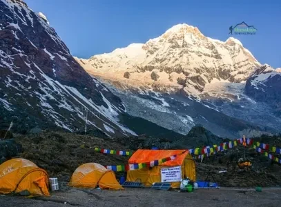
Annapurna Base Camp (ABC): Best Close-Up View
-
Viewpoint Altitude: 4,130m
-
Best For: Face-to-face views of Annapurna I
-
What You See: Annapurna I South Face directly above base camp
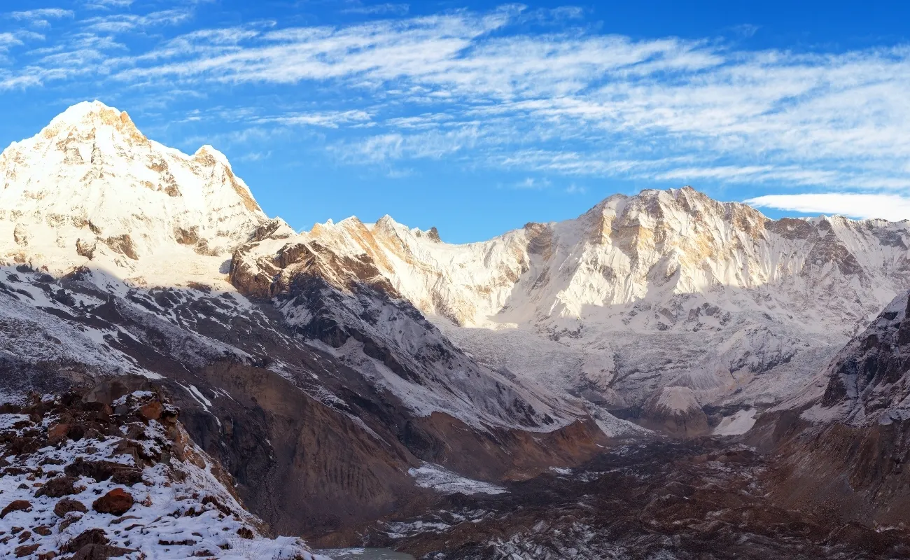
The Annapurna Base Camp Trek offers the closest and most dramatic view of Annapurna I. You stand inside a glacial bowl surrounded by 7,000 m and 8,000 m peaks. This is the only trek where Annapurna I dominates your entire field of vision.
Mardi Himal Trek: Best Ridge Perspective
-
Key Viewpoints: High Camp (3,580m), Mardi Viewpoint (~4,200m)
-
Best For: Photography and layered mountain views
The Mardi Himal Trek provides a sharp side profile of Annapurna I, with Machhapuchhre in the foreground. The ridge route means continuous views, not just at the endpoint.
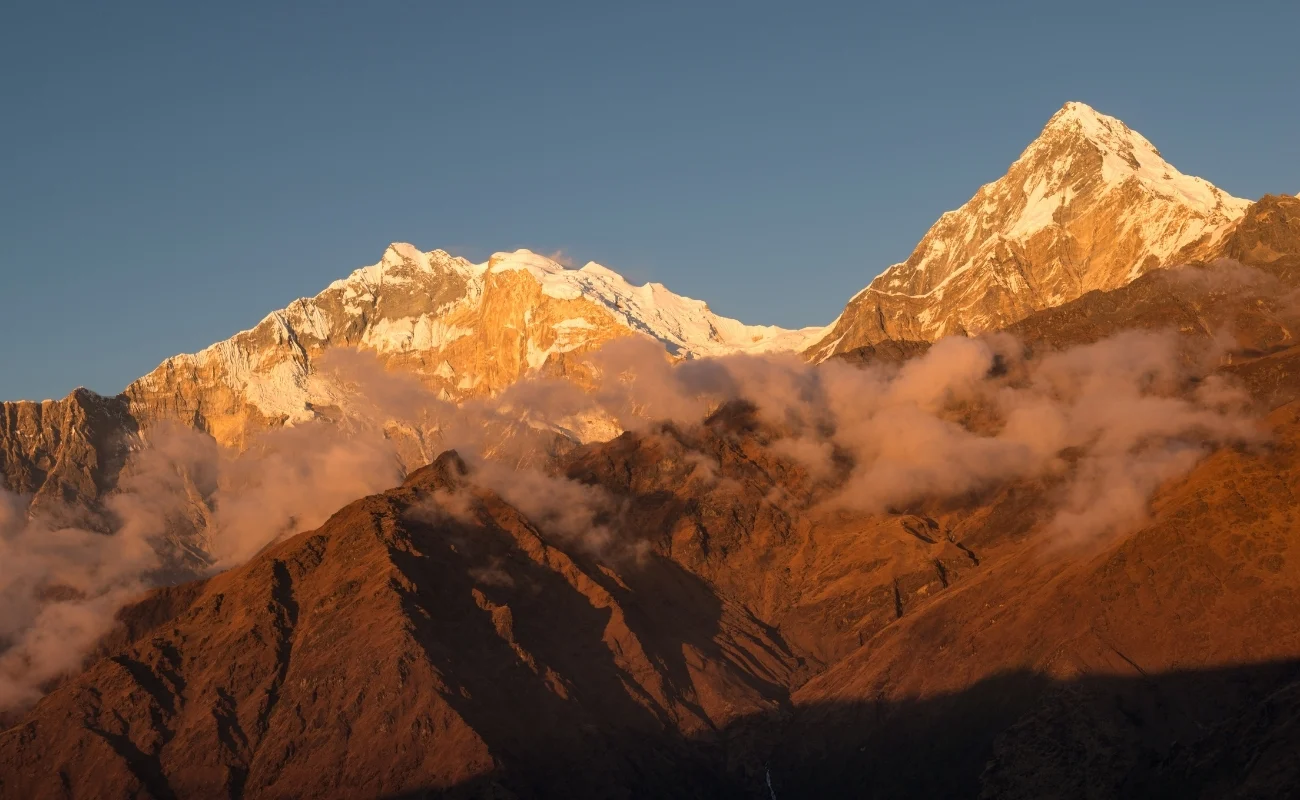
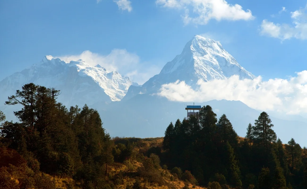
Ghorepani Poon Hill: Best Sunrise Panorama
-
Viewpoint Altitude: 3,210m
-
Visible Peaks: Annapurna I and Dhaulagiri I
-
Best For: Beginners and short trips.
From the Poon Hill trek, you can see two 8,000 m peaks during sunrise with minimal trekking days. It is the most accessible viewpoint for Annapurna I.
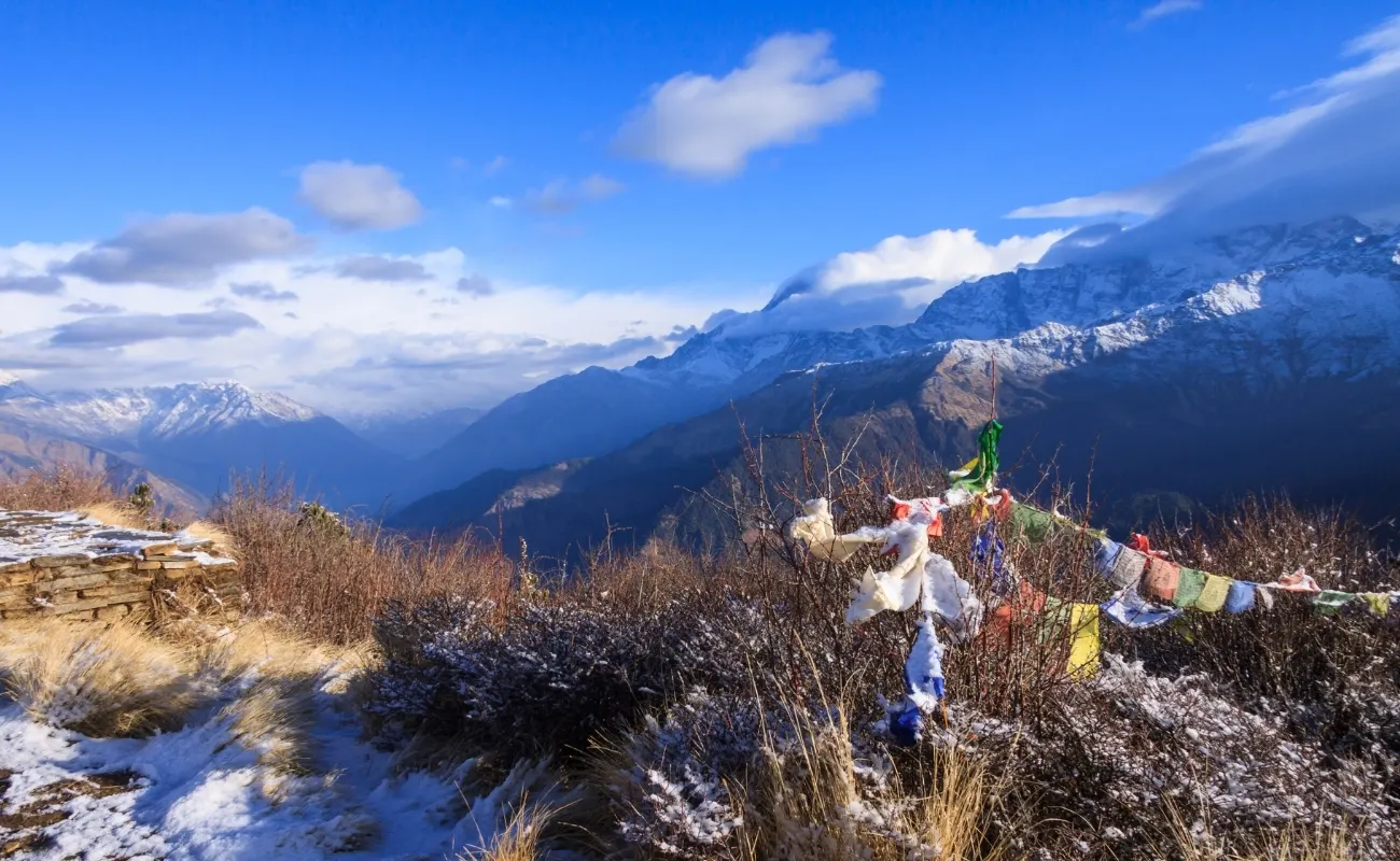
Annapurna Circuit: Best Wide-Angle View
-
Highest Point: Thorong La Pass (5,416m)
-
Best For: Understanding the full Annapurna Massif
The Annapurna Circuit Trek offers distant but expansive views of Annapurna I while crossing varied landscapes from forests to high-altitude desert
Safety Measures for Annapurna Trekking
The Annapurna region is stunning, but the high altitude and changing weather can be risky. Here are the most important safety measures for 2026.
1. Slow Ascent to Avoid Altitude Sickness (AMS): Above 3,000 m, your body needs time to adjust.
2. Follow the rule: Climb only 300–500 m per day and keep a rest day every 2–3 days.
2. Hydrate & Eat Regularly: Drink 3–4 liters of water daily and eat energy-rich food.
3. Check Weather Daily (Especially for Thorong La): Weather in the Annapurna Conservation Area changes quickly. We check satellite weather updates every day before moving higher.
4. Trek With a Guide or Partner (Don’t Go Alone): In case of injury or AMS, help is far away. A guide can manage altitude symptoms and make safe decisions.
5. Recognize AMS Symptoms & Act Fast: Descend to a lower altitude right away.
7. Respect ACAP Rules & Leave No Trace: This keeps the trails clean and helps.
Annapurna Trekking Packing List
This packing list guideline is suitable for Annapurna Base Camp (ABC), Annapurna Circuit, Mardi Himal, Poon Hill, and other treks in the Annapurna region.
|
Category |
Must-Have Items |
Why It Matters |
|
Clothing |
2–3 moisture-wicking shirts, thermal set, fleece, down jacket (-15°C), and a shell |
Keeps you warm and dry |
|
Bottoms |
2 trekking pants + thermal leggings |
Comfort + cold protection |
|
Footwear |
Waterproof boots (broken-in), camp shoes |
Prevents blisters |
|
Warm Gear |
Wool socks, gloves, beanie, sun hat |
Essential for high altitude |
|
Sleeping |
Sleeping bag (-10°C to -15°C) |
Tea house blankets aren’t enough |
|
Gear |
Trekking poles, headlamp, power bank |
Supports long days and low power |
|
Health |
Water filter/tablets, basic first-aid, Diamox |
Prevents AMS and sickness |
|
Sun & Hygiene |
SPF 50+, lip balm, wet wipes |
Strong UV + limited facilities |
|
Documents |
Travel insurance + permits |
Required for trekking in ACAP |
For the latest travel guidelines, check the Nepal Tourism Board’s official rules.
Final Thoughts
Annapurna I is one of the most famous peaks in the Annapurna mountain range, and the best way to feel its power is through treks like ABC, the Annapurna Circuit, and Thorong La Pass. From Pokhara, you’ll pass through rhododendron forests and traditional Gurung and Magar villages, enjoying the incredible views of the Annapurna Massif and the Annapurna I summit.
But the Annapurna I weather can change quickly, and altitude sickness (AMS) is a real risk, so ACAP & TIMS permits and proper acclimatization are essential. With the right planning and a trusted guide, the Annapurna region becomes a safe and unforgettable adventure that stays with you forever.
Want the best view of Annapurna I? Speak with Himalaya Trekking Nepal now, and we’ll guide you to the top viewpoints.
FAQ's
How many people have died on Annapurna I?
According to expedition records, Annapurna I has recorded over 75 deaths, giving it one of the highest Annapurna I death rates among all Himalayan peaks.
Is Annapurna I easy to climb?
No, Annapurna I is not easy to climb due to unstable snow, frequent avalanches, and unpredictable Annapurna I weather, even for experienced mountaineers.
What is the difference between Annapurna I and Annapurna II?
Annapurna I (8,091 m) is the highest and most dangerous peak in the Annapurna mountain range, while Annapurna II is lower and significantly less risky to climb.
Where is Annapurna I located?
Annapurna I is located in north-central Nepal within the Annapurna mountain range, known locally as (Annapurna in Nepali).
How long does it take to climb Annapurna I?
Reaching the Annapurna I summit typically takes 6 to 8 weeks, including acclimatization, route fixing, and waiting for safe weather windows.
Is K2 or Annapurna I deadlier?
Statistically, Annapurna I has a higher death rate than Mount Everest and K2, making it one of the deadliest 8,000-metre mountains ever climbed.
How much does it cost to climb Annapurna I?
Climbing Annapurna I usually costs USD 40,000–70,000, depending on logistics, permits, Sherpa support, and oxygen requirements.
Why is Annapurna I so hard?
Annapurna I is hard because of extreme avalanche exposure, unstable glaciers, severe Annapurna I weather, and long summit days at Annapurna I height (8,091 m).
More About Author

Khilak Budhathoki
Travel Director
Khilak Budhathoki is the co-founder and lead trekking guide at Himalaya Trekking Nepal, a locally owned and operated adventure company based in Kathmandu. Born and raised in the foothills of Nepal, Khilak developed a deep love for the mountains from an early age. With over a deca...
USD$1,400 pp
Our Recommendation
Related Blogs

Dec 04, 2025
Best Short Treks in Annapurna Region | 2–7 Days

Jan 23, 2026
Annapurna Sanctuary: Complete Travel Guide

